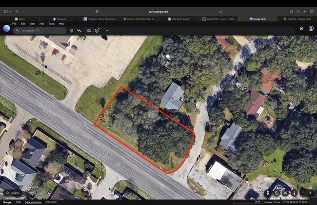
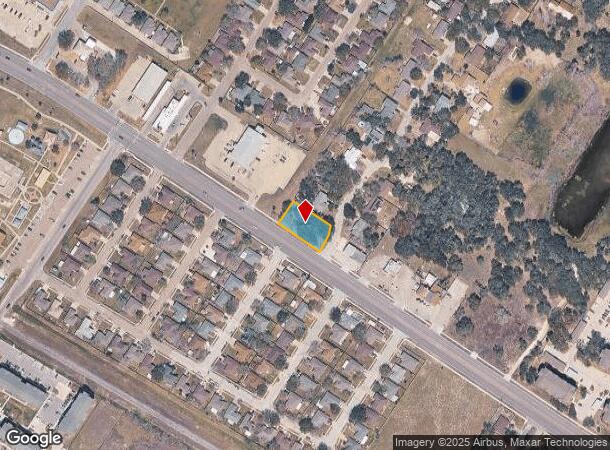
Property Record
0 Highway 361, Ingleside, TX 78362
Property Detail
0 Highway 361
Corpus Christi, TX
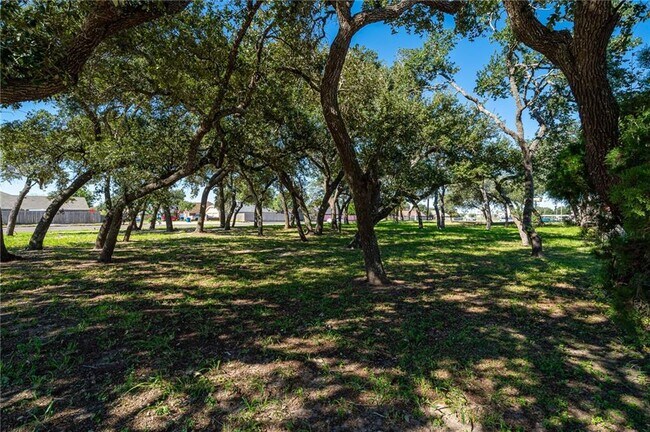
TIMBERLINE PLACE BLK 1 LOT 1
57526
SAN PATRICIO
Residentialacreage
Texas
B and X Area of moderate flood hazard, usually the area between the limits of the 100-year and 500-year floods.
1
2024
0.38 AC
2025
Portland/Ingleside
010301
Corpus Christi
NEARBY LISTINGS FOR SALE OR LEASE
DEMOGRAPHICS near 0 Highway 361
1 mile
3 mile
5 mile
2025 Total Population
7,045
13,847
22,620
2030 Population
7,352
14,373
23,700
Pop Growth 2025-2030
+ 4.36%
+ 3.80%
+ 4.77%
Average Age
36
38
40
2025 Total Households
2,527
4,998
8,549
HH Growth 2025-2030
+ 4.43%
+ 3.86%
+ 4.90%
Median Household Inc
$70,647
$75,543
$68,056
Avg Household Size
2.70
2.70
2.60
2025 Avg HH Vehicles
2.00
2.00
2.00
Median Home Value
$206,509
$212,630
$203,243
Median Year Built
1998
1995
1994
Nearby Places
Map Layers
Map Styles
 Street
 Aerial
Transit
 Traffic
 Biking
Places
Listings with unknown addresses are not visible on the map
- Restaurants
- Banks
- Shops
- Fitness
- Groceries
PUBLIC TRANSPORTATION
AIRPORT
Corpus Christi International
Drive
Walk
Distance
Corpus Christi International
34 min
25.8 mi
Freight Ports
Port of Corpus Christi
Drive
Walk
Distance
Port of Corpus Christi
21 min
17.8 mi
SALE & LEASE HISTORY
LISTING DATE
SALE/LEASE

May 27, 2025
For Sale
Nearby Properties
Address
Land Use
TOTAL SIZE
Lot Size
Zoning
Address
Land Use
TOTAL SIZE
Lot Size
Zoning
537.46 AC
Address
Land Use
TOTAL SIZE
Lot Size
Zoning
227,262 SF
15.04 AC
Address
Land Use
TOTAL SIZE
Lot Size
Zoning
479.82 AC
Address
Land Use
TOTAL SIZE
Lot Size
Zoning
39,253 SF
54.77 AC
Address
Land Use
TOTAL SIZE
Lot Size
Zoning
176,520 SF
7.80 AC
Address
Land Use
TOTAL SIZE
Lot Size
Zoning
403.08 AC
Address
Land Use
TOTAL SIZE
Lot Size
Zoning
88,488 SF
5.87 AC
Address
Land Use
TOTAL SIZE
Lot Size
Zoning
212.69 AC
Address
Land Use
TOTAL SIZE
Lot Size
Zoning
207.18 AC
Address
Land Use
TOTAL SIZE
Lot Size
Zoning
325.39 AC
Address
Land Use
TOTAL SIZE
Lot Size
Zoning
124,357 SF
12.62 AC
Address
Land Use
TOTAL SIZE
Lot Size
Zoning
174.77 AC
Address
Land Use
TOTAL SIZE
Lot Size
Zoning
173.79 AC
Address
Land Use
TOTAL SIZE
Lot Size
Zoning
435.67 AC
Address
Land Use
TOTAL SIZE
Lot Size
Zoning
146.04 AC
Address
Land Use
TOTAL SIZE
Lot Size
Zoning
129.57 AC
Address
Land Use
TOTAL SIZE
Lot Size
Zoning
147,255 SF
8.74 AC
Address
Land Use
TOTAL SIZE
Lot Size
Zoning
78,992 SF
16.50 AC
Address
Land Use
TOTAL SIZE
Lot Size
Zoning
100.55 AC
Address
Land Use
TOTAL SIZE
Lot Size
Zoning
66,894 SF
10.04 AC
Address
Land Use
TOTAL SIZE
Lot Size
Zoning
74,536 SF
4.81 AC
Address
Land Use
TOTAL SIZE
Lot Size
Zoning
150.12 AC
Address
Land Use
TOTAL SIZE
Lot Size
Zoning
1,480 SF
130.28 AC
Address
Land Use
TOTAL SIZE
Lot Size
Zoning
Address
Land Use
TOTAL SIZE
Lot Size
Zoning
136.75 AC
Address
Land Use
TOTAL SIZE
Lot Size
Zoning
42,328 SF
3.25 AC
Address
Land Use
TOTAL SIZE
Lot Size
Zoning
77.03 AC
Address
Land Use
TOTAL SIZE
Lot Size
Zoning
72.40 AC
Address
Land Use
TOTAL SIZE
Lot Size
Zoning
70.73 AC
Address
Land Use
TOTAL SIZE
Lot Size
Zoning
120.36 AC
The World's #1 Commercial Real Estate Marketplace
Connect with us
© 2026 CoStar Group
The information above has been obtained from sources believed reliable. While we do not doubt its accuracy we have not verified it and make no guarantee, warranty or representation about it. It is your responsibility to independently confirm its accuracy and completeness. Any projections, opinions, assumptions, or estimates used are for example only and do not represent the current or future performance of the property. The value of this transaction to you depends on tax and other factors which should be evaluated by your tax, financial, and legal advisors. You and your advisors should conduct a careful, independent investigation of the property to determine to your satisfaction the suitability of the property for your needs.