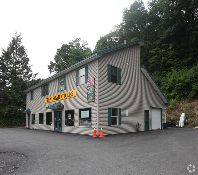
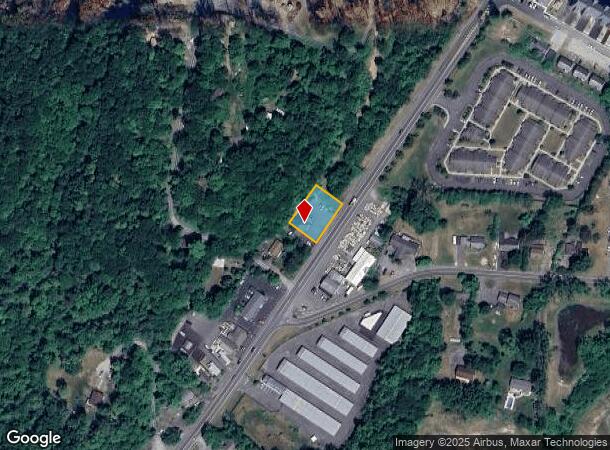
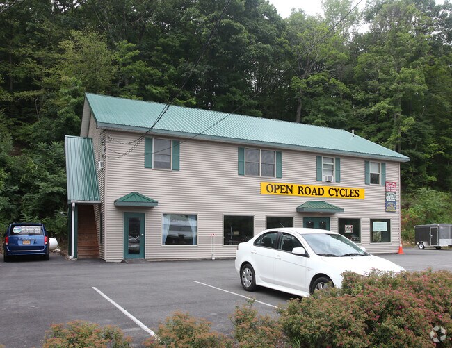
Property Record
2917 Route 9W, Saugerties, NY 12477
NEARBY LISTINGS FOR SALE OR LEASE
Property Detail
2917 Route 9W
4889-028.002-0003-013.000-0000
Ulster
Commercialofficeresidentialmixeduse
New York
X
13.000
36111C0315E
0.46 AC
2025
Hudson Valley Area
2024
Other Market Areas
950300
Kingston, NY
4,228 SF
DEMOGRAPHICS near 2917 Route 9W
1 mile
3 mile
5 mile
2024 Total Population
2,828
13,505
24,581
2029 Population
2,797
13,426
24,479
Pop Growth 2024-2029
(1.10%)
(0.58%)
(0.41%)
Average Age
45
44
45
2024 Total Households
1,265
5,909
10,204
HH Growth 2024-2029
(1.03%)
(0.56%)
(0.43%)
Median Household Inc
$75,674
$68,586
$77,341
Avg Household Size
2.20
2.20
2.30
2024 Avg HH Vehicles
2.00
2.00
2.00
Median Home Value
$255,904
$285,999
$306,442
Median Year Built
1979
1962
1966
Nearby Places
Map Layers
Map Styles
 Street
 Aerial
Transit
 Traffic
 Biking
Places
Listings with unknown addresses are not visible on the map
- Restaurants
- Banks
- Shops
- Fitness
- Groceries
SALE & LEASE HISTORY
LISTING DATE
SALE/LEASE

Sep 25, 2016
For Lease
Nearby Properties
Address
Land Use
TOTAL SIZE
Lot Size
Zoning
Address
Land Use
TOTAL SIZE
Lot Size
Zoning
12,489 SF
15.10 AC
02 - SINGL
Address
Land Use
TOTAL SIZE
Lot Size
Zoning
19.70 AC
04
Address
Land Use
TOTAL SIZE
Lot Size
Zoning
19,280 SF
35.45 AC
LC
Address
Land Use
TOTAL SIZE
Lot Size
Zoning
78.11 AC
WC
Address
Land Use
TOTAL SIZE
Lot Size
Zoning
7.90 AC
03 - MULTI
Address
Land Use
TOTAL SIZE
Lot Size
Zoning
7,994 SF
13.70 AC
23
Address
Land Use
TOTAL SIZE
Lot Size
Zoning
54,461 SF
2.50 AC
03 - MULTI
Address
Land Use
TOTAL SIZE
Lot Size
Zoning
45,441 SF
4.80 AC
05 - COMME
Address
Land Use
TOTAL SIZE
Lot Size
Zoning
7,275 SF
63.90 AC
Address
Land Use
TOTAL SIZE
Lot Size
Zoning
19,210 SF
23.30 AC
LC
Address
Land Use
TOTAL SIZE
Lot Size
Zoning
11,080 SF
13.01 AC
LC
Address
Land Use
TOTAL SIZE
Lot Size
Zoning
77,033 SF
7.40 AC
05 - COMME
Address
Land Use
TOTAL SIZE
Lot Size
Zoning
41,213 SF
7.90 AC
02
Address
Land Use
TOTAL SIZE
Lot Size
Zoning
2,276 SF
99.63 AC
R1A
Address
Land Use
TOTAL SIZE
Lot Size
Zoning
56,845 SF
17.70 AC
02 - SINGL
Address
Land Use
TOTAL SIZE
Lot Size
Zoning
7,444 SF
12.16 AC
LC
Address
Land Use
TOTAL SIZE
Lot Size
Zoning
21.70 AC
LC
Address
Land Use
TOTAL SIZE
Lot Size
Zoning
36,004 SF
7.10 AC
05 - COMME
Address
Land Use
TOTAL SIZE
Lot Size
Zoning
13.90 AC
WC
Address
Land Use
TOTAL SIZE
Lot Size
Zoning
3,568 SF
38.59 AC
LC
Address
Land Use
TOTAL SIZE
Lot Size
Zoning
47,679 SF
14 AC
02 - SINGL
Address
Land Use
TOTAL SIZE
Lot Size
Zoning
5,225 SF
432.29 AC
RD5
Address
Land Use
TOTAL SIZE
Lot Size
Zoning
7,135 SF
13.70 AC
22
Address
Land Use
TOTAL SIZE
Lot Size
Zoning
117,450 SF
14.20 AC
02 - SINGL
Address
Land Use
TOTAL SIZE
Lot Size
Zoning
5,664 SF
5.30 AC
WC
Address
Land Use
TOTAL SIZE
Lot Size
Zoning
4,325 SF
6.91 AC
07 - MIXED
Address
Land Use
TOTAL SIZE
Lot Size
Zoning
37,032 SF
0.89 AC
07 - MIXED
Address
Land Use
TOTAL SIZE
Lot Size
Zoning
3,719 SF
19.40 AC
06 - INDUS
Address
Land Use
TOTAL SIZE
Lot Size
Zoning
9,524 SF
3.30 AC
02 - SINGL
Address
Land Use
TOTAL SIZE
Lot Size
Zoning
13,066 SF
149 AC
The World's #1 Commercial Real Estate Marketplace
Connect with us
© 2026 CoStar Group
The information above has been obtained from sources believed reliable. While we do not doubt its accuracy we have not verified it and make no guarantee, warranty or representation about it. It is your responsibility to independently confirm its accuracy and completeness. Any projections, opinions, assumptions, or estimates used are for example only and do not represent the current or future performance of the property. The value of this transaction to you depends on tax and other factors which should be evaluated by your tax, financial, and legal advisors. You and your advisors should conduct a careful, independent investigation of the property to determine to your satisfaction the suitability of the property for your needs.