Property Record
2919 Galloway Rd Ne, Bolivia, NC 28422

NEARBY LISTINGS FOR SALE OR LEASE
Property Detail
2919 Galloway Rd Ne
1530000122
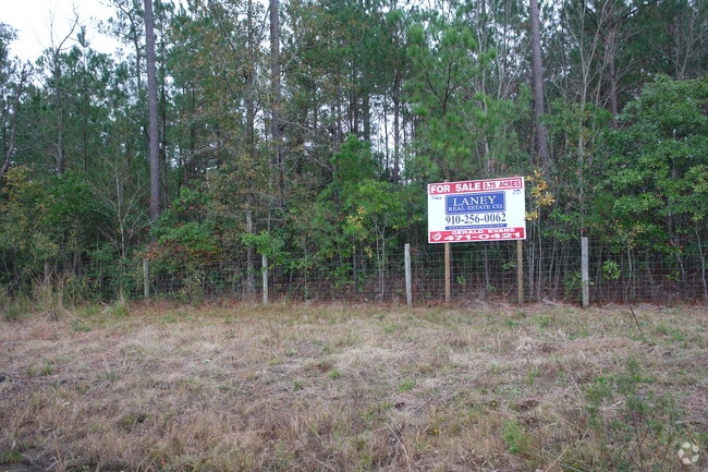
11.08 ACRES PLAT 35/241 US 17 & SR 1401
Religious
Brunswick
X
North Carolina
3720212000K
11.08 AC
0
Leland
2025
Wilmington
020603
Myrtle Beach-Conway-North Myrtle Beach, SC-NC
20,800 SF
DEMOGRAPHICS near 2919 Galloway Rd Ne
1 Mile
3 Mile
5 Mile
2024 Total Population
98
1,891
8,336
2029 Population
127
2,449
10,920
Pop Growth 2024-2029
+ 29.59%
+ 29.51%
+ 31.00%
Average Age
42
42
46
2024 Total Households
35
691
3,313
HH Growth 2024-2029
+ 28.57%
+ 29.52%
+ 30.97%
Median Household Inc
$46,000
$46,212
$58,328
Avg Household Size
2.50
2.50
2.30
2024 Avg HH Vehicles
2.00
2.00
2.00
Median Home Value
$154,545
$168,719
$268,242
Median Year Built
1994
1996
2006
Nearby Places
Map Layers
Map Styles
 Street
 Aerial
- Restaurants
- Banks
- Shops
- Fitness
- Groceries
PUBLIC TRANSPORTATION
AIRPORT
Wilmington International
DRIVE
WALK
Distance
Wilmington International
46 min
30.8 mi
Freight Ports
Port of Wilmington
DRIVE
WALK
Distance
Port of Wilmington
37 min
26.5 mi
Nearby Properties
Address
Land Use
TOTAL SIZE
Lot Size
Zoning
Address
Land Use
TOTAL SIZE
Lot Size
Zoning
265,552 SF
93.50 AC
CLD
Address
Land Use
TOTAL SIZE
Lot Size
Zoning
55,658 SF
170.17 AC
CLD
Address
Land Use
TOTAL SIZE
Lot Size
Zoning
33,033 SF
268.40 AC
RR
Address
Land Use
TOTAL SIZE
Lot Size
Zoning
99,977 SF
39.68 AC
R75
Address
Land Use
TOTAL SIZE
Lot Size
Zoning
62,095 SF
14.30 AC
CLD
Address
Land Use
TOTAL SIZE
Lot Size
Zoning
35,524 SF
2.91 AC
CLD
Address
Land Use
TOTAL SIZE
Lot Size
Zoning
38,870 SF
5 AC
CLD
Address
Land Use
TOTAL SIZE
Lot Size
Zoning
6,140 SF
2.94 AC
CLD
Address
Land Use
TOTAL SIZE
Lot Size
Zoning
20,672 SF
3.10 AC
CLD
Address
Land Use
TOTAL SIZE
Lot Size
Zoning
14,968 SF
10.59 AC
CLD
Address
Land Use
TOTAL SIZE
Lot Size
Zoning
7,840 SF
136.34 AC
IG
Address
Land Use
TOTAL SIZE
Lot Size
Zoning
1,484 SF
2.60 AC
CLD
Address
Land Use
TOTAL SIZE
Lot Size
Zoning
5,160 SF
3.02 AC
CLD
Address
Land Use
TOTAL SIZE
Lot Size
Zoning
194.81 AC
CLD
Address
Land Use
TOTAL SIZE
Lot Size
Zoning
14,721 SF
5.75 AC
CLD
Address
Land Use
TOTAL SIZE
Lot Size
Zoning
775.49 AC
R75
Address
Land Use
TOTAL SIZE
Lot Size
Zoning
7,895 SF
2.32 AC
CLD
Address
Land Use
TOTAL SIZE
Lot Size
Zoning
9,173 SF
1.47 AC
CLD
Address
Land Use
TOTAL SIZE
Lot Size
Zoning
18,525 SF
6.01 AC
CLD
Address
Land Use
TOTAL SIZE
Lot Size
Zoning
6,591 SF
2.68 AC
NC
Address
Land Use
TOTAL SIZE
Lot Size
Zoning
7.93 AC
CLD
Address
Land Use
TOTAL SIZE
Lot Size
Zoning
4,496 SF
1.18 AC
CLD
Address
Land Use
TOTAL SIZE
Lot Size
Zoning
878.93 AC
RR
Address
Land Use
TOTAL SIZE
Lot Size
Zoning
4,500 SF
2 AC
CLD
Address
Land Use
TOTAL SIZE
Lot Size
Zoning
3,794 SF
1.75 AC
CLD
Address
Land Use
TOTAL SIZE
Lot Size
Zoning
13,620 SF
9.22 AC
IG
Address
Land Use
TOTAL SIZE
Lot Size
Zoning
161.93 AC
RR
Address
Land Use
TOTAL SIZE
Lot Size
Zoning
3,916 SF
1.39 AC
CLD
The World's #1 Commercial Real Estate Marketplace
Connect with us
© 2025 CoStar Group
The information above has been obtained from sources believed reliable. While we do not doubt its accuracy we have not verified it and make no guarantee, warranty or representation about it. It is your responsibility to independently confirm its accuracy and completeness. Any projections, opinions, assumptions, or estimates used are for example only and do not represent the current or future performance of the property. The value of this transaction to you depends on tax and other factors which should be evaluated by your tax, financial, and legal advisors. You and your advisors should conduct a careful, independent investigation of the property to determine to your satisfaction the suitability of the property for your needs.