Property Record
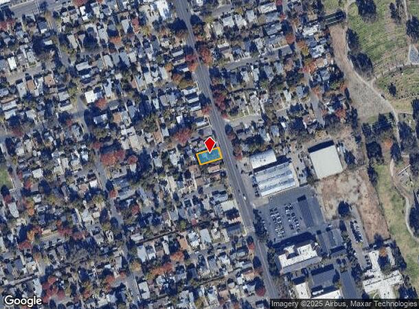
2919 N California St, Stockton, CA 95204
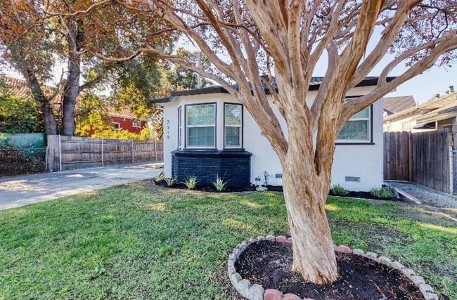
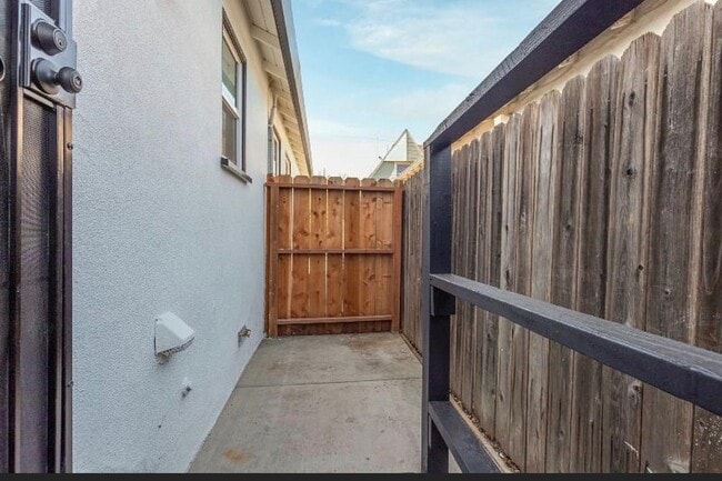
This Property Is For Sale
NEARBY LISTINGS FOR SALE OR LEASE
Property Detail
2919 N California St
Stockton-Lodi, CA
Northern Add
125-290-19
San Joaquin
Duplex
California
X
0.11 AC
06077C0460F
Country Club/Pacific
1,292 SF
Stockton/Modesto
DEMOGRAPHICS near 2919 N California St
1 Mile
3 Mile
5 Mile
2024 Total Population
18,658
169,148
340,724
2029 Population
19,449
176,029
354,631
Pop Growth 2024-2029
+ 4.24%
+ 4.07%
+ 4.08%
Average Age
38
37
37
2024 Total Households
6,749
55,545
106,522
HH Growth 2024-2029
+ 4.70%
+ 4.35%
+ 4.26%
Median Household Inc
$71,345
$64,954
$72,174
Avg Household Size
2.60
2.90
3.10
2024 Avg HH Vehicles
2.00
2.00
2.00
Median Home Value
$378,650
$383,356
$409,644
Median Year Built
1950
1967
1974
Nearby Places
- Restaurants
- Banks
- Shops
- Fitness
- Groceries
PUBLIC TRANSPORTATION
COMMUTER RAIL
Stockton (ACE Train - Altamont Commuter Express (ACE), Altamont Corridor Express - Altamont Commuter Express (ACE))
DRIVE
WALK
Distance
Stockton (ACE Train - Altamont Commuter Express (ACE), Altamont Corridor Express - Altamont Commuter Express (ACE))
6 min
2.7 mi
Stockton (San Joaquins - Amtrak)
DRIVE
WALK
Distance
Stockton (San Joaquins - Amtrak)
7 min
3.0 mi
AIRPORT
Stockton Metro
DRIVE
WALK
Distance
Stockton Metro
15 min
7.7 mi
Freight Ports
Port of Stockton
DRIVE
WALK
Distance
Port of Stockton
10 min
4.0 mi
Nearby Properties
Address
Land Use
TOTAL SIZE
Lot Size
Zoning
Address
Land Use
TOTAL SIZE
Lot Size
Zoning
530,700 SF
8.35 AC
Address
Land Use
TOTAL SIZE
Lot Size
Zoning
30,080 SF
82.44 AC
Address
Land Use
TOTAL SIZE
Lot Size
Zoning
105,083 SF
24.90 AC
O
Address
Land Use
TOTAL SIZE
Lot Size
Zoning
152,000 SF
1.31 AC
Address
Land Use
TOTAL SIZE
Lot Size
Zoning
4.78 AC
Address
Land Use
TOTAL SIZE
Lot Size
Zoning
10,208 SF
47.57 AC
Address
Land Use
TOTAL SIZE
Lot Size
Zoning
9,750 SF
136.94 AC
AU20
Address
Land Use
TOTAL SIZE
Lot Size
Zoning
22.89 AC
Address
Land Use
TOTAL SIZE
Lot Size
Zoning
652,548 SF
35.24 AC
IL
Address
Land Use
TOTAL SIZE
Lot Size
Zoning
254,378 SF
17.07 AC
Address
Land Use
TOTAL SIZE
Lot Size
Zoning
121,574 SF
5.49 AC
RHD
Address
Land Use
TOTAL SIZE
Lot Size
Zoning
23,112 SF
9.20 AC
Address
Land Use
TOTAL SIZE
Lot Size
Zoning
82,512 SF
4.14 AC
Address
Land Use
TOTAL SIZE
Lot Size
Zoning
219,572 SF
16.53 AC
IL
Address
Land Use
TOTAL SIZE
Lot Size
Zoning
14,212 SF
26.11 AC
Address
Land Use
TOTAL SIZE
Lot Size
Zoning
23.30 AC
Address
Land Use
TOTAL SIZE
Lot Size
Zoning
97,276 SF
5.46 AC
RHD
Address
Land Use
TOTAL SIZE
Lot Size
Zoning
8,000 SF
0.67 AC
Address
Land Use
TOTAL SIZE
Lot Size
Zoning
190,923 SF
3.96 AC
Address
Land Use
TOTAL SIZE
Lot Size
Zoning
62,588 SF
43.56 AC
IW
Address
Land Use
TOTAL SIZE
Lot Size
Zoning
0.79 AC
Address
Land Use
TOTAL SIZE
Lot Size
Zoning
37,846 SF
2.94 AC
Address
Land Use
TOTAL SIZE
Lot Size
Zoning
17,573 SF
3.17 AC
Address
Land Use
TOTAL SIZE
Lot Size
Zoning
51,892 SF
5.33 AC
Address
Land Use
TOTAL SIZE
Lot Size
Zoning
52,644 SF
2 AC
Address
Land Use
TOTAL SIZE
Lot Size
Zoning
14,035 SF
10.02 AC
Address
Land Use
TOTAL SIZE
Lot Size
Zoning
117,320 SF
2.86 AC
Address
Land Use
TOTAL SIZE
Lot Size
Zoning
2.42 AC
Address
Land Use
TOTAL SIZE
Lot Size
Zoning
2,876 SF
10.54 AC
Address
Land Use
TOTAL SIZE
Lot Size
Zoning
67,195 SF
5.30 AC
The World's #1 Commercial Real Estate Marketplace
Connect with us
© 2025 CoStar Group
The information above has been obtained from sources believed reliable. While we do not doubt its accuracy we have not verified it and make no guarantee, warranty or representation about it. It is your responsibility to independently confirm its accuracy and completeness. Any projections, opinions, assumptions, or estimates used are for example only and do not represent the current or future performance of the property. The value of this transaction to you depends on tax and other factors which should be evaluated by your tax, financial, and legal advisors. You and your advisors should conduct a careful, independent investigation of the property to determine to your satisfaction the suitability of the property for your needs.