Property Record
292 Payne Rd, Scarborough, ME 04074


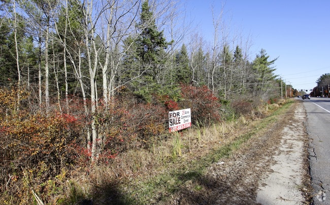
This Property Is For Sale
NEARBY LISTINGS FOR SALE OR LEASE
Property Detail
292 Payne Rd
SCAR-000039R-000000-000003
Cumberland
Commercialacreage
Maine
X
3
23005C0801F
20.26 AC
2025
SW Cumberland County
2025
Portland/South Portland
017305
Portland-South Portland, ME
DEMOGRAPHICS near 292 Payne Rd
1 Mile
3 Mile
5 Mile
2024 Total Population
1,260
14,690
50,555
2029 Population
1,337
15,345
52,470
Pop Growth 2024-2029
+ 6.11%
+ 4.46%
+ 3.79%
Average Age
42
45
42
2024 Total Households
544
6,334
21,138
HH Growth 2024-2029
+ 6.25%
+ 4.91%
+ 3.99%
Median Household Inc
$85,690
$80,151
$82,284
Avg Household Size
2.30
2.20
2.30
2024 Avg HH Vehicles
2.00
2.00
2.00
Median Home Value
$409,483
$395,417
$381,848
Median Year Built
1999
1990
1980
Nearby Places
Map Layers
Map Styles
 Street
 Aerial
- Restaurants
- Banks
- Shops
- Fitness
- Groceries
PUBLIC TRANSPORTATION
COMMUTER RAIL
Portland (Downeaster - Amtrak)
DRIVE
WALK
Distance
Portland (Downeaster - Amtrak)
10 min
7.0 mi
Old Orchard Beach Amtrak (Downeaster - Amtrak)
DRIVE
WALK
Distance
Old Orchard Beach Amtrak (Downeaster - Amtrak)
16 min
8.6 mi
AIRPORT
Portland International Jetport
DRIVE
WALK
Distance
Portland International Jetport
11 min
5.6 mi
Freight Ports
Portland, ME
DRIVE
WALK
Distance
Portland, ME
12 min
8.2 mi
Nearby Properties
Address
Land Use
TOTAL SIZE
Lot Size
Zoning
Address
Land Use
TOTAL SIZE
Lot Size
Zoning
28.33 AC
24
Address
Land Use
TOTAL SIZE
Lot Size
Zoning
401,800 SF
51.38 AC
31
Address
Land Use
TOTAL SIZE
Lot Size
Zoning
7.51 AC
Z
Address
Land Use
TOTAL SIZE
Lot Size
Zoning
80,058 SF
14.69 AC
32
Address
Land Use
TOTAL SIZE
Lot Size
Zoning
176,100 SF
9.71 AC
Z
Address
Land Use
TOTAL SIZE
Lot Size
Zoning
113,445 SF
12.70 AC
32
Address
Land Use
TOTAL SIZE
Lot Size
Zoning
115,965 SF
6.27 AC
Z
Address
Land Use
TOTAL SIZE
Lot Size
Zoning
20.33 AC
Z
Address
Land Use
TOTAL SIZE
Lot Size
Zoning
129,885 SF
28.33 AC
24
Address
Land Use
TOTAL SIZE
Lot Size
Zoning
113,025 SF
7.30 AC
31
Address
Land Use
TOTAL SIZE
Lot Size
Zoning
217,672 SF
17.80 AC
Z
Address
Land Use
TOTAL SIZE
Lot Size
Zoning
78,053 SF
9.74 AC
32
Address
Land Use
TOTAL SIZE
Lot Size
Zoning
14.51 AC
Z
Address
Land Use
TOTAL SIZE
Lot Size
Zoning
116,600 SF
12.37 AC
Z
Address
Land Use
TOTAL SIZE
Lot Size
Zoning
144,304 SF
10.01 AC
Z
Address
Land Use
TOTAL SIZE
Lot Size
Zoning
188,361 SF
13.45 AC
MM
Address
Land Use
TOTAL SIZE
Lot Size
Zoning
88,032 SF
11.98 AC
Address
Land Use
TOTAL SIZE
Lot Size
Zoning
16 AC
26
Address
Land Use
TOTAL SIZE
Lot Size
Zoning
96,050 SF
12.90 AC
Z
Address
Land Use
TOTAL SIZE
Lot Size
Zoning
18.83 AC
22
Address
Land Use
TOTAL SIZE
Lot Size
Zoning
226,870 SF
26.38 AC
22
Address
Land Use
TOTAL SIZE
Lot Size
Zoning
5.15 AC
MM
Address
Land Use
TOTAL SIZE
Lot Size
Zoning
160,311 SF
19.25 AC
39
Address
Land Use
TOTAL SIZE
Lot Size
Zoning
880 SF
25.60 AC
26
Address
Land Use
TOTAL SIZE
Lot Size
Zoning
79,130 SF
6.06 AC
32
Address
Land Use
TOTAL SIZE
Lot Size
Zoning
95,457 SF
5.25 AC
Z
Address
Land Use
TOTAL SIZE
Lot Size
Zoning
1,303 SF
11.32 AC
27
Address
Land Use
TOTAL SIZE
Lot Size
Zoning
117,195 SF
8.08 AC
Address
Land Use
TOTAL SIZE
Lot Size
Zoning
109,988 SF
14.51 AC
33
Address
Land Use
TOTAL SIZE
Lot Size
Zoning
2,880 SF
176.89 AC
22
The World's #1 Commercial Real Estate Marketplace
Connect with us
© 2026 CoStar Group
The information above has been obtained from sources believed reliable. While we do not doubt its accuracy we have not verified it and make no guarantee, warranty or representation about it. It is your responsibility to independently confirm its accuracy and completeness. Any projections, opinions, assumptions, or estimates used are for example only and do not represent the current or future performance of the property. The value of this transaction to you depends on tax and other factors which should be evaluated by your tax, financial, and legal advisors. You and your advisors should conduct a careful, independent investigation of the property to determine to your satisfaction the suitability of the property for your needs.