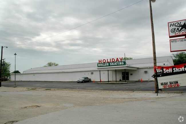
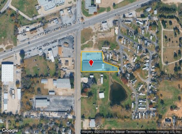
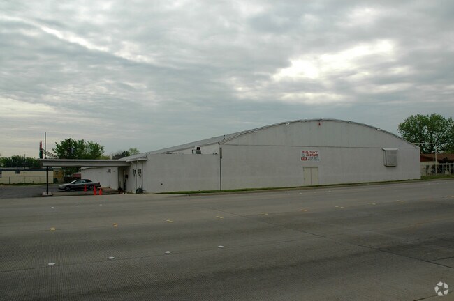
Property Record
2920 Carson St, Haltom City, TX 76117
NEARBY LISTINGS FOR SALE OR LEASE
Property Detail
2920 Carson St
03725855
Akers, George Survey
Commercialnec
AKERS, GEORGE SURVEY ABSTRACT 30 TRACT 11C & 11D2
X
Tarrant
48439C0195L
Texas
0
1.46 AC
2025
Haltom City
110301
Dallas/Ft Worth
22,662 SF
Dallas-Fort Worth-Arlington, TX
DEMOGRAPHICS near 2920 Carson St
1 Mile
3 Mile
5 Mile
2024 Total Population
8,831
74,587
258,466
2029 Population
9,308
78,408
273,263
Pop Growth 2024-2029
+ 5.40%
+ 5.12%
+ 5.72%
Average Age
37
37
37
2024 Total Households
3,215
27,524
94,998
HH Growth 2024-2029
+ 5.54%
+ 5.17%
+ 5.87%
Median Household Inc
$41,860
$54,107
$58,267
Avg Household Size
2.70
2.60
2.60
2024 Avg HH Vehicles
2.00
2.00
2.00
Median Home Value
$165,437
$203,737
$217,704
Median Year Built
1964
1969
1978
Nearby Places
Map Layers
Map Styles
 Street
 Aerial
- Restaurants
- Banks
- Shops
- Fitness
- Groceries
PUBLIC TRANSPORTATION
COMMUTER RAIL
Richland Hills (Trinity Railway Express - Dallas Area Rapid Transit (DART))
DRIVE
WALK
Distance
Richland Hills (Trinity Railway Express - Dallas Area Rapid Transit (DART))
6 min
3.1 mi
DRIVE
WALK
Distance
7 min
3.3 mi
AIRPORT
Dallas-Fort Worth International
DRIVE
WALK
Distance
Dallas-Fort Worth International
26 min
18.6 mi
Dallas Love Field
DRIVE
WALK
Distance
Dallas Love Field
37 min
27.2 mi
Nearby Properties
Address
Land Use
TOTAL SIZE
Lot Size
Zoning
Address
Land Use
TOTAL SIZE
Lot Size
Zoning
699,246 SF
40.69 AC
Address
Land Use
TOTAL SIZE
Lot Size
Zoning
385,697 SF
15.94 AC
Address
Land Use
TOTAL SIZE
Lot Size
Zoning
810,978 SF
45.84 AC
Address
Land Use
TOTAL SIZE
Lot Size
Zoning
174,596 SF
11.91 AC
Address
Land Use
TOTAL SIZE
Lot Size
Zoning
231,871 SF
17.08 AC
Address
Land Use
TOTAL SIZE
Lot Size
Zoning
318,602 SF
9.90 AC
Address
Land Use
TOTAL SIZE
Lot Size
Zoning
697,140 SF
37.84 AC
Address
Land Use
TOTAL SIZE
Lot Size
Zoning
248,993 SF
15.40 AC
Address
Land Use
TOTAL SIZE
Lot Size
Zoning
293,972 SF
17.30 AC
Address
Land Use
TOTAL SIZE
Lot Size
Zoning
459,540 SF
36.02 AC
Address
Land Use
TOTAL SIZE
Lot Size
Zoning
237,551 SF
4.39 AC
Address
Land Use
TOTAL SIZE
Lot Size
Zoning
197,131 SF
43.78 AC
Address
Land Use
TOTAL SIZE
Lot Size
Zoning
241,064 SF
12.63 AC
Address
Land Use
TOTAL SIZE
Lot Size
Zoning
307,568 SF
13.13 AC
Address
Land Use
TOTAL SIZE
Lot Size
Zoning
232,295 SF
21.49 AC
Address
Land Use
TOTAL SIZE
Lot Size
Zoning
187,236 SF
9.85 AC
Address
Land Use
TOTAL SIZE
Lot Size
Zoning
526,195 SF
40.84 AC
Address
Land Use
TOTAL SIZE
Lot Size
Zoning
132,145 SF
12.26 AC
Address
Land Use
TOTAL SIZE
Lot Size
Zoning
306,524 SF
24.92 AC
Address
Land Use
TOTAL SIZE
Lot Size
Zoning
204,948 SF
23.93 AC
Address
Land Use
TOTAL SIZE
Lot Size
Zoning
427,908 SF
22.04 AC
Address
Land Use
TOTAL SIZE
Lot Size
Zoning
350,000 SF
26.71 AC
Address
Land Use
TOTAL SIZE
Lot Size
Zoning
146,918 SF
3.31 AC
Address
Land Use
TOTAL SIZE
Lot Size
Zoning
764,254 SF
40.80 AC
Address
Land Use
TOTAL SIZE
Lot Size
Zoning
141,276 SF
12.04 AC
Address
Land Use
TOTAL SIZE
Lot Size
Zoning
125,838 SF
12.38 AC
Address
Land Use
TOTAL SIZE
Lot Size
Zoning
185,047 SF
10 AC
Address
Land Use
TOTAL SIZE
Lot Size
Zoning
214,083 SF
19.84 AC
Address
Land Use
TOTAL SIZE
Lot Size
Zoning
106,045 SF
9.64 AC
Address
Land Use
TOTAL SIZE
Lot Size
Zoning
112,000 SF
12.85 AC
The World's #1 Commercial Real Estate Marketplace
Connect with us
© 2026 CoStar Group
The information above has been obtained from sources believed reliable. While we do not doubt its accuracy we have not verified it and make no guarantee, warranty or representation about it. It is your responsibility to independently confirm its accuracy and completeness. Any projections, opinions, assumptions, or estimates used are for example only and do not represent the current or future performance of the property. The value of this transaction to you depends on tax and other factors which should be evaluated by your tax, financial, and legal advisors. You and your advisors should conduct a careful, independent investigation of the property to determine to your satisfaction the suitability of the property for your needs.