Property Record
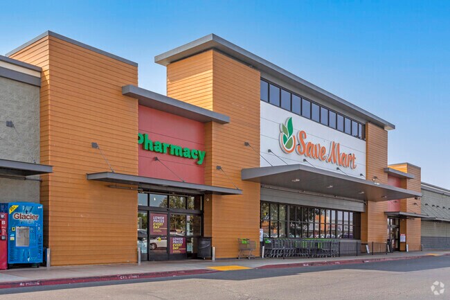
2920 E Whitmore Ave, Ceres, CA 95307


Property Detail
2920 E Whitmore Ave
053-09-10
EQUIPMENT & SUPPLIES DD
Regionalshoppingcenterormallwithanchorstore
STANISLAUS
B and X Area of moderate flood hazard, usually the area between the limits of the 100-year and 500-year floods.
California
2025
3.62 AC
2025
Modesto
002602
Stockton/Modesto
43,105 SF
Modesto, CA
NEARBY LISTINGS FOR SALE OR LEASE
DEMOGRAPHICS near 2920 E Whitmore Ave
1 mile
3 mile
5 mile
2025 Total Population
17,692
65,649
167,871
2030 Population
17,757
66,024
168,549
Pop Growth 2025-2030
+ 0.37%
+ 0.57%
+ 0.40%
Average Age
36
35
36
2025 Total Households
5,087
18,242
50,147
HH Growth 2025-2030
+ 0.43%
+ 0.59%
+ 0.41%
Median Household Inc
$79,407
$78,619
$75,077
Avg Household Size
3.50
3.50
3.20
2025 Avg HH Vehicles
2.00
2.00
2.00
Median Home Value
$432,760
$435,305
$422,097
Median Year Built
1976
1982
1977
Nearby Places
Map Layers
Map Styles
 Street
 Aerial
Transit
 Traffic
 Biking
Places
Listings with unknown addresses are not visible on the map
- Restaurants
- Banks
- Shops
- Fitness
- Groceries
PUBLIC TRANSPORTATION
AIRPORT
Stockton Metro
Drive
Walk
Distance
Stockton Metro
40 min
29.8 mi
Nearby Properties
Address
Land Use
TOTAL SIZE
Lot Size
Zoning
Address
Land Use
TOTAL SIZE
Lot Size
Zoning
517,008 SF
71.35 AC
Address
Land Use
TOTAL SIZE
Lot Size
Zoning
726,299 SF
38.86 AC
M2
Address
Land Use
TOTAL SIZE
Lot Size
Zoning
774,633 SF
39.18 AC
MODM2
Address
Land Use
TOTAL SIZE
Lot Size
Zoning
1,897,790 SF
92.04 AC
M2
Address
Land Use
TOTAL SIZE
Lot Size
Zoning
697,000 SF
37.82 AC
MODM2
Address
Land Use
TOTAL SIZE
Lot Size
Zoning
1,225,202 SF
67.24 AC
MI
Address
Land Use
TOTAL SIZE
Lot Size
Zoning
482,100 SF
21 AC
Address
Land Use
TOTAL SIZE
Lot Size
Zoning
194,384 SF
17.34 AC
MODM2
Address
Land Use
TOTAL SIZE
Lot Size
Zoning
775,280 SF
30.42 AC
COUM
Address
Land Use
TOTAL SIZE
Lot Size
Zoning
327,227 SF
13.52 AC
MODM1
Address
Land Use
TOTAL SIZE
Lot Size
Zoning
476,580 SF
44.60 AC
Address
Land Use
TOTAL SIZE
Lot Size
Zoning
186,058 SF
14.35 AC
CERRC
Address
Land Use
TOTAL SIZE
Lot Size
Zoning
204,801 SF
12.99 AC
M2
Address
Land Use
TOTAL SIZE
Lot Size
Zoning
326,176 SF
14.92 AC
MODM2
Address
Land Use
TOTAL SIZE
Lot Size
Zoning
255,404 SF
17.49 AC
Address
Land Use
TOTAL SIZE
Lot Size
Zoning
165,196 SF
15.57 AC
Address
Land Use
TOTAL SIZE
Lot Size
Zoning
102,200 SF
9.85 AC
Address
Land Use
TOTAL SIZE
Lot Size
Zoning
71,572 SF
5.35 AC
Address
Land Use
TOTAL SIZE
Lot Size
Zoning
362,384 SF
19.43 AC
Address
Land Use
TOTAL SIZE
Lot Size
Zoning
318,687 SF
36.39 AC
COUM
Address
Land Use
TOTAL SIZE
Lot Size
Zoning
61,640 SF
5.39 AC
Address
Land Use
TOTAL SIZE
Lot Size
Zoning
174,524 SF
11.61 AC
M
Address
Land Use
TOTAL SIZE
Lot Size
Zoning
149,756 SF
9.68 AC
Address
Land Use
TOTAL SIZE
Lot Size
Zoning
392,796 SF
25.89 AC
COUM
Address
Land Use
TOTAL SIZE
Lot Size
Zoning
397,665 SF
15.05 AC
Address
Land Use
TOTAL SIZE
Lot Size
Zoning
144,256 SF
5.80 AC
COUM
Address
Land Use
TOTAL SIZE
Lot Size
Zoning
266,250 SF
8.88 AC
Address
Land Use
TOTAL SIZE
Lot Size
Zoning
261,267 SF
9.20 AC
Address
Land Use
TOTAL SIZE
Lot Size
Zoning
172,380 SF
11.92 AC
M2
Address
Land Use
TOTAL SIZE
Lot Size
Zoning
102,489 SF
10.27 AC
C2
The World's #1 Commercial Real Estate Marketplace
Connect with us
© 2026 CoStar Group
The information above has been obtained from sources believed reliable. While we do not doubt its accuracy we have not verified it and make no guarantee, warranty or representation about it. It is your responsibility to independently confirm its accuracy and completeness. Any projections, opinions, assumptions, or estimates used are for example only and do not represent the current or future performance of the property. The value of this transaction to you depends on tax and other factors which should be evaluated by your tax, financial, and legal advisors. You and your advisors should conduct a careful, independent investigation of the property to determine to your satisfaction the suitability of the property for your needs.