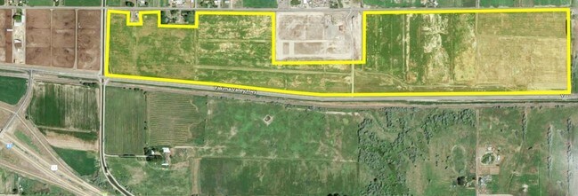
Property Record
2920 N Outlook Rd, Outlook, WA 98938
NEARBY LISTINGS FOR SALE OR LEASE
Property Detail
2920 N Outlook Rd
221027-12006
TH PT OF N1/2 NE1/4 LY N OF R-W OF N.P.RY EX E 1334.8 FT.ALSO EX CO.RD.& R-W OF SNIPES MT.LAT.& EX N 199.8 FT OF E 436 FT OF NW1/4 NE1/4 & EX S 50 FT OF N 250 FT OF W 58 FT OF E 436 FT OF NW1/4 NE1/4 EX ST.HIWAY & EX E 110 FT OF W 460 FT OF N 175 FT
Vacantlandnec
Yakima
X
Washington
53077C1900D
75.44 AC
2022
Outlying Yakima County
2025
Yakima
002104
Yakima, WA
2,618 SF
DEMOGRAPHICS near 2920 N Outlook Rd
1 Mile
3 Mile
5 Mile
2024 Total Population
604
19,625
24,039
2029 Population
590
19,639
23,998
Pop Growth 2024-2029
(2.32%)
+ 0.07%
(0.17%)
Average Age
34
32
33
2024 Total Households
172
5,509
6,778
HH Growth 2024-2029
(2.33%)
(0.02%)
(0.28%)
Median Household Inc
$39,921
$48,774
$49,774
Avg Household Size
3.50
3.50
3.50
2024 Avg HH Vehicles
2.00
3.00
3.00
Median Home Value
$201,667
$191,296
$201,476
Median Year Built
1980
1974
1974
Nearby Places
Map Layers
Map Styles
 Street
 Aerial
- Restaurants
- Banks
- Shops
- Fitness
- Groceries
PUBLIC TRANSPORTATION
AIRPORT
Yakima Air Trml/McAllister Field
DRIVE
WALK
Distance
Yakima Air Trml/McAllister Field
43 min
32.6 mi
SALE & LEASE HISTORY
LISTING DATE
SALE/LEASE

Sep 24, 2016
For Sale
Nearby Properties
Address
Land Use
TOTAL SIZE
Lot Size
Zoning
Address
Land Use
TOTAL SIZE
Lot Size
Zoning
504,969 SF
75.89 AC
PF
Address
Land Use
TOTAL SIZE
Lot Size
Zoning
136,437 SF
14.46 AC
PF
Address
Land Use
TOTAL SIZE
Lot Size
Zoning
92,281 SF
18.90 AC
PF
Address
Land Use
TOTAL SIZE
Lot Size
Zoning
76,449 SF
2.78 AC
PB
Address
Land Use
TOTAL SIZE
Lot Size
Zoning
187,651 SF
18.17 AC
M2
Address
Land Use
TOTAL SIZE
Lot Size
Zoning
65,578 SF
41.08 AC
PF
Address
Land Use
TOTAL SIZE
Lot Size
Zoning
272,152 SF
17.57 AC
M1
Address
Land Use
TOTAL SIZE
Lot Size
Zoning
59,806 SF
8.89 AC
AG
Address
Land Use
TOTAL SIZE
Lot Size
Zoning
224,160 SF
8.53 AC
M2
Address
Land Use
TOTAL SIZE
Lot Size
Zoning
83,940 SF
28.15 AC
PF
Address
Land Use
TOTAL SIZE
Lot Size
Zoning
17,861 SF
7.03 AC
R2
Address
Land Use
TOTAL SIZE
Lot Size
Zoning
113,242 SF
12.92 AC
M1
Address
Land Use
TOTAL SIZE
Lot Size
Zoning
133,376 SF
11.48 AC
B1
Address
Land Use
TOTAL SIZE
Lot Size
Zoning
110,860 SF
7.49 AC
M1
Address
Land Use
TOTAL SIZE
Lot Size
Zoning
36,382 SF
5 AC
R1
Address
Land Use
TOTAL SIZE
Lot Size
Zoning
268,860 SF
12.15 AC
M2
Address
Land Use
TOTAL SIZE
Lot Size
Zoning
52,132 SF
4.74 AC
R2
Address
Land Use
TOTAL SIZE
Lot Size
Zoning
26,021 SF
10.12 AC
PF
Address
Land Use
TOTAL SIZE
Lot Size
Zoning
50,548 SF
0.97 AC
R3
Address
Land Use
TOTAL SIZE
Lot Size
Zoning
134,029 SF
7.19 AC
B2
Address
Land Use
TOTAL SIZE
Lot Size
Zoning
29,120 SF
1.94 AC
R3
Address
Land Use
TOTAL SIZE
Lot Size
Zoning
15,432 SF
21.94 AC
M2
Address
Land Use
TOTAL SIZE
Lot Size
Zoning
10,433 SF
25.30 AC
PF
Address
Land Use
TOTAL SIZE
Lot Size
Zoning
31,724 SF
1.40 AC
R2
Address
Land Use
TOTAL SIZE
Lot Size
Zoning
38.68 AC
AG
Address
Land Use
TOTAL SIZE
Lot Size
Zoning
38,396 SF
2.10 AC
B3
Address
Land Use
TOTAL SIZE
Lot Size
Zoning
39,050 SF
2.50 AC
R3
Address
Land Use
TOTAL SIZE
Lot Size
Zoning
11,141 SF
17.71 AC
PF
Address
Land Use
TOTAL SIZE
Lot Size
Zoning
15,883 SF
0.72 AC
B3
Address
Land Use
TOTAL SIZE
Lot Size
Zoning
37,330 SF
4.95 AC
B2
The World's #1 Commercial Real Estate Marketplace
Connect with us
© 2026 CoStar Group
The information above has been obtained from sources believed reliable. While we do not doubt its accuracy we have not verified it and make no guarantee, warranty or representation about it. It is your responsibility to independently confirm its accuracy and completeness. Any projections, opinions, assumptions, or estimates used are for example only and do not represent the current or future performance of the property. The value of this transaction to you depends on tax and other factors which should be evaluated by your tax, financial, and legal advisors. You and your advisors should conduct a careful, independent investigation of the property to determine to your satisfaction the suitability of the property for your needs.