Property Record
29200 State Road 52, San Antonio, FL 33576


NEARBY LISTINGS FOR SALE OR LEASE
Property Detail
29200 State Road 52
08-25-20-0000-01000-0000
Shopping Center Or Other Site
Storebuilding
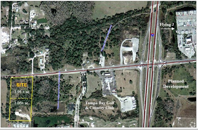
COM AT NW COR OF TAMPA BAY GOLF & COUNTRY CLUB PHAGE IIB PB 34 PG 81 TH S89DEG 5236E ALG NORTH NDY LINE OF SOUTH 3/4 OF SW1/4 OF SW1/4 OF SEC 8 1305.03 FT TO WEST BDY LINE OF EAST 1/2 OF SW1/4 OF SEC 8 TH N02DEG 0931E 835.38 FT FOR POB THE CONT ALG S
X
Pasco
12101C0254F
Florida
2024
7.06 AC
2026
Pasco County
032200
Tampa/St Petersburg
5,600 SF
Tampa-St. Petersburg-Clearwater, FL
DEMOGRAPHICS near 29200 State Road 52
1 Mile
3 Mile
5 Mile
2024 Total Population
1,365
5,025
26,157
2029 Population
1,640
6,101
31,829
Pop Growth 2024-2029
+ 20.15%
+ 21.41%
+ 21.68%
Average Age
68
59
41
2024 Total Households
767
2,446
9,147
HH Growth 2024-2029
+ 20.08%
+ 21.30%
+ 22.12%
Median Household Inc
$66,383
$70,325
$89,361
Avg Household Size
1.80
2.00
2.60
2024 Avg HH Vehicles
1.00
2.00
2.00
Median Home Value
$252,786
$271,283
$293,754
Median Year Built
2000
2004
2005
Nearby Places
Map Layers
Map Styles
 Street
 Aerial
- Restaurants
- Banks
- Shops
- Fitness
- Groceries
PUBLIC TRANSPORTATION
AIRPORT
Tampa International
DRIVE
WALK
Distance
Tampa International
47 min
36.4 mi
Freight Ports
Port of Tampa Bay
DRIVE
WALK
Distance
Port of Tampa Bay
43 min
32.1 mi
Nearby Properties
Address
Land Use
TOTAL SIZE
Lot Size
Zoning
Address
Land Use
TOTAL SIZE
Lot Size
Zoning
1,825,014 SF
157.17 AC
MPUD
Address
Land Use
TOTAL SIZE
Lot Size
Zoning
435,775 SF
138.45 AC
AR
Address
Land Use
TOTAL SIZE
Lot Size
Zoning
373,572 SF
23.16 AC
MPUD
Address
Land Use
TOTAL SIZE
Lot Size
Zoning
157,694 SF
17.50 AC
MPUD
Address
Land Use
TOTAL SIZE
Lot Size
Zoning
104,994 SF
5.04 AC
I1
Address
Land Use
TOTAL SIZE
Lot Size
Zoning
58.54 AC
MPUD
Address
Land Use
TOTAL SIZE
Lot Size
Zoning
60,265 SF
13.36 AC
MPUD
Address
Land Use
TOTAL SIZE
Lot Size
Zoning
39.73 AC
MPUD
Address
Land Use
TOTAL SIZE
Lot Size
Zoning
4,615 SF
19.57 AC
MPUD
Address
Land Use
TOTAL SIZE
Lot Size
Zoning
46,656 SF
2.99 AC
MPUD
Address
Land Use
TOTAL SIZE
Lot Size
Zoning
35.95 AC
MPUD
Address
Land Use
TOTAL SIZE
Lot Size
Zoning
68.79 AC
MPUD
Address
Land Use
TOTAL SIZE
Lot Size
Zoning
1,838 SF
29.25 AC
MPUD
Address
Land Use
TOTAL SIZE
Lot Size
Zoning
46,825 SF
19.67 AC
C2
Address
Land Use
TOTAL SIZE
Lot Size
Zoning
2,688 SF
10.21 AC
MPUD
Address
Land Use
TOTAL SIZE
Lot Size
Zoning
32.62 AC
MPUD
Address
Land Use
TOTAL SIZE
Lot Size
Zoning
37,508 SF
10.33 AC
AC
Address
Land Use
TOTAL SIZE
Lot Size
Zoning
18.02 AC
MPUD
Address
Land Use
TOTAL SIZE
Lot Size
Zoning
30,939 SF
25.65 AC
AC
Address
Land Use
TOTAL SIZE
Lot Size
Zoning
1,218 SF
19.67 AC
MF1
Address
Land Use
TOTAL SIZE
Lot Size
Zoning
36,024 SF
2.05 AC
MPUD
Address
Land Use
TOTAL SIZE
Lot Size
Zoning
33,600 SF
5.85 AC
AR
Address
Land Use
TOTAL SIZE
Lot Size
Zoning
12.50 AC
MPUD
Address
Land Use
TOTAL SIZE
Lot Size
Zoning
14 AC
MPUD
Address
Land Use
TOTAL SIZE
Lot Size
Zoning
43,176 SF
8.99 AC
I1
Address
Land Use
TOTAL SIZE
Lot Size
Zoning
15,067 SF
19.12 AC
I2
Address
Land Use
TOTAL SIZE
Lot Size
Zoning
39,984 SF
2.69 AC
I1
Address
Land Use
TOTAL SIZE
Lot Size
Zoning
7,020 SF
12.47 AC
AR
Address
Land Use
TOTAL SIZE
Lot Size
Zoning
14.76 AC
MPUD
The World's #1 Commercial Real Estate Marketplace
Connect with us
© 2025 CoStar Group
The information above has been obtained from sources believed reliable. While we do not doubt its accuracy we have not verified it and make no guarantee, warranty or representation about it. It is your responsibility to independently confirm its accuracy and completeness. Any projections, opinions, assumptions, or estimates used are for example only and do not represent the current or future performance of the property. The value of this transaction to you depends on tax and other factors which should be evaluated by your tax, financial, and legal advisors. You and your advisors should conduct a careful, independent investigation of the property to determine to your satisfaction the suitability of the property for your needs.