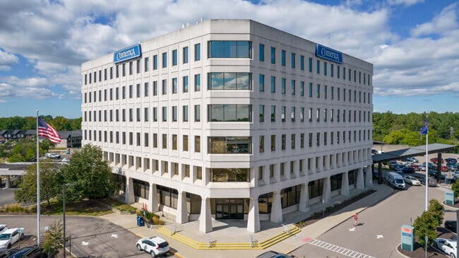
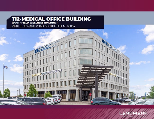
Property Record
29201 Telegraph Rd, Southfield, MI 48034
Current Lease Availabilities
NEARBY LISTINGS FOR SALE OR LEASE
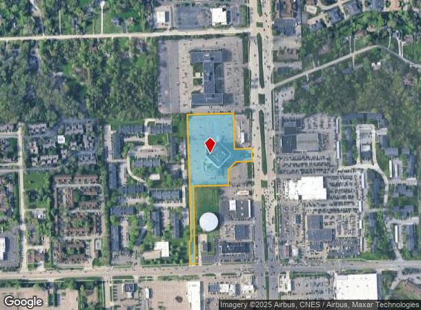
Property Detail
29201 Telegraph Rd
24-08-451-010
T1N, R10E, SEC 8 PART OF SE 1/4 BEG AT PT DIST E 1239.14 FT & N 00-02-04 E 713.86 FT FROM S 1/4 COR, TH S 89-39-02 W 275.93
Commercialnec
Oakland
X
Michigan
26125C0518F
6.82 AC
2022
Southfield
2022
Detroit
160900
Detroit-Warren-Dearborn, MI
DEMOGRAPHICS near 29201 Telegraph Rd
1 Mile
3 Mile
5 Mile
2024 Total Population
7,824
61,198
208,321
2029 Population
7,718
60,521
205,932
Pop Growth 2024-2029
(1.35%)
(1.11%)
(1.15%)
Average Age
43
44
43
2024 Total Households
3,971
26,877
88,350
HH Growth 2024-2029
(1.41%)
(1.07%)
(1.10%)
Median Household Inc
$62,500
$76,443
$83,036
Avg Household Size
1.90
2.20
2.30
2024 Avg HH Vehicles
2.00
2.00
2.00
Median Home Value
$339,627
$300,723
$282,161
Median Year Built
1974
1970
1965
Nearby Places
Map Layers
Map Styles
 Street
 Aerial
- Restaurants
- Banks
- Shops
- Fitness
- Groceries
PUBLIC TRANSPORTATION
COMMUTER RAIL
Troy Amtrak Station (Wolverine - Amtrak)
DRIVE
WALK
Distance
Troy Amtrak Station (Wolverine - Amtrak)
18 min
8.2 mi
Royal Oak Amtrak (Wolverine - Amtrak)
DRIVE
WALK
Distance
Royal Oak Amtrak (Wolverine - Amtrak)
15 min
9.9 mi
AIRPORT
Windsor International
DRIVE
WALK
Distance
Windsor International
49 min
28.4 mi
Detroit Metro Wayne County
DRIVE
WALK
Distance
Detroit Metro Wayne County
42 min
33.7 mi
Freight Ports
Port of Toledo
DRIVE
WALK
Distance
Port of Toledo
91 min
75.3 mi
Nearby Properties
Address
Land Use
TOTAL SIZE
Lot Size
Zoning
Address
Land Use
TOTAL SIZE
Lot Size
Zoning
2,373,792 SF
17.35 AC
RC
Address
Land Use
TOTAL SIZE
Lot Size
Zoning
350,140 SF
37.78 AC
RC
Address
Land Use
TOTAL SIZE
Lot Size
Zoning
882,862 SF
8.22 AC
RC
Address
Land Use
TOTAL SIZE
Lot Size
Zoning
588 SF
53.02 AC
RM
Address
Land Use
TOTAL SIZE
Lot Size
Zoning
460,062 SF
10.01 AC
RC
Address
Land Use
TOTAL SIZE
Lot Size
Zoning
558,088 SF
40.09 AC
AI
Address
Land Use
TOTAL SIZE
Lot Size
Zoning
544,945 SF
23.89 AC
BI
Address
Land Use
TOTAL SIZE
Lot Size
Zoning
592,350 SF
23.64 AC
RC
Address
Land Use
TOTAL SIZE
Lot Size
Zoning
535,287 SF
9.26 AC
RC
Address
Land Use
TOTAL SIZE
Lot Size
Zoning
859,104 SF
9.59 AC
RC
Address
Land Use
TOTAL SIZE
Lot Size
Zoning
439,171 SF
28.57 AC
RMM
Address
Land Use
TOTAL SIZE
Lot Size
Zoning
167,882 SF
16.18 AC
BI
Address
Land Use
TOTAL SIZE
Lot Size
Zoning
261,633 SF
12.19 AC
RMM
Address
Land Use
TOTAL SIZE
Lot Size
Zoning
655,519 SF
9.18 AC
ERO
Address
Land Use
TOTAL SIZE
Lot Size
Zoning
170,465 SF
4.84 AC
BV
Address
Land Use
TOTAL SIZE
Lot Size
Zoning
228,544 SF
35.02 AC
BI
Address
Land Use
TOTAL SIZE
Lot Size
Zoning
246,695 SF
18.46 AC
BI
Address
Land Use
TOTAL SIZE
Lot Size
Zoning
17.19 AC
RC
Address
Land Use
TOTAL SIZE
Lot Size
Zoning
280,500 SF
3.58 AC
RC
Address
Land Use
TOTAL SIZE
Lot Size
Zoning
350,140 SF
27.11 AC
RC
Address
Land Use
TOTAL SIZE
Lot Size
Zoning
255,136 SF
21.19 AC
AI
Address
Land Use
TOTAL SIZE
Lot Size
Zoning
248,911 SF
4.55 AC
RC
Address
Land Use
TOTAL SIZE
Lot Size
Zoning
233,598 SF
17.24 AC
RS
Address
Land Use
TOTAL SIZE
Lot Size
Zoning
301,269 SF
25.47 AC
OS
Address
Land Use
TOTAL SIZE
Lot Size
Zoning
405,020 SF
18.74 AC
RMM
Address
Land Use
TOTAL SIZE
Lot Size
Zoning
367,101 SF
37.77 AC
R-E
Address
Land Use
TOTAL SIZE
Lot Size
Zoning
344,960 SF
8.90 AC
RC
Address
Land Use
TOTAL SIZE
Lot Size
Zoning
Address
Land Use
TOTAL SIZE
Lot Size
Zoning
213,135 SF
6.17 AC
RC
Address
Land Use
TOTAL SIZE
Lot Size
Zoning
325,654 SF
7.45 AC
ERO
The World's #1 Commercial Real Estate Marketplace
Connect with us
© 2025 CoStar Group
The information above has been obtained from sources believed reliable. While we do not doubt its accuracy we have not verified it and make no guarantee, warranty or representation about it. It is your responsibility to independently confirm its accuracy and completeness. Any projections, opinions, assumptions, or estimates used are for example only and do not represent the current or future performance of the property. The value of this transaction to you depends on tax and other factors which should be evaluated by your tax, financial, and legal advisors. You and your advisors should conduct a careful, independent investigation of the property to determine to your satisfaction the suitability of the property for your needs.