Property Record
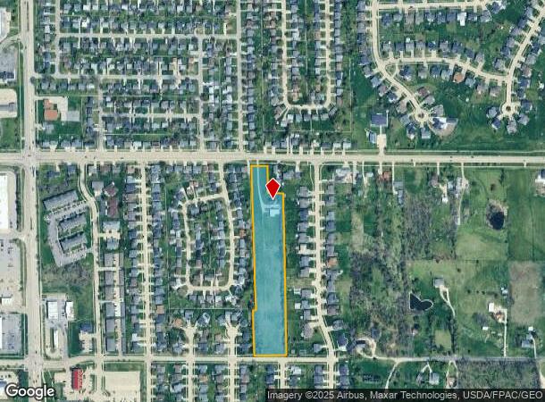
2921 33Rd Ave Sw, Cedar Rapids, IA 52404

NEARBY LISTINGS FOR SALE OR LEASE
Property Detail
2921 33Rd Ave Sw
19062-76011-00000
Rolling Green
Commercialnec
W 6A SE NW EX N230 E100 & EX ROLLING GREEN UNIT V & EX RD 6 82 7
X
Linn
19113C0405F
Iowa
2024
5.04 AC
2025
Iowa City/Waterloo
003005
Other Market Areas
3,371 SF
Cedar Rapids, IA
DEMOGRAPHICS near 2921 33Rd Ave Sw
1 Mile
3 Mile
5 Mile
2024 Total Population
5,529
51,421
95,591
2029 Population
5,528
51,491
95,544
Pop Growth 2024-2029
(0.02%)
+ 0.14%
(0.05%)
Average Age
39
40
39
2024 Total Households
2,204
21,506
39,941
HH Growth 2024-2029
+ 0.09%
+ 0.13%
(0.02%)
Median Household Inc
$77,202
$58,082
$60,265
Avg Household Size
2.40
2.30
2.20
2024 Avg HH Vehicles
2.00
2.00
2.00
Median Home Value
$194,060
$156,478
$167,695
Median Year Built
2002
1972
1973
Nearby Places
Map Layers
Map Styles
 Street
 Aerial
- Restaurants
- Banks
- Shops
- Fitness
- Groceries
PUBLIC TRANSPORTATION
AIRPORT
The Eastern Iowa
DRIVE
WALK
Distance
The Eastern Iowa
10 min
4.8 mi
Freight Ports
Port Milwaukee
DRIVE
WALK
Distance
Port Milwaukee
300 min
250.8 mi
Nearby Properties
Address
Land Use
TOTAL SIZE
Lot Size
Zoning
Address
Land Use
TOTAL SIZE
Lot Size
Zoning
269,397 SF
153.19 AC
Address
Land Use
TOTAL SIZE
Lot Size
Zoning
1,012,084 SF
45.85 AC
Address
Land Use
TOTAL SIZE
Lot Size
Zoning
308,309 SF
17.97 AC
Address
Land Use
TOTAL SIZE
Lot Size
Zoning
550,428 SF
78.91 AC
Address
Land Use
TOTAL SIZE
Lot Size
Zoning
427,700 SF
12.67 AC
Address
Land Use
TOTAL SIZE
Lot Size
Zoning
592,459 SF
45.65 AC
Address
Land Use
TOTAL SIZE
Lot Size
Zoning
218,451 SF
18.74 AC
Address
Land Use
TOTAL SIZE
Lot Size
Zoning
68,553 SF
7.70 AC
Address
Land Use
TOTAL SIZE
Lot Size
Zoning
42,449 SF
4.70 AC
Address
Land Use
TOTAL SIZE
Lot Size
Zoning
1,049,268 SF
79.35 AC
Address
Land Use
TOTAL SIZE
Lot Size
Zoning
59,467 SF
8.39 AC
Address
Land Use
TOTAL SIZE
Lot Size
Zoning
243,300 SF
22.44 AC
Address
Land Use
TOTAL SIZE
Lot Size
Zoning
110,583 SF
15.56 AC
Address
Land Use
TOTAL SIZE
Lot Size
Zoning
80,530 SF
2.96 AC
Address
Land Use
TOTAL SIZE
Lot Size
Zoning
66,922 SF
4.90 AC
Address
Land Use
TOTAL SIZE
Lot Size
Zoning
156,678 SF
21.85 AC
Address
Land Use
TOTAL SIZE
Lot Size
Zoning
907,717 SF
152.19 AC
Address
Land Use
TOTAL SIZE
Lot Size
Zoning
315,459 SF
13.85 AC
Address
Land Use
TOTAL SIZE
Lot Size
Zoning
416,830 SF
18.06 AC
Address
Land Use
TOTAL SIZE
Lot Size
Zoning
88,849 SF
18.63 AC
Address
Land Use
TOTAL SIZE
Lot Size
Zoning
203,840 SF
18.22 AC
Address
Land Use
TOTAL SIZE
Lot Size
Zoning
212,316 SF
23.89 AC
Address
Land Use
TOTAL SIZE
Lot Size
Zoning
205,013 SF
16.44 AC
Address
Land Use
TOTAL SIZE
Lot Size
Zoning
189,188 SF
19.44 AC
Address
Land Use
TOTAL SIZE
Lot Size
Zoning
198,251 SF
16.85 AC
Address
Land Use
TOTAL SIZE
Lot Size
Zoning
39,271 SF
0.66 AC
Address
Land Use
TOTAL SIZE
Lot Size
Zoning
175,600 SF
15.91 AC
Address
Land Use
TOTAL SIZE
Lot Size
Zoning
74,525 SF
5.69 AC
Address
Land Use
TOTAL SIZE
Lot Size
Zoning
44,754 SF
6 AC
Address
Land Use
TOTAL SIZE
Lot Size
Zoning
68,384 SF
17.90 AC
The World's #1 Commercial Real Estate Marketplace
Connect with us
© 2025 CoStar Group
The information above has been obtained from sources believed reliable. While we do not doubt its accuracy we have not verified it and make no guarantee, warranty or representation about it. It is your responsibility to independently confirm its accuracy and completeness. Any projections, opinions, assumptions, or estimates used are for example only and do not represent the current or future performance of the property. The value of this transaction to you depends on tax and other factors which should be evaluated by your tax, financial, and legal advisors. You and your advisors should conduct a careful, independent investigation of the property to determine to your satisfaction the suitability of the property for your needs.