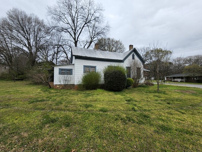
Property Record
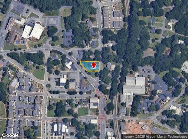
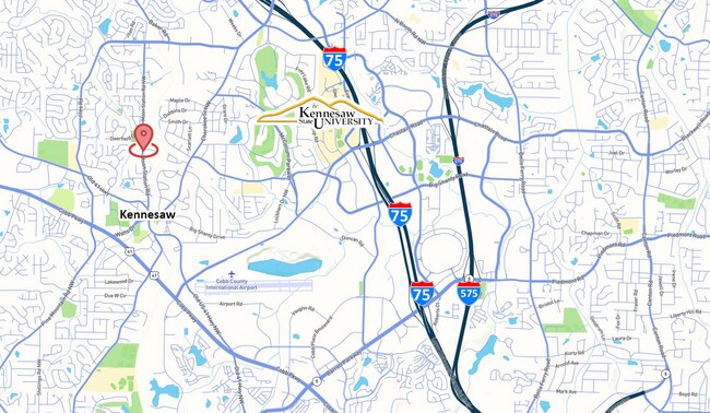
2921 Moon Station Rd Nw, Kennesaw, GA 30144
NEARBY LISTINGS FOR SALE OR LEASE
Property Detail
2921 Moon Station Rd Nw
Atlanta-Sandy Springs-Roswell, GA
Cobb
20-0138-0-159-0
Georgia
Residentialnec
0.42 AC
X
Kennesaw/Town Center
13057C0350E
Atlanta
2,032 SF
DEMOGRAPHICS near 2921 Moon Station Rd Nw
1 Mile
3 Mile
5 Mile
2024 Total Population
7,710
76,543
173,313
2029 Population
7,763
77,693
177,701
Pop Growth 2024-2029
+ 0.69%
+ 1.50%
+ 2.53%
Average Age
37
37
39
2024 Total Households
2,974
28,669
63,963
HH Growth 2024-2029
+ 0.84%
+ 1.61%
+ 2.53%
Median Household Inc
$71,333
$82,995
$90,641
Avg Household Size
2.50
2.50
2.60
2024 Avg HH Vehicles
2.00
2.00
2.00
Median Home Value
$232,002
$279,337
$308,322
Median Year Built
1988
1996
1995
Nearby Places
Map Layers
Map Styles
 Street
 Aerial
- Restaurants
- Banks
- Shops
- Fitness
- Groceries
PUBLIC TRANSPORTATION
AIRPORT
Hartsfield - Jackson Atlanta International
DRIVE
WALK
Distance
Hartsfield - Jackson Atlanta International
49 min
34.9 mi
Freight Ports
Georgia Ports - Savannah
DRIVE
WALK
Distance
Georgia Ports - Savannah
312 min
274.2 mi
SALE & LEASE HISTORY
LISTING DATE
SALE/LEASE

Mar 12, 2022
For Sale
Jan 25, 2021
For Sale
Dec 04, 2024
For Sale
Aug 22, 2017
For Sale
Nearby Properties
Address
Land Use
TOTAL SIZE
Lot Size
Zoning
Address
Land Use
TOTAL SIZE
Lot Size
Zoning
497,466 SF
40.63 AC
RM-12
Address
Land Use
TOTAL SIZE
Lot Size
Zoning
449,337 SF
53.52 AC
RM-12
Address
Land Use
TOTAL SIZE
Lot Size
Zoning
489,796 SF
44.09 AC
RM-12
Address
Land Use
TOTAL SIZE
Lot Size
Zoning
4,812 SF
4.20 AC
PVC
Address
Land Use
TOTAL SIZE
Lot Size
Zoning
416,821 SF
12.96 AC
Address
Land Use
TOTAL SIZE
Lot Size
Zoning
35,085 SF
3.77 AC
RRC
Address
Land Use
TOTAL SIZE
Lot Size
Zoning
95,228 SF
12.97 AC
CBD
Address
Land Use
TOTAL SIZE
Lot Size
Zoning
342,443 SF
19.15 AC
NRC/RM12
Address
Land Use
TOTAL SIZE
Lot Size
Zoning
7.79 AC
RRC
Address
Land Use
TOTAL SIZE
Lot Size
Zoning
382,704 SF
18.72 AC
RM-16
Address
Land Use
TOTAL SIZE
Lot Size
Zoning
31.37 AC
PVC
Address
Land Use
TOTAL SIZE
Lot Size
Zoning
352,938 SF
19.86 AC
RM-16
Address
Land Use
TOTAL SIZE
Lot Size
Zoning
269,464 SF
2.61 AC
CBD
Address
Land Use
TOTAL SIZE
Lot Size
Zoning
69,476 SF
8.11 AC
PVC
Address
Land Use
TOTAL SIZE
Lot Size
Zoning
617,562 SF
35.22 AC
PSC
Address
Land Use
TOTAL SIZE
Lot Size
Zoning
13.43 AC
OI
Address
Land Use
TOTAL SIZE
Lot Size
Zoning
437,231 SF
5.79 AC
PVC
Address
Land Use
TOTAL SIZE
Lot Size
Zoning
7.53 AC
OI
Address
Land Use
TOTAL SIZE
Lot Size
Zoning
283,134 SF
13.10 AC
PVC
Address
Land Use
TOTAL SIZE
Lot Size
Zoning
3.16 AC
PVC
Address
Land Use
TOTAL SIZE
Lot Size
Zoning
13.46 AC
PVC
Address
Land Use
TOTAL SIZE
Lot Size
Zoning
367,587 SF
26.87 AC
RM-12
Address
Land Use
TOTAL SIZE
Lot Size
Zoning
375,544 SF
27.82 AC
RM-12
Address
Land Use
TOTAL SIZE
Lot Size
Zoning
270,275 SF
21.52 AC
RM-12
Address
Land Use
TOTAL SIZE
Lot Size
Zoning
245,066 SF
15.41 AC
UC
Address
Land Use
TOTAL SIZE
Lot Size
Zoning
360,937 SF
32.56 AC
RM-12
Address
Land Use
TOTAL SIZE
Lot Size
Zoning
272,064 SF
22.59 AC
RM-12
Address
Land Use
TOTAL SIZE
Lot Size
Zoning
280,546 SF
26.91 AC
RM-12
Address
Land Use
TOTAL SIZE
Lot Size
Zoning
288,926 SF
75 AC
LI
Address
Land Use
TOTAL SIZE
Lot Size
Zoning
218,895 SF
8.10 AC
PVC
The World's #1 Commercial Real Estate Marketplace
Connect with us
© 2025 CoStar Group
The information above has been obtained from sources believed reliable. While we do not doubt its accuracy we have not verified it and make no guarantee, warranty or representation about it. It is your responsibility to independently confirm its accuracy and completeness. Any projections, opinions, assumptions, or estimates used are for example only and do not represent the current or future performance of the property. The value of this transaction to you depends on tax and other factors which should be evaluated by your tax, financial, and legal advisors. You and your advisors should conduct a careful, independent investigation of the property to determine to your satisfaction the suitability of the property for your needs.