Property Record
2921 Us 220, Summerfield, NC 27358
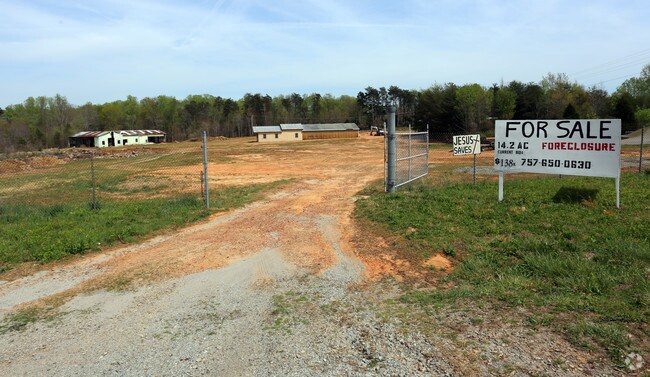


This Property Is For Sale
Current Lease Availabilities
Property Detail
2921 Us 220
121625
13.43 AC CHILTON LANDSCAP ING & TREE SERVICE INC CHILTON LANDSCPING SURVEY
Mill
ROCKINGHAM
HWY COMM C
North Carolina
B and X Area of moderate flood hazard, usually the area between the limits of the 100-year and 500-year floods.
13.43 AC
2025
Rockingham County
2025
Greensboro/Winston-Salem
015800
Greensboro-High Point, NC
NEARBY LISTINGS FOR SALE OR LEASE
-
-
View all Summerfield listings for sale on LoopNet.com
DEMOGRAPHICS near 2921 Us 220
1 mile
3 mile
5 mile
2025 Total Population
519
4,180
11,719
2030 Population
534
4,293
12,049
Pop Growth 2025-2030
+ 2.89%
+ 2.70%
+ 2.82%
Average Age
45
44
43
2025 Total Households
205
1,673
4,852
HH Growth 2025-2030
+ 2.93%
+ 2.75%
+ 2.84%
Median Household Inc
$77,155
$73,577
$68,560
Avg Household Size
2.30
2.40
2.40
2025 Avg HH Vehicles
3.00
3.00
2.00
Median Home Value
$230,000
$230,360
$223,662
Median Year Built
1992
1992
1990
Nearby Places
Map Layers
Map Styles
 Street
 Aerial
Layers
 Traffic
 Biking
Places
Listings with unknown addresses are not visible on the map
- Restaurants
- Banks
- Shops
- Fitness
- Groceries
PUBLIC TRANSPORTATION
AIRPORT
Piedmont Triad International
Drive
Walk
Distance
Piedmont Triad International
33 min
22.7 mi
Freight Ports
Virginia Port Authority - Richmond
Drive
Walk
Distance
Virginia Port Authority - Richmond
246 min
187.1 mi
Nearby Properties
Address
Land Use
TOTAL SIZE
Lot Size
Zoning
Address
Land Use
TOTAL SIZE
Lot Size
Zoning
75,125 SF
42.96 AC
RES AG COU
Address
Land Use
TOTAL SIZE
Lot Size
Zoning
8,000 SF
17.09 AC
HWY COMM C
Address
Land Use
TOTAL SIZE
Lot Size
Zoning
6,600 SF
48.42 AC
RES AG COU
Address
Land Use
TOTAL SIZE
Lot Size
Zoning
6,240 SF
9.16 AC
OFF&INST C
Address
Land Use
TOTAL SIZE
Lot Size
Zoning
4,500 SF
12 AC
IN MORE TH
Address
Land Use
TOTAL SIZE
Lot Size
Zoning
16,443 SF
3.70 AC
LIGHT IND
Address
Land Use
TOTAL SIZE
Lot Size
Zoning
9,100 SF
8.22 AC
RES AG HWY
Address
Land Use
TOTAL SIZE
Lot Size
Zoning
11,800 SF
3.01 AC
GENERAL CO
Address
Land Use
TOTAL SIZE
Lot Size
Zoning
10,759 SF
10.59 AC
HWY COMM C
Address
Land Use
TOTAL SIZE
Lot Size
Zoning
22,650 SF
5.23 AC
HWY COMM C
Address
Land Use
TOTAL SIZE
Lot Size
Zoning
54.72 AC
IN MORE TH
Address
Land Use
TOTAL SIZE
Lot Size
Zoning
111.73 AC
RES AG COU
Address
Land Use
TOTAL SIZE
Lot Size
Zoning
91.01 AC
RES AG COU
Address
Land Use
TOTAL SIZE
Lot Size
Zoning
21,450 SF
9.85 AC
LIGHT INDU
Address
Land Use
TOTAL SIZE
Lot Size
Zoning
12,000 SF
3.92 AC
LIGHT INDU
Address
Land Use
TOTAL SIZE
Lot Size
Zoning
40,000 SF
14.41 AC
RES AG LGT
Address
Land Use
TOTAL SIZE
Lot Size
Zoning
164.98 AC
RES AG/RES
Address
Land Use
TOTAL SIZE
Lot Size
Zoning
2,985 SF
1.03 AC
HWY COMM C
Address
Land Use
TOTAL SIZE
Lot Size
Zoning
3,344 SF
14.09 AC
RES AG HWY
Address
Land Use
TOTAL SIZE
Lot Size
Zoning
112.54 AC
RES AG/RES
Address
Land Use
TOTAL SIZE
Lot Size
Zoning
6,180 SF
3.88 AC
RES AG COU
Address
Land Use
TOTAL SIZE
Lot Size
Zoning
20,980 SF
2.90 AC
LIGHT INDU
Address
Land Use
TOTAL SIZE
Lot Size
Zoning
99.50 AC
RES AG COU
Address
Land Use
TOTAL SIZE
Lot Size
Zoning
113.19 AC
RES AG COU
Address
Land Use
TOTAL SIZE
Lot Size
Zoning
102.73 AC
RES AG COU
Address
Land Use
TOTAL SIZE
Lot Size
Zoning
122.22 AC
RES AG COU
Address
Land Use
TOTAL SIZE
Lot Size
Zoning
5,424 SF
10.50 AC
IN MORE TH
Address
Land Use
TOTAL SIZE
Lot Size
Zoning
95.20 AC
RES MIXED
Address
Land Use
TOTAL SIZE
Lot Size
Zoning
1.27 AC
RES AG COU
Address
Land Use
TOTAL SIZE
Lot Size
Zoning
135.06 AC
RES AG COU
The World's #1 Commercial Real Estate Marketplace
Connect with us
© 2026 CoStar Group
The information above has been obtained from sources believed reliable. While we do not doubt its accuracy we have not verified it and make no guarantee, warranty or representation about it. It is your responsibility to independently confirm its accuracy and completeness. Any projections, opinions, assumptions, or estimates used are for example only and do not represent the current or future performance of the property. The value of this transaction to you depends on tax and other factors which should be evaluated by your tax, financial, and legal advisors. You and your advisors should conduct a careful, independent investigation of the property to determine to your satisfaction the suitability of the property for your needs.