Property Record
2923 N Main St, Fort Worth, TX 76106


NEARBY LISTINGS FOR SALE OR LEASE
Property Detail
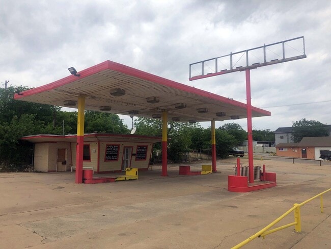
2923 N Main St
Dallas-Fort Worth-Arlington, TX
Ellis, M G Addition
00835994
ELLIS, M G ADDITION BLOCK 67 LOT 9 THRU 12
Commercialnec
Tarrant
X
Texas
48439C0190L
9-12
2024
0.64 AC
2025
North Fort Worth
100300
Dallas/Ft Worth
472 SF
DEMOGRAPHICS near 2923 N Main St
1 Mile
3 Mile
5 Mile
2024 Total Population
12,773
77,251
243,320
2029 Population
13,493
81,937
258,134
Pop Growth 2024-2029
+ 5.64%
+ 6.07%
+ 6.09%
Average Age
34
35
36
2024 Total Households
3,534
24,932
87,272
HH Growth 2024-2029
+ 5.69%
+ 6.55%
+ 6.51%
Median Household Inc
$49,589
$52,110
$61,014
Avg Household Size
3.40
3.00
2.60
2024 Avg HH Vehicles
2.00
2.00
2.00
Median Home Value
$119,727
$139,693
$216,140
Median Year Built
1956
1960
1985
Nearby Places
Map Layers
Map Styles
 Street
 Aerial
- Restaurants
- Banks
- Shops
- Fitness
- Groceries
PUBLIC TRANSPORTATION
COMMUTER RAIL
DRIVE
WALK
Distance
9 min
4.1 mi
Fort Worth Intermodal Transportation Center (ITC) (Trinity Railway Express - Dallas Area Rapid Transit (DART))
DRIVE
WALK
Distance
Fort Worth Intermodal Transportation Center (ITC) (Trinity Railway Express - Dallas Area Rapid Transit (DART))
9 min
4.1 mi
AIRPORT
Dallas-Fort Worth International
DRIVE
WALK
Distance
Dallas-Fort Worth International
36 min
26.2 mi
Dallas Love Field
DRIVE
WALK
Distance
Dallas Love Field
46 min
34.8 mi
SALE & LEASE HISTORY
LISTING DATE
SALE/LEASE

Sep 24, 2016
For Sale
Oct 07, 2022
For Lease
Apr 28, 2022
For Sale
Nearby Properties
Address
Land Use
TOTAL SIZE
Lot Size
Zoning
Address
Land Use
TOTAL SIZE
Lot Size
Zoning
133,700 SF
6.29 AC
Address
Land Use
TOTAL SIZE
Lot Size
Zoning
205,807 SF
3.19 AC
Address
Land Use
TOTAL SIZE
Lot Size
Zoning
1,291,500 SF
61.22 AC
Address
Land Use
TOTAL SIZE
Lot Size
Zoning
586,500 SF
159.54 AC
Address
Land Use
TOTAL SIZE
Lot Size
Zoning
419,815 SF
10.26 AC
Address
Land Use
TOTAL SIZE
Lot Size
Zoning
1,009,800 SF
49.98 AC
Address
Land Use
TOTAL SIZE
Lot Size
Zoning
699,246 SF
40.69 AC
Address
Land Use
TOTAL SIZE
Lot Size
Zoning
442,989 SF
7.15 AC
Address
Land Use
TOTAL SIZE
Lot Size
Zoning
257,308 SF
8.13 AC
Address
Land Use
TOTAL SIZE
Lot Size
Zoning
307,139 SF
14.02 AC
Address
Land Use
TOTAL SIZE
Lot Size
Zoning
697,140 SF
37.84 AC
Address
Land Use
TOTAL SIZE
Lot Size
Zoning
459,030 SF
4.84 AC
Address
Land Use
TOTAL SIZE
Lot Size
Zoning
252,000 SF
4.15 AC
Address
Land Use
TOTAL SIZE
Lot Size
Zoning
566,816 SF
32.79 AC
Address
Land Use
TOTAL SIZE
Lot Size
Zoning
255,773 SF
12.48 AC
Address
Land Use
TOTAL SIZE
Lot Size
Zoning
225,140 SF
11.68 AC
Address
Land Use
TOTAL SIZE
Lot Size
Zoning
436,844 SF
1.25 AC
Address
Land Use
TOTAL SIZE
Lot Size
Zoning
569,345 SF
33.77 AC
Address
Land Use
TOTAL SIZE
Lot Size
Zoning
352,131 SF
2.15 AC
Address
Land Use
TOTAL SIZE
Lot Size
Zoning
588,300 SF
37.67 AC
Address
Land Use
TOTAL SIZE
Lot Size
Zoning
310,780 SF
4.38 AC
Address
Land Use
TOTAL SIZE
Lot Size
Zoning
390,395 SF
4.18 AC
Address
Land Use
TOTAL SIZE
Lot Size
Zoning
197,131 SF
43.78 AC
Address
Land Use
TOTAL SIZE
Lot Size
Zoning
540,414 SF
28.67 AC
Address
Land Use
TOTAL SIZE
Lot Size
Zoning
728,054 SF
33.51 AC
Address
Land Use
TOTAL SIZE
Lot Size
Zoning
505,500 SF
27.72 AC
Address
Land Use
TOTAL SIZE
Lot Size
Zoning
362,702 SF
31.11 AC
Address
Land Use
TOTAL SIZE
Lot Size
Zoning
95,920 SF
3.13 AC
Address
Land Use
TOTAL SIZE
Lot Size
Zoning
388,446 SF
22.07 AC
Address
Land Use
TOTAL SIZE
Lot Size
Zoning
91,398 SF
3.48 AC
The World's #1 Commercial Real Estate Marketplace
Connect with us
© 2025 CoStar Group
The information above has been obtained from sources believed reliable. While we do not doubt its accuracy we have not verified it and make no guarantee, warranty or representation about it. It is your responsibility to independently confirm its accuracy and completeness. Any projections, opinions, assumptions, or estimates used are for example only and do not represent the current or future performance of the property. The value of this transaction to you depends on tax and other factors which should be evaluated by your tax, financial, and legal advisors. You and your advisors should conduct a careful, independent investigation of the property to determine to your satisfaction the suitability of the property for your needs.