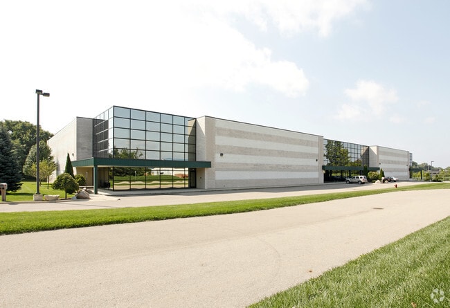
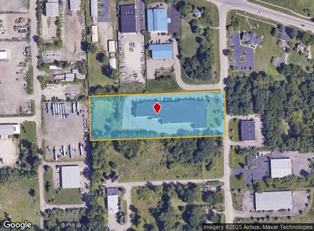
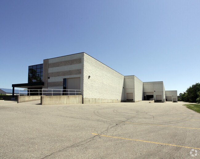
Property Record
29233 Haas Rd, Wixom, MI 48393
NEARBY LISTINGS FOR SALE OR LEASE
Property Detail
29233 Haas Rd
21-11-251-019
T1N, R7E, SEC 11 PART OF NE 1/4 BEG AT PT DIST N 89-54-38 E 600 FT & N 00-01-57 W 941.35 FT FROM CEN OF SEC, TH N 00-01-57 W 250 FT, TH N 89-54-38 E 762.35 FT, TH S 00-26-00 W 250 FT, TH S 89-54-38 W 760.32 FT TO BEG 4.37 A 3-22-99 FR 009
Manufacturinglight
Oakland
X
Michigan
26125C0464F
4.18 AC
2024
Central I-96 Corridor
2024
Detroit
138600
Detroit-Warren-Dearborn, MI
44,367 SF
DEMOGRAPHICS near 29233 Haas Rd
1 Mile
3 Mile
5 Mile
2024 Total Population
289
20,577
83,154
2029 Population
289
20,381
82,364
Pop Growth 2024-2029
0.00%
(0.95%)
(0.95%)
Average Age
40
37
39
2024 Total Households
96
7,308
32,704
HH Growth 2024-2029
(1.04%)
(1.23%)
(1.29%)
Median Household Inc
$148,863
$110,841
$99,056
Avg Household Size
2.90
2.80
2.50
2024 Avg HH Vehicles
3.00
2.00
2.00
Median Home Value
$433,333
$417,185
$370,850
Median Year Built
1995
2001
1993
Nearby Places
Map Layers
Map Styles
 Street
 Aerial
- Restaurants
- Banks
- Shops
- Fitness
- Groceries
PUBLIC TRANSPORTATION
AIRPORT
Detroit Metro Wayne County
DRIVE
WALK
Distance
Detroit Metro Wayne County
39 min
32.7 mi
Freight Ports
Port of Toledo
DRIVE
WALK
Distance
Port of Toledo
89 min
74.3 mi
Nearby Properties
Address
Land Use
TOTAL SIZE
Lot Size
Zoning
Address
Land Use
TOTAL SIZE
Lot Size
Zoning
873,288 SF
Address
Land Use
TOTAL SIZE
Lot Size
Zoning
433,305 SF
19.63 AC
Address
Land Use
TOTAL SIZE
Lot Size
Zoning
563,160 SF
47.06 AC
Address
Land Use
TOTAL SIZE
Lot Size
Zoning
317,215 SF
23.63 AC
Address
Land Use
TOTAL SIZE
Lot Size
Zoning
306,804 SF
Address
Land Use
TOTAL SIZE
Lot Size
Zoning
140,366 SF
30.67 AC
II
Address
Land Use
TOTAL SIZE
Lot Size
Zoning
172,700 SF
Address
Land Use
TOTAL SIZE
Lot Size
Zoning
7,471 SF
114.63 AC
MM
Address
Land Use
TOTAL SIZE
Lot Size
Zoning
325,725 SF
30.46 AC
Address
Land Use
TOTAL SIZE
Lot Size
Zoning
25.58 AC
RC1
Address
Land Use
TOTAL SIZE
Lot Size
Zoning
279,807 SF
31.24 AC
II
Address
Land Use
TOTAL SIZE
Lot Size
Zoning
154,490 SF
Address
Land Use
TOTAL SIZE
Lot Size
Zoning
200,926 SF
30.87 AC
M1
Address
Land Use
TOTAL SIZE
Lot Size
Zoning
287,382 SF
42.91 AC
II
Address
Land Use
TOTAL SIZE
Lot Size
Zoning
286,708 SF
Address
Land Use
TOTAL SIZE
Lot Size
Zoning
208,276 SF
28.02 AC
Address
Land Use
TOTAL SIZE
Lot Size
Zoning
101,752 SF
7.20 AC
Address
Land Use
TOTAL SIZE
Lot Size
Zoning
223,110 SF
18.53 AC
BI
Address
Land Use
TOTAL SIZE
Lot Size
Zoning
14.93 AC
RC2
Address
Land Use
TOTAL SIZE
Lot Size
Zoning
325,725 SF
Address
Land Use
TOTAL SIZE
Lot Size
Zoning
150,217 SF
10.22 AC
IV
Address
Land Use
TOTAL SIZE
Lot Size
Zoning
233,158 SF
24.50 AC
Address
Land Use
TOTAL SIZE
Lot Size
Zoning
132,101 SF
Address
Land Use
TOTAL SIZE
Lot Size
Zoning
2,980 SF
71.92 AC
MH
Address
Land Use
TOTAL SIZE
Lot Size
Zoning
148,298 SF
20.43 AC
Address
Land Use
TOTAL SIZE
Lot Size
Zoning
208,276 SF
34.53 AC
Address
Land Use
TOTAL SIZE
Lot Size
Zoning
69,072 SF
22.05 AC
Address
Land Use
TOTAL SIZE
Lot Size
Zoning
66,070 SF
Address
Land Use
TOTAL SIZE
Lot Size
Zoning
208,276 SF
Address
Land Use
TOTAL SIZE
Lot Size
Zoning
101,752 SF
4.25 AC
IRO
The World's #1 Commercial Real Estate Marketplace
Connect with us
© 2025 CoStar Group
The information above has been obtained from sources believed reliable. While we do not doubt its accuracy we have not verified it and make no guarantee, warranty or representation about it. It is your responsibility to independently confirm its accuracy and completeness. Any projections, opinions, assumptions, or estimates used are for example only and do not represent the current or future performance of the property. The value of this transaction to you depends on tax and other factors which should be evaluated by your tax, financial, and legal advisors. You and your advisors should conduct a careful, independent investigation of the property to determine to your satisfaction the suitability of the property for your needs.