Property Record
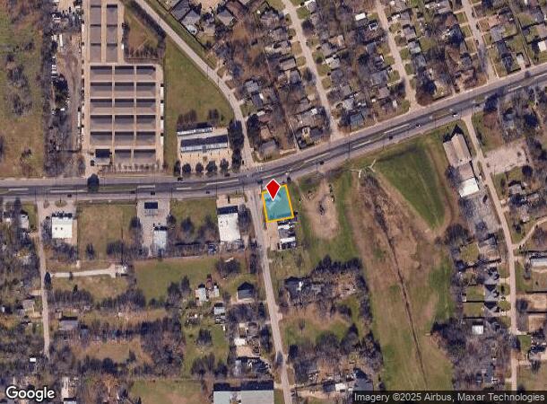
2924 W Scyene Rd, Mesquite, TX 75149


NEARBY LISTINGS FOR SALE OR LEASE
Property Detail
2924 W Scyene Rd
Dallas-Fort Worth-Arlington, TX
Sherwood Forest 1 & 2
38180500001190000
SHERWOOD FOREST 1 & 2 N 110 LOT 119 INT201600274332 DD09272016 CO-DC 1805000011900 3CM18050000
Storebuilding
Dallas
X
Texas
48113C0370K
119
2024
0.22 AC
2025
Mesquite
017606
Dallas/Ft Worth
892 SF
DEMOGRAPHICS near 2924 W Scyene Rd
1 Mile
3 Mile
5 Mile
2024 Total Population
18,401
125,103
309,182
2029 Population
17,875
123,010
304,704
Pop Growth 2024-2029
(2.86%)
(1.67%)
(1.45%)
Average Age
33
34
35
2024 Total Households
5,634
38,323
96,253
HH Growth 2024-2029
(3.46%)
(1.98%)
(1.68%)
Median Household Inc
$42,072
$47,795
$52,809
Avg Household Size
3.20
3.10
3.10
2024 Avg HH Vehicles
2.00
2.00
2.00
Median Home Value
$151,848
$154,872
$178,557
Median Year Built
1981
1975
1975
Nearby Places
Map Layers
Map Styles
 Street
 Aerial
- Restaurants
- Banks
- Shops
- Fitness
- Groceries
PUBLIC TRANSPORTATION
AIRPORT
Dallas Love Field
DRIVE
WALK
Distance
Dallas Love Field
29 min
15.2 mi
Dallas-Fort Worth International
DRIVE
WALK
Distance
Dallas-Fort Worth International
44 min
30.5 mi
Nearby Properties
Address
Land Use
TOTAL SIZE
Lot Size
Zoning
Address
Land Use
TOTAL SIZE
Lot Size
Zoning
768,482 SF
40.44 AC
Z109
Address
Land Use
TOTAL SIZE
Lot Size
Zoning
199,246 SF
15.32 AC
Z250
Address
Land Use
TOTAL SIZE
Lot Size
Zoning
194,385 SF
44.63 AC
Z396
Address
Land Use
TOTAL SIZE
Lot Size
Zoning
144,858 SF
9.69 AC
Z206
Address
Land Use
TOTAL SIZE
Lot Size
Zoning
184,728 SF
21.62 AC
Z298
Address
Land Use
TOTAL SIZE
Lot Size
Zoning
544,700 SF
29.75 AC
Z125
Address
Land Use
TOTAL SIZE
Lot Size
Zoning
255,008 SF
30.39 AC
Z250
Address
Land Use
TOTAL SIZE
Lot Size
Zoning
386,240 SF
20.03 AC
Z237
Address
Land Use
TOTAL SIZE
Lot Size
Zoning
588,625 SF
29.01 AC
Z109
Address
Land Use
TOTAL SIZE
Lot Size
Zoning
555,510 SF
32.62 AC
Z31
Address
Land Use
TOTAL SIZE
Lot Size
Zoning
97,000 SF
12.57 AC
Z239
Address
Land Use
TOTAL SIZE
Lot Size
Zoning
487,200 SF
29.56 AC
Z109
Address
Land Use
TOTAL SIZE
Lot Size
Zoning
902,719 SF
50.31 AC
Z109
Address
Land Use
TOTAL SIZE
Lot Size
Zoning
530,100 SF
28.84 AC
Z109
Address
Land Use
TOTAL SIZE
Lot Size
Zoning
508,750 SF
32.15 AC
Z125
Address
Land Use
TOTAL SIZE
Lot Size
Zoning
117,218 SF
8.49 AC
Z298
Address
Land Use
TOTAL SIZE
Lot Size
Zoning
491,561 SF
27.70 AC
Z109
Address
Land Use
TOTAL SIZE
Lot Size
Zoning
457,076 SF
27.74 AC
Z109
Address
Land Use
TOTAL SIZE
Lot Size
Zoning
242,741 SF
14.25 AC
Z237
Address
Land Use
TOTAL SIZE
Lot Size
Zoning
263,564 SF
12.71 AC
Z237
Address
Land Use
TOTAL SIZE
Lot Size
Zoning
214,853 SF
6.60 AC
Z372
Address
Land Use
TOTAL SIZE
Lot Size
Zoning
441,696 SF
30.72 AC
Z31
Address
Land Use
TOTAL SIZE
Lot Size
Zoning
397,800 SF
25.51 AC
Z125
Address
Land Use
TOTAL SIZE
Lot Size
Zoning
206,646 SF
10.35 AC
Z237
Address
Land Use
TOTAL SIZE
Lot Size
Zoning
395,065 SF
24.18 AC
Z206
Address
Land Use
TOTAL SIZE
Lot Size
Zoning
364,000 SF
40.25 AC
Z236
Address
Land Use
TOTAL SIZE
Lot Size
Zoning
389,005 SF
25.25 AC
Z109
Address
Land Use
TOTAL SIZE
Lot Size
Zoning
298,150 SF
20.01 AC
Z14
Address
Land Use
TOTAL SIZE
Lot Size
Zoning
260,634 SF
13.94 AC
Z237
Address
Land Use
TOTAL SIZE
Lot Size
Zoning
329,692 SF
64.89 AC
Z31
The World's #1 Commercial Real Estate Marketplace
Connect with us
© 2025 CoStar Group
The information above has been obtained from sources believed reliable. While we do not doubt its accuracy we have not verified it and make no guarantee, warranty or representation about it. It is your responsibility to independently confirm its accuracy and completeness. Any projections, opinions, assumptions, or estimates used are for example only and do not represent the current or future performance of the property. The value of this transaction to you depends on tax and other factors which should be evaluated by your tax, financial, and legal advisors. You and your advisors should conduct a careful, independent investigation of the property to determine to your satisfaction the suitability of the property for your needs.