Property Record
2925 Appling Rd, Bartlett, TN 38133
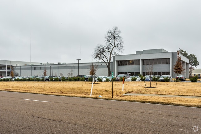

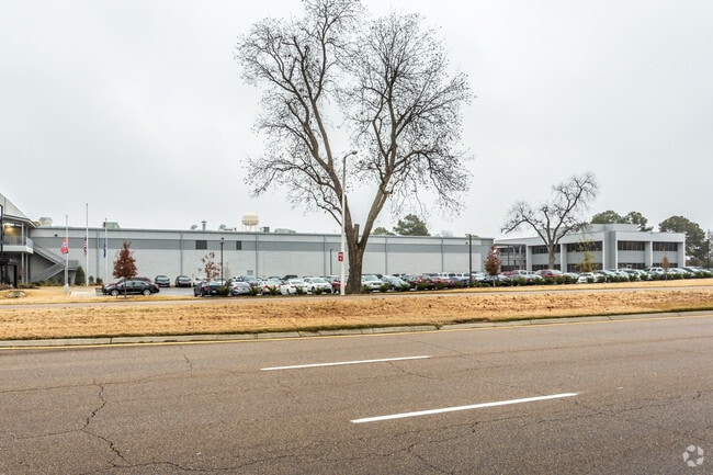
Property Detail
2925 Appling Rd
B0-158-0-0699
PART ENT LLC PROPERTY
Foodprocessing
Shelby
I-P
Tennessee
B and X Area of moderate flood hazard, usually the area between the limits of the 100-year and 500-year floods.
pt.1
2025
10.54 AC
2025
Northeast
020632
Memphis
256,617 SF
Memphis, TN-MS-AR
NEARBY LISTINGS FOR SALE OR LEASE
DEMOGRAPHICS near 2925 Appling Rd
1 mile
3 mile
5 mile
2025 Total Population
5,720
59,146
156,110
2030 Population
5,480
57,107
150,661
Pop Growth 2025-2030
(4.20%)
(3.45%)
(3.49%)
Average Age
37
40
39
2025 Total Households
2,100
22,793
59,690
HH Growth 2025-2030
(4.38%)
(3.55%)
(3.60%)
Median Household Inc
$80,546
$81,685
$84,504
Avg Household Size
2.70
2.50
2.50
2025 Avg HH Vehicles
2.00
2.00
2.00
Median Home Value
$223,615
$269,803
$278,593
Median Year Built
1989
1989
1990
Nearby Places
Map Layers
Map Styles
 Street
 Aerial
Layers
 Traffic
 Biking
Places
Listings with unknown addresses are not visible on the map
- Restaurants
- Banks
- Shops
- Fitness
- Groceries
PUBLIC TRANSPORTATION
AIRPORT
Memphis International
Drive
Walk
Distance
Memphis International
29 min
20.2 mi
Freight Ports
Port of Shreveport
Drive
Walk
Distance
Port of Shreveport
421 min
387.5 mi
Nearby Properties
Address
Land Use
TOTAL SIZE
Lot Size
Zoning
Address
Land Use
TOTAL SIZE
Lot Size
Zoning
270,045 SF
28.34 AC
CA
Address
Land Use
TOTAL SIZE
Lot Size
Zoning
1,153,892 SF
50.47 AC
I-P
Address
Land Use
TOTAL SIZE
Lot Size
Zoning
231,038 SF
24.97 AC
RU-2
Address
Land Use
TOTAL SIZE
Lot Size
Zoning
207,537 SF
21.73 AC
C-G
Address
Land Use
TOTAL SIZE
Lot Size
Zoning
134,272 SF
28.85 AC
CMP-1
Address
Land Use
TOTAL SIZE
Lot Size
Zoning
591,149 SF
45.48 AC
CMU-3
Address
Land Use
TOTAL SIZE
Lot Size
Zoning
325,370 SF
64.04 AC
CA
Address
Land Use
TOTAL SIZE
Lot Size
Zoning
94,003 SF
7.20 AC
CMU-2
Address
Land Use
TOTAL SIZE
Lot Size
Zoning
338,215 SF
33.08 AC
CA
Address
Land Use
TOTAL SIZE
Lot Size
Zoning
498,680 SF
46.61 AC
I-P
Address
Land Use
TOTAL SIZE
Lot Size
Zoning
19,050 SF
24.99 AC
R-M
Address
Land Use
TOTAL SIZE
Lot Size
Zoning
75,099 SF
12.22 AC
EMP
Address
Land Use
TOTAL SIZE
Lot Size
Zoning
171,906 SF
7.52 AC
RU-3
Address
Land Use
TOTAL SIZE
Lot Size
Zoning
64,002 SF
67.10 AC
RU-2
Address
Land Use
TOTAL SIZE
Lot Size
Zoning
79,341 SF
31.15 AC
RU-3
Address
Land Use
TOTAL SIZE
Lot Size
Zoning
260,599 SF
28.13 AC
CA
Address
Land Use
TOTAL SIZE
Lot Size
Zoning
62,852 SF
10.15 AC
RS-12
Address
Land Use
TOTAL SIZE
Lot Size
Zoning
222,468 SF
37.55 AC
C-H
Address
Land Use
TOTAL SIZE
Lot Size
Zoning
108,678 SF
8.99 AC
R-E
Address
Land Use
TOTAL SIZE
Lot Size
Zoning
56,431 SF
1.24 AC
C-G
Address
Land Use
TOTAL SIZE
Lot Size
Zoning
133,020 SF
11.73 AC
SC-1
Address
Land Use
TOTAL SIZE
Lot Size
Zoning
39,581 SF
7.69 AC
R-6
Address
Land Use
TOTAL SIZE
Lot Size
Zoning
191,316 SF
21.71 AC
CMU-3
Address
Land Use
TOTAL SIZE
Lot Size
Zoning
199,320 SF
9.05 AC
CA
Address
Land Use
TOTAL SIZE
Lot Size
Zoning
105,950 SF
21.19 AC
RU-3
Address
Land Use
TOTAL SIZE
Lot Size
Zoning
134,599 SF
6.43 AC
I-P
Address
Land Use
TOTAL SIZE
Lot Size
Zoning
86,875 SF
7.09 AC
I-P
Address
Land Use
TOTAL SIZE
Lot Size
Zoning
253,831 SF
16.74 AC
EMP
Address
Land Use
TOTAL SIZE
Lot Size
Zoning
142,703 SF
18.62 AC
CMU-3
The World's #1 Commercial Real Estate Marketplace
Connect with us
© 2026 CoStar Group
The information above has been obtained from sources believed reliable. While we do not doubt its accuracy we have not verified it and make no guarantee, warranty or representation about it. It is your responsibility to independently confirm its accuracy and completeness. Any projections, opinions, assumptions, or estimates used are for example only and do not represent the current or future performance of the property. The value of this transaction to you depends on tax and other factors which should be evaluated by your tax, financial, and legal advisors. You and your advisors should conduct a careful, independent investigation of the property to determine to your satisfaction the suitability of the property for your needs.