Property Record
2925 E W T Harris Blvd, Charlotte, NC 28213


NEARBY LISTINGS FOR SALE OR LEASE
Property Detail
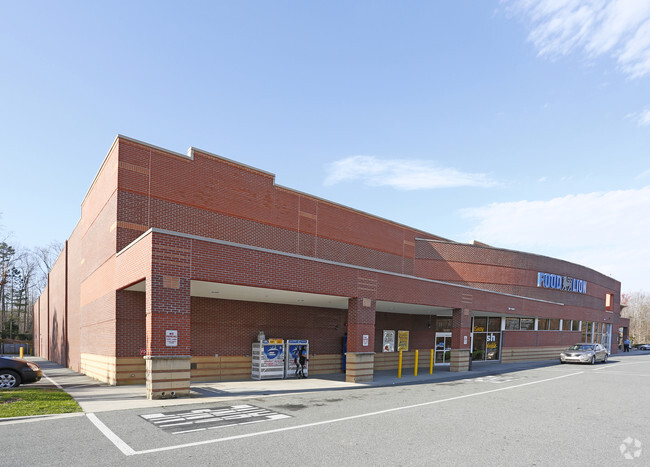
2925 E W T Harris Blvd
Charlotte-Concord-Gastonia, NC-SC
Rockey River Centre Map 1
105-082-06
L1 M51-100
Commercialnec
Mecklenburg
X
North Carolina
3710458500K
1
2024
10.16 AC
2025
East
005613
Charlotte
42,068 SF
DEMOGRAPHICS near 2925 E W T Harris Blvd
1 Mile
3 Mile
5 Mile
2024 Total Population
5,630
79,025
223,089
2029 Population
5,983
84,122
237,707
Pop Growth 2024-2029
+ 6.27%
+ 6.45%
+ 6.55%
Average Age
36
35
35
2024 Total Households
2,100
29,179
85,424
HH Growth 2024-2029
+ 6.38%
+ 6.49%
+ 6.52%
Median Household Inc
$73,999
$52,384
$56,628
Avg Household Size
2.60
2.60
2.50
2024 Avg HH Vehicles
2.00
2.00
2.00
Median Home Value
$270,817
$242,126
$254,742
Median Year Built
1998
1994
1993
Nearby Places
Map Layers
Map Styles
 Street
 Aerial
- Restaurants
- Banks
- Shops
- Fitness
- Groceries
PUBLIC TRANSPORTATION
AIRPORT
Charlotte/Douglas International
DRIVE
WALK
Distance
Charlotte/Douglas International
29 min
18.9 mi
Freight Ports
Port of Wilmington
DRIVE
WALK
Distance
Port of Wilmington
1 min
174.4 mi
SALE & LEASE HISTORY
LISTING DATE
SALE/LEASE

Sep 25, 2016
For Lease
Nearby Properties
Address
Land Use
TOTAL SIZE
Lot Size
Zoning
Address
Land Use
TOTAL SIZE
Lot Size
Zoning
2,022,784 SF
654.80 AC
INST
Address
Land Use
TOTAL SIZE
Lot Size
Zoning
628,300 SF
197.32 AC
INST
Address
Land Use
TOTAL SIZE
Lot Size
Zoning
727,169 SF
6.07 AC
INST
Address
Land Use
TOTAL SIZE
Lot Size
Zoning
419,364 SF
17.40 AC
Address
Land Use
TOTAL SIZE
Lot Size
Zoning
16,601 SF
7.42 AC
R-12MF(CD)
Address
Land Use
TOTAL SIZE
Lot Size
Zoning
389,680 SF
28.83 AC
R17MFCD
Address
Land Use
TOTAL SIZE
Lot Size
Zoning
324,898 SF
22.31 AC
R17MFCD
Address
Land Use
TOTAL SIZE
Lot Size
Zoning
215,899 SF
4.86 AC
B-2(CD)
Address
Land Use
TOTAL SIZE
Lot Size
Zoning
335,688 SF
22.54 AC
Address
Land Use
TOTAL SIZE
Lot Size
Zoning
549,120 SF
5.29 AC
NS
Address
Land Use
TOTAL SIZE
Lot Size
Zoning
306,269 SF
9.44 AC
MUDD-O
Address
Land Use
TOTAL SIZE
Lot Size
Zoning
464,520 SF
3.43 AC
Address
Land Use
TOTAL SIZE
Lot Size
Zoning
325,799 SF
37.65 AC
R9MFCD
Address
Land Use
TOTAL SIZE
Lot Size
Zoning
352,085 SF
23.50 AC
NS
Address
Land Use
TOTAL SIZE
Lot Size
Zoning
276,596 SF
41.26 AC
Address
Land Use
TOTAL SIZE
Lot Size
Zoning
311,358 SF
8.95 AC
B2
Address
Land Use
TOTAL SIZE
Lot Size
Zoning
205,022 SF
15.68 AC
R9MFCD
Address
Land Use
TOTAL SIZE
Lot Size
Zoning
322,390 SF
7.05 AC
O-15(CD)
Address
Land Use
TOTAL SIZE
Lot Size
Zoning
432,086 SF
2.92 AC
TOD-CC
Address
Land Use
TOTAL SIZE
Lot Size
Zoning
261,810 SF
46.15 AC
R3
Address
Land Use
TOTAL SIZE
Lot Size
Zoning
5.60 AC
MUDD(CD)
Address
Land Use
TOTAL SIZE
Lot Size
Zoning
312,279 SF
4.93 AC
R17MF
Address
Land Use
TOTAL SIZE
Lot Size
Zoning
193,547 SF
21.40 AC
R12MFCD
Address
Land Use
TOTAL SIZE
Lot Size
Zoning
265,612 SF
6.83 AC
R-3
Address
Land Use
TOTAL SIZE
Lot Size
Zoning
251,930 SF
7.51 AC
B2CD
Address
Land Use
TOTAL SIZE
Lot Size
Zoning
258,524 SF
10.29 AC
Address
Land Use
TOTAL SIZE
Lot Size
Zoning
181,510 SF
10.85 AC
R17MFCD
Address
Land Use
TOTAL SIZE
Lot Size
Zoning
193,132 SF
5.63 AC
Address
Land Use
TOTAL SIZE
Lot Size
Zoning
204,709 SF
22.34 AC
R17MFCD
Address
Land Use
TOTAL SIZE
Lot Size
Zoning
364,613 SF
58.97 AC
CC
The World's #1 Commercial Real Estate Marketplace
Connect with us
© 2026 CoStar Group
The information above has been obtained from sources believed reliable. While we do not doubt its accuracy we have not verified it and make no guarantee, warranty or representation about it. It is your responsibility to independently confirm its accuracy and completeness. Any projections, opinions, assumptions, or estimates used are for example only and do not represent the current or future performance of the property. The value of this transaction to you depends on tax and other factors which should be evaluated by your tax, financial, and legal advisors. You and your advisors should conduct a careful, independent investigation of the property to determine to your satisfaction the suitability of the property for your needs.