Property Record
2925 Fm 1960 Rd E, Humble, TX 77338
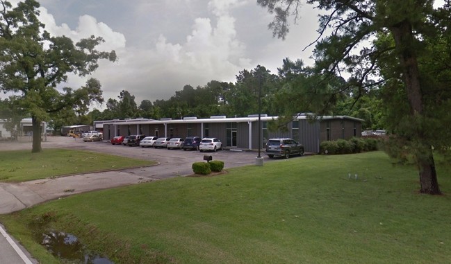

Property Detail
2925 Fm 1960 Rd E
0420800000012
TR 1A ABST 223 R DUNMAN
Warehouse
HARRIS
B and X Area of moderate flood hazard, usually the area between the limits of the 100-year and 500-year floods.
Texas
2024
1.83 AC
2025
Northeast Hwy 90
250701
Houston
14,710 SF
Houston-Pasadena-The Woodlands, TX
NEARBY LISTINGS FOR SALE OR LEASE
DEMOGRAPHICS near 2925 Fm 1960 Rd E
1 mile
3 mile
5 mile
2025 Total Population
468
59,274
204,232
2030 Population
504
62,805
220,178
Pop Growth 2025-2030
+ 7.69%
+ 5.96%
+ 7.81%
Average Age
40
36
37
2025 Total Households
170
19,814
70,477
HH Growth 2025-2030
+ 8.24%
+ 6.14%
+ 8.25%
Median Household Inc
$53,889
$88,797
$94,348
Avg Household Size
2.80
2.90
2.90
2025 Avg HH Vehicles
2.00
2.00
2.00
Median Home Value
$388,709
$267,741
$296,895
Median Year Built
1987
1995
2002
Nearby Places
Map Layers
Map Styles
 Street
 Aerial
Transit
 Traffic
 Biking
Places
Listings with unknown addresses are not visible on the map
- Restaurants
- Banks
- Shops
- Fitness
- Groceries
PUBLIC TRANSPORTATION
AIRPORT
George Bush Intcntl/Houston
Drive
Walk
Distance
George Bush Intcntl/Houston
17 min
11.0 mi
William P Hobby
Drive
Walk
Distance
William P Hobby
49 min
32.6 mi
Freight Ports
Port of Houston
Drive
Walk
Distance
Port of Houston
38 min
26.3 mi
Nearby Properties
Address
Land Use
TOTAL SIZE
Lot Size
Zoning
Address
Land Use
TOTAL SIZE
Lot Size
Zoning
687,195 SF
33.75 AC
Address
Land Use
TOTAL SIZE
Lot Size
Zoning
685,400 SF
38.82 AC
Address
Land Use
TOTAL SIZE
Lot Size
Zoning
432,617 SF
19.41 AC
Address
Land Use
TOTAL SIZE
Lot Size
Zoning
326,166 SF
11.84 AC
Address
Land Use
TOTAL SIZE
Lot Size
Zoning
320,200 SF
19.56 AC
Address
Land Use
TOTAL SIZE
Lot Size
Zoning
212,020 SF
Address
Land Use
TOTAL SIZE
Lot Size
Zoning
268,939 SF
11.24 AC
Address
Land Use
TOTAL SIZE
Lot Size
Zoning
304,671 SF
14.77 AC
Address
Land Use
TOTAL SIZE
Lot Size
Zoning
196,468 SF
9.51 AC
Address
Land Use
TOTAL SIZE
Lot Size
Zoning
165,737 SF
14 AC
Address
Land Use
TOTAL SIZE
Lot Size
Zoning
174,820 SF
13.30 AC
Address
Land Use
TOTAL SIZE
Lot Size
Zoning
156,756 SF
17.05 AC
Address
Land Use
TOTAL SIZE
Lot Size
Zoning
128,886 SF
6.36 AC
Address
Land Use
TOTAL SIZE
Lot Size
Zoning
64,980 SF
4.19 AC
Address
Land Use
TOTAL SIZE
Lot Size
Zoning
56,344 SF
3.25 AC
Address
Land Use
TOTAL SIZE
Lot Size
Zoning
98,124 SF
7.58 AC
Address
Land Use
TOTAL SIZE
Lot Size
Zoning
192,620 SF
7.46 AC
Address
Land Use
TOTAL SIZE
Lot Size
Zoning
4,168 SF
20.04 AC
Address
Land Use
TOTAL SIZE
Lot Size
Zoning
213,292 SF
9.81 AC
Address
Land Use
TOTAL SIZE
Lot Size
Zoning
132,930 SF
11.23 AC
Address
Land Use
TOTAL SIZE
Lot Size
Zoning
136,154 SF
15.33 AC
Address
Land Use
TOTAL SIZE
Lot Size
Zoning
111,599 SF
9.38 AC
Address
Land Use
TOTAL SIZE
Lot Size
Zoning
102,704 SF
4 AC
Address
Land Use
TOTAL SIZE
Lot Size
Zoning
122,944 SF
10.72 AC
Address
Land Use
TOTAL SIZE
Lot Size
Zoning
88,437 SF
9 AC
Address
Land Use
TOTAL SIZE
Lot Size
Zoning
117,795 SF
5.45 AC
Address
Land Use
TOTAL SIZE
Lot Size
Zoning
102,723 SF
4.20 AC
Address
Land Use
TOTAL SIZE
Lot Size
Zoning
161,641 SF
6.74 AC
Address
Land Use
TOTAL SIZE
Lot Size
Zoning
47,988 SF
1.86 AC
Address
Land Use
TOTAL SIZE
Lot Size
Zoning
91,090 SF
4.72 AC
The World's #1 Commercial Real Estate Marketplace
Connect with us
© 2026 CoStar Group
The information above has been obtained from sources believed reliable. While we do not doubt its accuracy we have not verified it and make no guarantee, warranty or representation about it. It is your responsibility to independently confirm its accuracy and completeness. Any projections, opinions, assumptions, or estimates used are for example only and do not represent the current or future performance of the property. The value of this transaction to you depends on tax and other factors which should be evaluated by your tax, financial, and legal advisors. You and your advisors should conduct a careful, independent investigation of the property to determine to your satisfaction the suitability of the property for your needs.