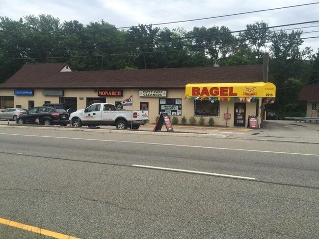
Property Record
2925 State Rt 23, Newfoundland, NJ 07435

Property Detail
2925 State Rt 23
New York-Jersey City-White Plains, NY-NJ
PASSAIC
15-15804-0000-00014
New Jersey
Vacantlandnec
14
C and X Area of minimal flood hazard, usually depicted on FIRMs as above the 500-year flood level.
4.60 AC
2024
Upper Suburban Passaic
2025
Northern New Jersey
256805
NEARBY LISTINGS FOR SALE OR LEASE
DEMOGRAPHICS near 2925 State Rt 23
1 mile
3 mile
5 mile
2025 Total Population
1,178
5,450
25,563
2030 Population
1,213
5,634
26,487
Pop Growth 2025-2030
+ 2.97%
+ 3.38%
+ 3.61%
Average Age
43
43
43
2025 Total Households
421
1,972
9,319
HH Growth 2025-2030
+ 2.61%
+ 3.40%
+ 3.64%
Median Household Inc
$123,993
$125,261
$132,546
Avg Household Size
2.80
2.70
2.70
2025 Avg HH Vehicles
2.00
2.00
2.00
Median Home Value
$450,000
$461,779
$448,163
Median Year Built
1968
1973
1971
Nearby Places
Map Layers
Map Styles
 Street
 Aerial
Layers
 Traffic
 Biking
Places
Listings with unknown addresses are not visible on the map
- Restaurants
- Banks
- Shops
- Fitness
- Groceries
PUBLIC TRANSPORTATION
AIRPORT
Newark Liberty International
Drive
Walk
Distance
Newark Liberty International
45 min
38.4 mi
LaGuardia
Drive
Walk
Distance
LaGuardia
61 min
46.4 mi
Freight Ports
Maher Terminal
Drive
Walk
Distance
Maher Terminal
52 min
38.3 mi
SALE & LEASE HISTORY
LISTING DATE
SALE/LEASE

Nov 02, 2020
For Lease
Mar 13, 2017
For Lease
Mar 13, 2017
For Sale
Nearby Properties
Address
Land Use
TOTAL SIZE
Lot Size
Zoning
Address
Land Use
TOTAL SIZE
Lot Size
Zoning
15.53 AC
C-1
Address
Land Use
TOTAL SIZE
Lot Size
Zoning
2,372.35 AC
RC
Address
Land Use
TOTAL SIZE
Lot Size
Zoning
493.70 AC
R
Address
Land Use
TOTAL SIZE
Lot Size
Zoning
7,836 SF
19.11 AC
B-1
Address
Land Use
TOTAL SIZE
Lot Size
Zoning
6.63 AC
C-1
Address
Land Use
TOTAL SIZE
Lot Size
Zoning
5 AC
R-44
Address
Land Use
TOTAL SIZE
Lot Size
Zoning
1,920.40 AC
Address
Land Use
TOTAL SIZE
Lot Size
Zoning
Address
Land Use
TOTAL SIZE
Lot Size
Zoning
1,788.04 AC
Address
Land Use
TOTAL SIZE
Lot Size
Zoning
3,600 SF
1.27 AC
C-1
Address
Land Use
TOTAL SIZE
Lot Size
Zoning
9,093 SF
9.87 AC
B-1
Address
Land Use
TOTAL SIZE
Lot Size
Zoning
1,012.20 AC
RC
Address
Land Use
TOTAL SIZE
Lot Size
Zoning
1,117.99 AC
Address
Land Use
TOTAL SIZE
Lot Size
Zoning
1.90 AC
Address
Land Use
TOTAL SIZE
Lot Size
Zoning
10.40 AC
C-1
Address
Land Use
TOTAL SIZE
Lot Size
Zoning
2,914 SF
4.23 AC
Address
Land Use
TOTAL SIZE
Lot Size
Zoning
965.60 AC
R20A
Address
Land Use
TOTAL SIZE
Lot Size
Zoning
Address
Land Use
TOTAL SIZE
Lot Size
Zoning
3.34 AC
Address
Land Use
TOTAL SIZE
Lot Size
Zoning
10.07 AC
Address
Land Use
TOTAL SIZE
Lot Size
Zoning
2,002 SF
8.39 AC
Address
Land Use
TOTAL SIZE
Lot Size
Zoning
Address
Land Use
TOTAL SIZE
Lot Size
Zoning
Address
Land Use
TOTAL SIZE
Lot Size
Zoning
3,544 SF
1.70 AC
R-13
Address
Land Use
TOTAL SIZE
Lot Size
Zoning
12,180 SF
11.10 AC
O
Address
Land Use
TOTAL SIZE
Lot Size
Zoning
553.75 AC
Address
Land Use
TOTAL SIZE
Lot Size
Zoning
3.39 AC
Address
Land Use
TOTAL SIZE
Lot Size
Zoning
10,700 SF
22.44 AC
IP
Address
Land Use
TOTAL SIZE
Lot Size
Zoning
Address
Land Use
TOTAL SIZE
Lot Size
Zoning
822 SF
2.60 AC
The World's #1 Commercial Real Estate Marketplace
Connect with us
© 2026 CoStar Group
The information above has been obtained from sources believed reliable. While we do not doubt its accuracy we have not verified it and make no guarantee, warranty or representation about it. It is your responsibility to independently confirm its accuracy and completeness. Any projections, opinions, assumptions, or estimates used are for example only and do not represent the current or future performance of the property. The value of this transaction to you depends on tax and other factors which should be evaluated by your tax, financial, and legal advisors. You and your advisors should conduct a careful, independent investigation of the property to determine to your satisfaction the suitability of the property for your needs.