Property Record
2925 W 4Th St, Williamsport, PA 17701


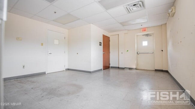
Current Lease Availabilities
NEARBY LISTINGS FOR SALE OR LEASE
Property Detail
2925 W 4Th St
Manufacturinglight
Lycoming
X
Pennsylvania
42081C0427G
8.30 AC
2025
Pennsylvania Central Area
2025
Other Market Areas
001000
Williamsport, PA
47,600 SF
67-017.0-0200.00-000
DEMOGRAPHICS near 2925 W 4Th St
1 Mile
3 Mile
5 Mile
2024 Total Population
5,185
27,016
49,992
2029 Population
5,184
27,133
50,111
Pop Growth 2024-2029
(0.02%)
+ 0.43%
+ 0.24%
Average Age
39
39
40
2024 Total Households
2,157
11,044
20,794
HH Growth 2024-2029
(0.19%)
+ 0.43%
+ 0.23%
Median Household Inc
$54,861
$49,129
$50,824
Avg Household Size
2.30
2.20
2.20
2024 Avg HH Vehicles
2.00
2.00
2.00
Median Home Value
$114,988
$139,066
$149,617
Median Year Built
1950
1956
1954
Nearby Places
Map Layers
Map Styles
 Street
 Aerial
- Restaurants
- Banks
- Shops
- Fitness
- Groceries
Nearby Properties
Address
Land Use
TOTAL SIZE
Lot Size
Zoning
Address
Land Use
TOTAL SIZE
Lot Size
Zoning
230,400 SF
101.67 AC
INSR
Address
Land Use
TOTAL SIZE
Lot Size
Zoning
494,653 SF
61.63 AC
RESR
Address
Land Use
TOTAL SIZE
Lot Size
Zoning
90,171 SF
14.27 AC
Address
Land Use
TOTAL SIZE
Lot Size
Zoning
11,760 SF
4.67 AC
RESR
Address
Land Use
TOTAL SIZE
Lot Size
Zoning
21,696 SF
5.69 AC
INSR
Address
Land Use
TOTAL SIZE
Lot Size
Zoning
76,264 SF
9.55 AC
INDR
Address
Land Use
TOTAL SIZE
Lot Size
Zoning
3,111 SF
10,053.58 AC
5RER
Address
Land Use
TOTAL SIZE
Lot Size
Zoning
41,600 SF
41.94 AC
COMI
Address
Land Use
TOTAL SIZE
Lot Size
Zoning
16,152 SF
1.38 AC
Address
Land Use
TOTAL SIZE
Lot Size
Zoning
33,686 SF
68.10 AC
AGR
Address
Land Use
TOTAL SIZE
Lot Size
Zoning
25,480 SF
11.03 AC
Address
Land Use
TOTAL SIZE
Lot Size
Zoning
44,295 SF
Address
Land Use
TOTAL SIZE
Lot Size
Zoning
2,600 SF
37.50 AC
04INB
Address
Land Use
TOTAL SIZE
Lot Size
Zoning
31,080 SF
3.06 AC
RESR
Address
Land Use
TOTAL SIZE
Lot Size
Zoning
78,416 SF
15.70 AC
05REC
Address
Land Use
TOTAL SIZE
Lot Size
Zoning
7,748 SF
8.81 AC
RESR
Address
Land Use
TOTAL SIZE
Lot Size
Zoning
10,026 SF
52.88 AC
Address
Land Use
TOTAL SIZE
Lot Size
Zoning
10,400 SF
31.90 AC
INDP
Address
Land Use
TOTAL SIZE
Lot Size
Zoning
6,768 SF
11.10 AC
4COA
Address
Land Use
TOTAL SIZE
Lot Size
Zoning
24,639 SF
10 AC
RESR
Address
Land Use
TOTAL SIZE
Lot Size
Zoning
148,759 SF
26.28 AC
04REI
Address
Land Use
TOTAL SIZE
Lot Size
Zoning
3,200 SF
39.49 AC
OPEI
Address
Land Use
TOTAL SIZE
Lot Size
Zoning
32,193 SF
1.32 AC
RESR
Address
Land Use
TOTAL SIZE
Lot Size
Zoning
912 SF
10.30 AC
INDI
Address
Land Use
TOTAL SIZE
Lot Size
Zoning
99,200 SF
25.43 AC
5INC
Address
Land Use
TOTAL SIZE
Lot Size
Zoning
13,804 SF
2.72 AC
RESR
Address
Land Use
TOTAL SIZE
Lot Size
Zoning
140,000 SF
32.80 AC
INDI
Address
Land Use
TOTAL SIZE
Lot Size
Zoning
5,840 SF
0.85 AC
RESR
Address
Land Use
TOTAL SIZE
Lot Size
Zoning
14,080 SF
18.36 AC
INDP
Address
Land Use
TOTAL SIZE
Lot Size
Zoning
142,495 SF
24.59 AC
The World's #1 Commercial Real Estate Marketplace
Connect with us
© 2026 CoStar Group
The information above has been obtained from sources believed reliable. While we do not doubt its accuracy we have not verified it and make no guarantee, warranty or representation about it. It is your responsibility to independently confirm its accuracy and completeness. Any projections, opinions, assumptions, or estimates used are for example only and do not represent the current or future performance of the property. The value of this transaction to you depends on tax and other factors which should be evaluated by your tax, financial, and legal advisors. You and your advisors should conduct a careful, independent investigation of the property to determine to your satisfaction the suitability of the property for your needs.