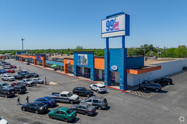
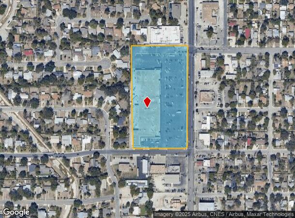
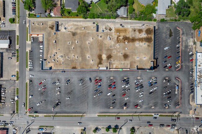
Property Record
2925 West Ave, San Antonio, TX 78201

NEARBY LISTINGS FOR SALE OR LEASE
Property Detail
2925 West Ave
San Antonio-New Braunfels, TX
Conv A/S Code
10383-011-0200
NCB 10383 BLK 11 LOT 20
Regionalshoppingcenterormallwithanchorstore
Bexar
X
Texas
48029C0382H
20
2024
6.40 AC
2025
Northwest
180902
San Antonio
73,600 SF
DEMOGRAPHICS near 2925 West Ave
1 Mile
3 Mile
5 Mile
2024 Total Population
19,652
136,531
385,505
2029 Population
20,771
144,726
410,654
Pop Growth 2024-2029
+ 5.69%
+ 6.00%
+ 6.52%
Average Age
38
39
38
2024 Total Households
7,009
54,928
157,318
HH Growth 2024-2029
+ 6.09%
+ 6.27%
+ 6.91%
Median Household Inc
$44,035
$46,474
$47,143
Avg Household Size
2.70
2.40
2.30
2024 Avg HH Vehicles
2.00
2.00
2.00
Median Home Value
$148,229
$186,412
$192,506
Median Year Built
1957
1961
1971
Nearby Places
Map Layers
Map Styles
 Street
 Aerial
- Restaurants
- Banks
- Shops
- Fitness
- Groceries
PUBLIC TRANSPORTATION
COMMUTER RAIL
San Antonio Amtrak Station (Sunset Limited - Amtrak, Texas Eagle - Amtrak)
DRIVE
WALK
Distance
San Antonio Amtrak Station (Sunset Limited - Amtrak, Texas Eagle - Amtrak)
12 min
6.8 mi
AIRPORT
San Antonio International
DRIVE
WALK
Distance
San Antonio International
10 min
5.5 mi
Freight Ports
Calhoun Port
DRIVE
WALK
Distance
Calhoun Port
188 min
154.2 mi
SALE & LEASE HISTORY
LISTING DATE
SALE/LEASE

Jan 09, 2017
For Lease
Nearby Properties
Address
Land Use
TOTAL SIZE
Lot Size
Zoning
Address
Land Use
TOTAL SIZE
Lot Size
Zoning
557,078 SF
10.73 AC
Address
Land Use
TOTAL SIZE
Lot Size
Zoning
632,091 SF
27.82 AC
Address
Land Use
TOTAL SIZE
Lot Size
Zoning
429,561 SF
25.70 AC
Address
Land Use
TOTAL SIZE
Lot Size
Zoning
278,352 SF
10 AC
Address
Land Use
TOTAL SIZE
Lot Size
Zoning
482,412 SF
22.97 AC
Address
Land Use
TOTAL SIZE
Lot Size
Zoning
506,058 SF
25.23 AC
Address
Land Use
TOTAL SIZE
Lot Size
Zoning
219,400 SF
6.16 AC
Address
Land Use
TOTAL SIZE
Lot Size
Zoning
392,678 SF
21.04 AC
Address
Land Use
TOTAL SIZE
Lot Size
Zoning
356,368 SF
18.58 AC
Address
Land Use
TOTAL SIZE
Lot Size
Zoning
122,292 SF
12.83 AC
Address
Land Use
TOTAL SIZE
Lot Size
Zoning
293,420 SF
9.24 AC
Address
Land Use
TOTAL SIZE
Lot Size
Zoning
256,678 SF
4.42 AC
Address
Land Use
TOTAL SIZE
Lot Size
Zoning
308,299 SF
14.55 AC
Address
Land Use
TOTAL SIZE
Lot Size
Zoning
138,674 SF
11.14 AC
Address
Land Use
TOTAL SIZE
Lot Size
Zoning
207,445 SF
9.55 AC
Address
Land Use
TOTAL SIZE
Lot Size
Zoning
72,611 SF
10.73 AC
Address
Land Use
TOTAL SIZE
Lot Size
Zoning
235,725 SF
3.69 AC
Address
Land Use
TOTAL SIZE
Lot Size
Zoning
97,800 SF
0.85 AC
Address
Land Use
TOTAL SIZE
Lot Size
Zoning
279,112 SF
10.62 AC
Address
Land Use
TOTAL SIZE
Lot Size
Zoning
166,170 SF
25.56 AC
Address
Land Use
TOTAL SIZE
Lot Size
Zoning
84,922 SF
6.39 AC
Address
Land Use
TOTAL SIZE
Lot Size
Zoning
184,262 SF
6.13 AC
Address
Land Use
TOTAL SIZE
Lot Size
Zoning
181,290 SF
5.57 AC
Address
Land Use
TOTAL SIZE
Lot Size
Zoning
217,700 SF
11.90 AC
Address
Land Use
TOTAL SIZE
Lot Size
Zoning
113,121 SF
5.23 AC
Address
Land Use
TOTAL SIZE
Lot Size
Zoning
134,802 SF
8.02 AC
Address
Land Use
TOTAL SIZE
Lot Size
Zoning
195,411 SF
5.15 AC
Address
Land Use
TOTAL SIZE
Lot Size
Zoning
175,347 SF
4.71 AC
Address
Land Use
TOTAL SIZE
Lot Size
Zoning
Address
Land Use
TOTAL SIZE
Lot Size
Zoning
710,775 SF
3.91 AC
The World's #1 Commercial Real Estate Marketplace
Connect with us
© 2025 CoStar Group
The information above has been obtained from sources believed reliable. While we do not doubt its accuracy we have not verified it and make no guarantee, warranty or representation about it. It is your responsibility to independently confirm its accuracy and completeness. Any projections, opinions, assumptions, or estimates used are for example only and do not represent the current or future performance of the property. The value of this transaction to you depends on tax and other factors which should be evaluated by your tax, financial, and legal advisors. You and your advisors should conduct a careful, independent investigation of the property to determine to your satisfaction the suitability of the property for your needs.