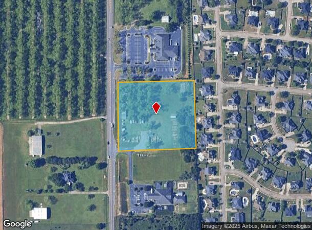
Property Record
2926 Us Highway 41 Ave N, Warner Robins, GA 31093
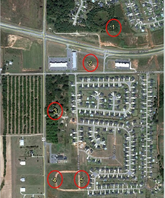
NEARBY LISTINGS FOR SALE OR LEASE
Property Detail
2926 Us Highway 41 Ave N
Warner Robins, GA
Hwy 96 Lake Joy Ac
0W1200040000
TRACT 1 5.00 ACRES 95/10TH
Commercialacreage
Houston
X
Georgia
13225C0130C
95
2024
5 AC
2024
Perry/Warner Robins
020111
Other Market Areas
DEMOGRAPHICS near 2926 Us Highway 41 Ave N
1 Mile
3 Mile
5 Mile
2024 Total Population
5,555
28,128
81,037
2029 Population
6,058
30,565
88,219
Pop Growth 2024-2029
+ 9.05%
+ 8.66%
+ 8.86%
Average Age
36
38
38
2024 Total Households
2,022
10,387
31,244
HH Growth 2024-2029
+ 8.85%
+ 8.48%
+ 8.69%
Median Household Inc
$107,431
$102,782
$81,540
Avg Household Size
2.80
2.70
2.60
2024 Avg HH Vehicles
2.00
2.00
2.00
Median Home Value
$219,131
$206,872
$179,272
Median Year Built
2005
2002
1998
Nearby Places
Map Layers
Map Styles
 Street
 Aerial
- Restaurants
- Banks
- Shops
- Fitness
- Groceries
SALE & LEASE HISTORY
LISTING DATE
SALE/LEASE

Sep 24, 2016
For Sale
Nearby Properties
Address
Land Use
TOTAL SIZE
Lot Size
Zoning
Address
Land Use
TOTAL SIZE
Lot Size
Zoning
5,648 SF
49.72 AC
R4
Address
Land Use
TOTAL SIZE
Lot Size
Zoning
9,828 SF
18.63 AC
R4
Address
Land Use
TOTAL SIZE
Lot Size
Zoning
14,754 SF
24 AC
C2
Address
Land Use
TOTAL SIZE
Lot Size
Zoning
15,006 SF
28 AC
PDE
Address
Land Use
TOTAL SIZE
Lot Size
Zoning
7,172 SF
24.73 AC
R4
Address
Land Use
TOTAL SIZE
Lot Size
Zoning
219,205 SF
26.17 AC
R2
Address
Land Use
TOTAL SIZE
Lot Size
Zoning
54,900 SF
19.60 AC
C-2, WR
Address
Land Use
TOTAL SIZE
Lot Size
Zoning
338,708 SF
28.28 AC
M-2
Address
Land Use
TOTAL SIZE
Lot Size
Zoning
18,954 SF
20 AC
C2
Address
Land Use
TOTAL SIZE
Lot Size
Zoning
63,274 SF
40.80 AC
C-2, WR
Address
Land Use
TOTAL SIZE
Lot Size
Zoning
67,732 SF
25 AC
R4
Address
Land Use
TOTAL SIZE
Lot Size
Zoning
56,260 SF
17.70 AC
C2
Address
Land Use
TOTAL SIZE
Lot Size
Zoning
5,320 SF
15.47 AC
R-4
Address
Land Use
TOTAL SIZE
Lot Size
Zoning
100,500 SF
19.64 AC
R2
Address
Land Use
TOTAL SIZE
Lot Size
Zoning
60,300 SF
6.99 AC
M-2, WR
Address
Land Use
TOTAL SIZE
Lot Size
Zoning
78,956 SF
9.05 AC
C2
Address
Land Use
TOTAL SIZE
Lot Size
Zoning
100,500 SF
19.74 AC
R2
Address
Land Use
TOTAL SIZE
Lot Size
Zoning
100,000 SF
19.66 AC
R1
Address
Land Use
TOTAL SIZE
Lot Size
Zoning
138,518 SF
14.72 AC
C2
Address
Land Use
TOTAL SIZE
Lot Size
Zoning
14,140 SF
16.59 AC
R1
Address
Land Use
TOTAL SIZE
Lot Size
Zoning
35,841 SF
38.62 AC
RMH
Address
Land Use
TOTAL SIZE
Lot Size
Zoning
4,800 SF
101.24 AC
RAG
Address
Land Use
TOTAL SIZE
Lot Size
Zoning
57,872 SF
2.57 AC
C2
Address
Land Use
TOTAL SIZE
Lot Size
Zoning
152.11 AC
PDE (WR)
Address
Land Use
TOTAL SIZE
Lot Size
Zoning
760 SF
18.83 AC
C2
Address
Land Use
TOTAL SIZE
Lot Size
Zoning
54.81 AC
C-2, WR
Address
Land Use
TOTAL SIZE
Lot Size
Zoning
39,400 SF
7.88 AC
C2
Address
Land Use
TOTAL SIZE
Lot Size
Zoning
17,300 SF
7.78 AC
C3
Address
Land Use
TOTAL SIZE
Lot Size
Zoning
23,100 SF
5.39 AC
C2
Address
Land Use
TOTAL SIZE
Lot Size
Zoning
51,648 SF
1.63 AC
C2
The World's #1 Commercial Real Estate Marketplace
Connect with us
© 2025 CoStar Group
The information above has been obtained from sources believed reliable. While we do not doubt its accuracy we have not verified it and make no guarantee, warranty or representation about it. It is your responsibility to independently confirm its accuracy and completeness. Any projections, opinions, assumptions, or estimates used are for example only and do not represent the current or future performance of the property. The value of this transaction to you depends on tax and other factors which should be evaluated by your tax, financial, and legal advisors. You and your advisors should conduct a careful, independent investigation of the property to determine to your satisfaction the suitability of the property for your needs.