Property Record
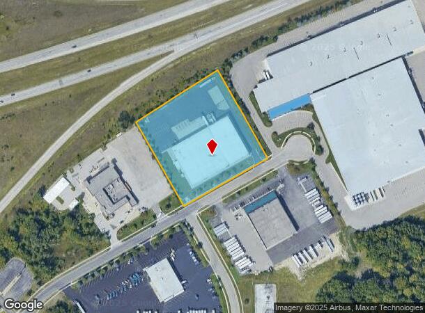
2929 Corporate Grove Dr, Hudsonville, MI 49426
NEARBY LISTINGS FOR SALE OR LEASE
Property Detail
2929 Corporate Grove Dr
70-18-04-198-004
LOTS 4 & 5 HUDSONVILLE BUSINESS PARK 1
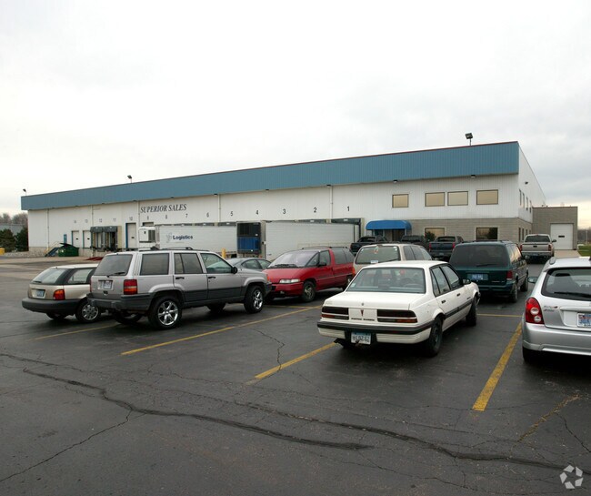
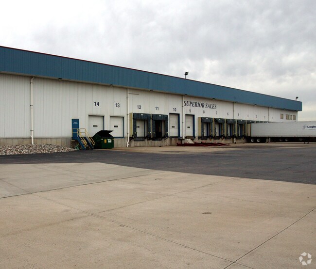
Coldstorage
Ottawa
X
Michigan
26005C0100G
4-5
2024
3.75 AC
2025
E Ottawa Cnty/Hudsonville
023001
West Michigan
48,736 SF
Grand Rapids-Wyoming, MI
DEMOGRAPHICS near 2929 Corporate Grove Dr
1 Mile
3 Mile
5 Mile
2024 Total Population
6,056
23,693
68,754
2029 Population
6,414
24,930
71,976
Pop Growth 2024-2029
+ 5.91%
+ 5.22%
+ 4.69%
Average Age
35
37
38
2024 Total Households
2,122
8,180
23,909
HH Growth 2024-2029
+ 5.98%
+ 5.32%
+ 4.76%
Median Household Inc
$82,518
$92,360
$89,952
Avg Household Size
2.80
2.90
2.80
2024 Avg HH Vehicles
2.00
2.00
2.00
Median Home Value
$263,456
$280,359
$273,238
Median Year Built
2001
1997
1989
Nearby Places
- Restaurants
- Banks
- Shops
- Fitness
- Groceries
PUBLIC TRANSPORTATION
AIRPORT
Gerald R Ford International
DRIVE
WALK
Distance
Gerald R Ford International
30 min
20.9 mi
Nearby Properties
Address
Land Use
TOTAL SIZE
Lot Size
Zoning
Address
Land Use
TOTAL SIZE
Lot Size
Zoning
196,665 SF
46.39 AC
SEE MAP
Address
Land Use
TOTAL SIZE
Lot Size
Zoning
273,515 SF
Address
Land Use
TOTAL SIZE
Lot Size
Zoning
20.61 AC
HDR
Address
Land Use
TOTAL SIZE
Lot Size
Zoning
114,312 SF
22.23 AC
R-4
Address
Land Use
TOTAL SIZE
Lot Size
Zoning
392,381 SF
21.73 AC
SEE MAP
Address
Land Use
TOTAL SIZE
Lot Size
Zoning
85,799 SF
12.89 AC
SEE MAP
Address
Land Use
TOTAL SIZE
Lot Size
Zoning
138,648 SF
Address
Land Use
TOTAL SIZE
Lot Size
Zoning
60,000 SF
18.36 AC
I-1
Address
Land Use
TOTAL SIZE
Lot Size
Zoning
74.03 AC
MHP
Address
Land Use
TOTAL SIZE
Lot Size
Zoning
83,640 SF
R-1-A
Address
Land Use
TOTAL SIZE
Lot Size
Zoning
Address
Land Use
TOTAL SIZE
Lot Size
Zoning
124,950 SF
18.30 AC
MHR
Address
Land Use
TOTAL SIZE
Lot Size
Zoning
66,766 SF
R-1-A
Address
Land Use
TOTAL SIZE
Lot Size
Zoning
162,719 SF
19.77 AC
SEE MAP
Address
Land Use
TOTAL SIZE
Lot Size
Zoning
121,265 SF
17.97 AC
I-2
Address
Land Use
TOTAL SIZE
Lot Size
Zoning
8,464 SF
80.47 AC
SEE MAP
Address
Land Use
TOTAL SIZE
Lot Size
Zoning
139,774 SF
10.67 AC
HDR-B
Address
Land Use
TOTAL SIZE
Lot Size
Zoning
56,784 SF
7.93 AC
R-4
Address
Land Use
TOTAL SIZE
Lot Size
Zoning
11.56 AC
SEE MAP
Address
Land Use
TOTAL SIZE
Lot Size
Zoning
6.29 AC
SEE MAP
Address
Land Use
TOTAL SIZE
Lot Size
Zoning
78,846 SF
8.73 AC
I
Address
Land Use
TOTAL SIZE
Lot Size
Zoning
8,448 SF
2.68 AC
R-4
Address
Land Use
TOTAL SIZE
Lot Size
Zoning
91,450 SF
10.45 AC
SEE MAP
Address
Land Use
TOTAL SIZE
Lot Size
Zoning
78,392 SF
10.45 AC
I-2
Address
Land Use
TOTAL SIZE
Lot Size
Zoning
0.50 AC
Address
Land Use
TOTAL SIZE
Lot Size
Zoning
38,017 SF
5.46 AC
HC
Address
Land Use
TOTAL SIZE
Lot Size
Zoning
103,976 SF
8.68 AC
IND-G
Address
Land Use
TOTAL SIZE
Lot Size
Zoning
50,578 SF
31.51 AC
SEE MAP
Address
Land Use
TOTAL SIZE
Lot Size
Zoning
32,400 SF
67.30 AC
SEE MAP
Address
Land Use
TOTAL SIZE
Lot Size
Zoning
28,526 SF
3.39 AC
HC
The World's #1 Commercial Real Estate Marketplace
Connect with us
© 2025 CoStar Group
The information above has been obtained from sources believed reliable. While we do not doubt its accuracy we have not verified it and make no guarantee, warranty or representation about it. It is your responsibility to independently confirm its accuracy and completeness. Any projections, opinions, assumptions, or estimates used are for example only and do not represent the current or future performance of the property. The value of this transaction to you depends on tax and other factors which should be evaluated by your tax, financial, and legal advisors. You and your advisors should conduct a careful, independent investigation of the property to determine to your satisfaction the suitability of the property for your needs.