Property Record
2929 S Westmoreland Rd, Dallas, TX 75233
NEARBY LISTINGS FOR SALE OR LEASE
Property Detail
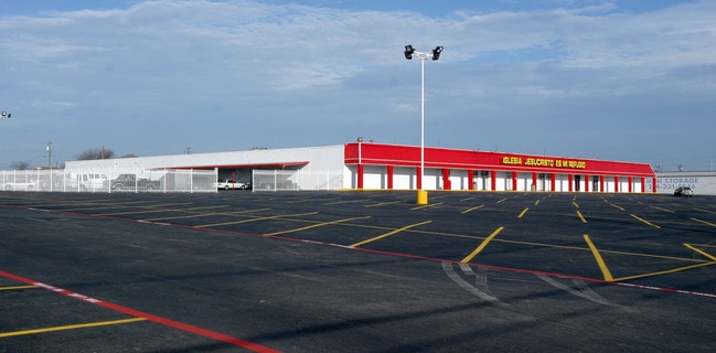
2929 S Westmoreland Rd
00000660343000000
A Bast Survey Abstract #109
Religious
BLK 6978 ACS 6.5443 SEE 00000660343009900 FOR REM IMP VOL2000157/5117 DD08042000 CO-DC 6978 000 000 2DA6978 000
X
Dallas
48113C0460K
Texas
0
6.54 AC
2025
Southwest Dallas
010805
Dallas/Ft Worth
43,200 SF
Dallas-Fort Worth-Arlington, TX
DEMOGRAPHICS near 2929 S Westmoreland Rd
1 Mile
3 Mile
5 Mile
2024 Total Population
17,275
126,883
281,976
2029 Population
17,000
125,542
280,021
Pop Growth 2024-2029
(1.59%)
(1.06%)
(0.69%)
Average Age
35
36
36
2024 Total Households
5,378
39,704
94,596
HH Growth 2024-2029
(1.84%)
(1.18%)
(0.75%)
Median Household Inc
$44,126
$49,896
$45,620
Avg Household Size
3.10
3.10
2.90
2024 Avg HH Vehicles
2.00
2.00
2.00
Median Home Value
$180,030
$203,432
$190,088
Median Year Built
1972
1962
1968
Nearby Places
Map Layers
Map Styles
 Street
 Aerial
- Restaurants
- Banks
- Shops
- Fitness
- Groceries
PUBLIC TRANSPORTATION
TRANSIT/SUBWAY
Westmoreland (DART LIGHT RAIL - RED LINE - Dallas Area Rapid Transit (DART), Red Line - Dallas Area Rapid Transit (DART))
DRIVE
WALK
Distance
Westmoreland (DART LIGHT RAIL - RED LINE - Dallas Area Rapid Transit (DART), Red Line - Dallas Area Rapid Transit (DART))
2 min
10 min
0.5 mi
COMMUTER RAIL
Victory Station (DART LIGHT RAIL - GREEN LINE - Dallas Area Rapid Transit (DART), DART LIGHT RAIL - ORANGE LINE - Dallas Area Rapid Transit (DART), TRINITY RAILWAY - Dallas Area Rapid Transit (DART))
DRIVE
WALK
Distance
Victory Station (DART LIGHT RAIL - GREEN LINE - Dallas Area Rapid Transit (DART), DART LIGHT RAIL - ORANGE LINE - Dallas Area Rapid Transit (DART), TRINITY RAILWAY - Dallas Area Rapid Transit (DART))
15 min
8.2 mi
Medical/Market Ctr Station (TRINITY RAILWAY - Dallas Area Rapid Transit (DART))
DRIVE
WALK
Distance
Medical/Market Ctr Station (TRINITY RAILWAY - Dallas Area Rapid Transit (DART))
18 min
8.3 mi
AIRPORT
Dallas Love Field
DRIVE
WALK
Distance
Dallas Love Field
23 min
10.8 mi
Dallas-Fort Worth International
DRIVE
WALK
Distance
Dallas-Fort Worth International
33 min
23.5 mi
Freight Ports
Port of Shreveport
DRIVE
WALK
Distance
Port of Shreveport
223 min
203.8 mi
Nearby Properties
Address
Land Use
TOTAL SIZE
Lot Size
Zoning
Address
Land Use
TOTAL SIZE
Lot Size
Zoning
344,801 SF
7.24 AC
Z125
Address
Land Use
TOTAL SIZE
Lot Size
Zoning
283,359 SF
16.25 AC
Z116
Address
Land Use
TOTAL SIZE
Lot Size
Zoning
192,086 SF
27.05 AC
Z125
Address
Land Use
TOTAL SIZE
Lot Size
Zoning
263,255 SF
28.40 AC
Z239
Address
Land Use
TOTAL SIZE
Lot Size
Zoning
310,850 SF
13.17 AC
Z239
Address
Land Use
TOTAL SIZE
Lot Size
Zoning
203,593 SF
11.20 AC
Z239
Address
Land Use
TOTAL SIZE
Lot Size
Zoning
552,991 SF
34.27 AC
Z164
Address
Land Use
TOTAL SIZE
Lot Size
Zoning
292,099 SF
11.08 AC
Z163
Address
Land Use
TOTAL SIZE
Lot Size
Zoning
532,726 SF
64.28 AC
Z248
Address
Land Use
TOTAL SIZE
Lot Size
Zoning
291,174 SF
9.49 AC
Z239
Address
Land Use
TOTAL SIZE
Lot Size
Zoning
164,120 SF
15.85 AC
Z163
Address
Land Use
TOTAL SIZE
Lot Size
Zoning
472,800 SF
27.19 AC
Z116
Address
Land Use
TOTAL SIZE
Lot Size
Zoning
236,300 SF
4.76 AC
Z239
Address
Land Use
TOTAL SIZE
Lot Size
Zoning
138,645 SF
195.45 AC
Z298
Address
Land Use
TOTAL SIZE
Lot Size
Zoning
376,601 SF
28.66 AC
Z116
Address
Land Use
TOTAL SIZE
Lot Size
Zoning
131,904 SF
11.99 AC
Z297
Address
Land Use
TOTAL SIZE
Lot Size
Zoning
237,127 SF
12.43 AC
Z164
Address
Land Use
TOTAL SIZE
Lot Size
Zoning
414,118 SF
49.01 AC
Z294
Address
Land Use
TOTAL SIZE
Lot Size
Zoning
73,485 SF
3.29 AC
Z297
Address
Land Use
TOTAL SIZE
Lot Size
Zoning
187,130 SF
15.39 AC
Z163
Address
Land Use
TOTAL SIZE
Lot Size
Zoning
500,000 SF
25 AC
Z116
Address
Land Use
TOTAL SIZE
Lot Size
Zoning
356,400 SF
20.17 AC
Z116
Address
Land Use
TOTAL SIZE
Lot Size
Zoning
465,000 SF
24.71 AC
Z116
Address
Land Use
TOTAL SIZE
Lot Size
Zoning
248,376 SF
15.62 AC
Z164
Address
Land Use
TOTAL SIZE
Lot Size
Zoning
142,616 SF
13.99 AC
Z125
Address
Land Use
TOTAL SIZE
Lot Size
Zoning
273,300 SF
12.52 AC
Z164
Address
Land Use
TOTAL SIZE
Lot Size
Zoning
330,000 SF
24.76 AC
Z116
Address
Land Use
TOTAL SIZE
Lot Size
Zoning
206,202 SF
11.18 AC
Z163
Address
Land Use
TOTAL SIZE
Lot Size
Zoning
324,000 SF
21.75 AC
Z116
Address
Land Use
TOTAL SIZE
Lot Size
Zoning
187,296 SF
9.93 AC
Z163
The World's #1 Commercial Real Estate Marketplace
Connect with us
© 2025 CoStar Group
The information above has been obtained from sources believed reliable. While we do not doubt its accuracy we have not verified it and make no guarantee, warranty or representation about it. It is your responsibility to independently confirm its accuracy and completeness. Any projections, opinions, assumptions, or estimates used are for example only and do not represent the current or future performance of the property. The value of this transaction to you depends on tax and other factors which should be evaluated by your tax, financial, and legal advisors. You and your advisors should conduct a careful, independent investigation of the property to determine to your satisfaction the suitability of the property for your needs.