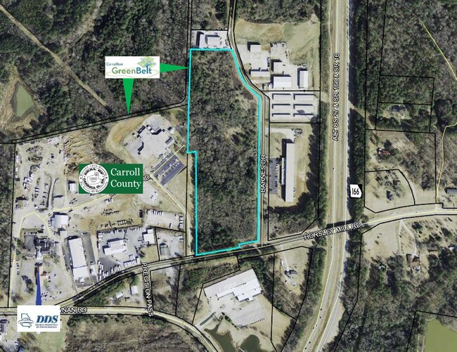
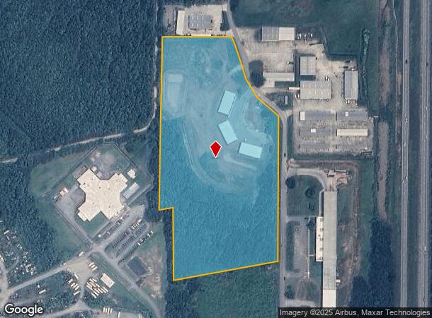
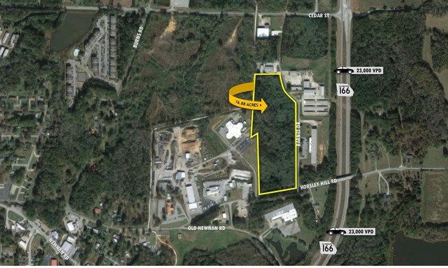
Property Record
293 Barnes Dr, Carrollton, GA 30117
NEARBY LISTINGS FOR SALE OR LEASE
Property Detail
293 Barnes Dr
C05-0310061
V/11.94 AC BARNES DRIVE C67
Industrialgeneral
Carroll
X
Georgia
13045C0258D
11.94 AC
2025
Villa Rica/West Outlying
2025
Atlanta
910705
Atlanta-Sandy Springs-Roswell, GA
DEMOGRAPHICS near 293 Barnes Dr
1 Mile
3 Mile
5 Mile
2024 Total Population
3,229
26,080
48,357
2029 Population
3,604
28,965
53,656
Pop Growth 2024-2029
+ 11.61%
+ 11.06%
+ 10.96%
Average Age
36
37
36
2024 Total Households
1,176
9,939
17,384
HH Growth 2024-2029
+ 11.99%
+ 11.16%
+ 11.15%
Median Household Inc
$43,566
$45,614
$49,090
Avg Household Size
2.60
2.50
2.60
2024 Avg HH Vehicles
2.00
2.00
2.00
Median Home Value
$217,308
$211,506
$217,543
Median Year Built
1994
1984
1987
Nearby Places
Map Layers
Map Styles
 Street
 Aerial
- Restaurants
- Banks
- Shops
- Fitness
- Groceries
SALE & LEASE HISTORY
LISTING DATE
SALE/LEASE

Sep 24, 2016
For Sale
Mar 09, 2017
For Sale
Nearby Properties
Address
Land Use
TOTAL SIZE
Lot Size
Zoning
Address
Land Use
TOTAL SIZE
Lot Size
Zoning
50,000 SF
28.63 AC
HS
Address
Land Use
TOTAL SIZE
Lot Size
Zoning
106,769 SF
11.26 AC
HS
Address
Land Use
TOTAL SIZE
Lot Size
Zoning
1,542,912 SF
118.16 AC
M2
Address
Land Use
TOTAL SIZE
Lot Size
Zoning
261,905 SF
64.74 AC
R2
Address
Land Use
TOTAL SIZE
Lot Size
Zoning
152,962 SF
108.90 AC
OI
Address
Land Use
TOTAL SIZE
Lot Size
Zoning
351,903 SF
30.04 AC
C2
Address
Land Use
TOTAL SIZE
Lot Size
Zoning
39,268 SF
12.05 AC
RM-10
Address
Land Use
TOTAL SIZE
Lot Size
Zoning
134,113 SF
2.80 AC
OI
Address
Land Use
TOTAL SIZE
Lot Size
Zoning
35.33 AC
OI
Address
Land Use
TOTAL SIZE
Lot Size
Zoning
354,354 SF
51.15 AC
I
Address
Land Use
TOTAL SIZE
Lot Size
Zoning
159,860 SF
20.74 AC
C2
Address
Land Use
TOTAL SIZE
Lot Size
Zoning
73,900 SF
10.57 AC
C2
Address
Land Use
TOTAL SIZE
Lot Size
Zoning
44,708 SF
9.92 AC
RESIDENTIA
Address
Land Use
TOTAL SIZE
Lot Size
Zoning
56,458 SF
21.87 AC
R3
Address
Land Use
TOTAL SIZE
Lot Size
Zoning
19,960 SF
0.53 AC
HS
Address
Land Use
TOTAL SIZE
Lot Size
Zoning
97,509 SF
15.50 AC
001
Address
Land Use
TOTAL SIZE
Lot Size
Zoning
7,700 SF
7.08 AC
R3
Address
Land Use
TOTAL SIZE
Lot Size
Zoning
276,510 SF
6.78 AC
M1
Address
Land Use
TOTAL SIZE
Lot Size
Zoning
109,900 SF
11.39 AC
C2
Address
Land Use
TOTAL SIZE
Lot Size
Zoning
3,240 SF
13.42 AC
C2
Address
Land Use
TOTAL SIZE
Lot Size
Zoning
56,288 SF
4.69 AC
C2
Address
Land Use
TOTAL SIZE
Lot Size
Zoning
19,840 SF
10.37 AC
R2
Address
Land Use
TOTAL SIZE
Lot Size
Zoning
163,568 SF
16.80 AC
C2
Address
Land Use
TOTAL SIZE
Lot Size
Zoning
90,800 SF
10.89 AC
C2
Address
Land Use
TOTAL SIZE
Lot Size
Zoning
42,905 SF
9.76 AC
002
Address
Land Use
TOTAL SIZE
Lot Size
Zoning
90,485 SF
10.35 AC
C2
Address
Land Use
TOTAL SIZE
Lot Size
Zoning
28,554 SF
0.74 AC
002
Address
Land Use
TOTAL SIZE
Lot Size
Zoning
30,985 SF
3.24 AC
HS
Address
Land Use
TOTAL SIZE
Lot Size
Zoning
49,314 SF
7.74 AC
001
Address
Land Use
TOTAL SIZE
Lot Size
Zoning
13,299 SF
226.96 AC
R20
The World's #1 Commercial Real Estate Marketplace
Connect with us
© 2025 CoStar Group
The information above has been obtained from sources believed reliable. While we do not doubt its accuracy we have not verified it and make no guarantee, warranty or representation about it. It is your responsibility to independently confirm its accuracy and completeness. Any projections, opinions, assumptions, or estimates used are for example only and do not represent the current or future performance of the property. The value of this transaction to you depends on tax and other factors which should be evaluated by your tax, financial, and legal advisors. You and your advisors should conduct a careful, independent investigation of the property to determine to your satisfaction the suitability of the property for your needs.