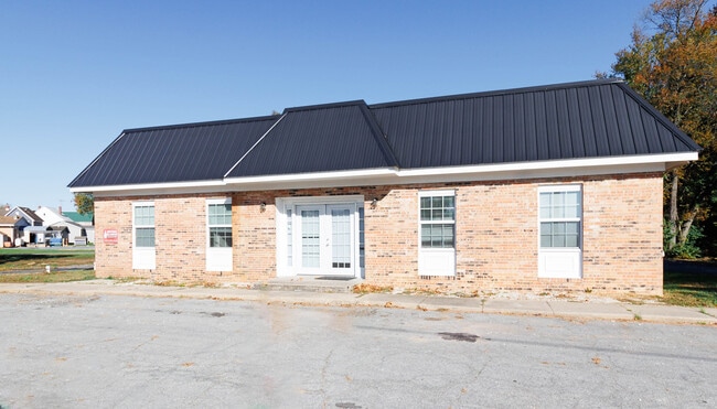
Property Record
293 Main St, Hartly, DE 19953

Save to a Folder
{{folder.Name}}
{{folder.ListingIds.length}} Properties
{{folder.ListingIds.length}} Property
Create a New Folder
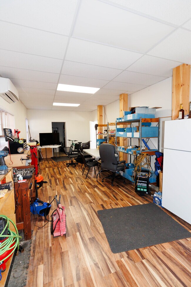
Property Detail
293 Main St
9-10-06319-01-3900-000
PAR 2-N SD MAIN ST 293 MAIN ST
Commercialnec
KENT
NA
Delaware
B and X Area of moderate flood hazard, usually the area between the limits of the 100-year and 500-year floods.
0.50 AC
2025
Kent County
2025
Philadelphia
041900
Dover, DE
1,192 SF
NEARBY LISTINGS FOR SALE OR LEASE
-
-
View all Hartly listings for sale on LoopNet.com
DEMOGRAPHICS near 293 Main St
1 mile
3 mile
5 mile
2025 Total Population
536
3,833
11,085
2030 Population
556
3,960
11,449
Pop Growth 2025-2030
+ 3.73%
+ 3.31%
+ 3.28%
Average Age
41
41
41
2025 Total Households
202
1,420
3,943
HH Growth 2025-2030
+ 3.96%
+ 3.52%
+ 3.35%
Median Household Inc
$70,262
$65,773
$65,750
Avg Household Size
2.60
2.60
2.70
2025 Avg HH Vehicles
2.00
2.00
2.00
Median Home Value
$239,285
$258,516
$294,530
Median Year Built
1992
1992
1992
Nearby Places
Map Layers
Map Styles
 Street
 Aerial
Layers
 Traffic
 Biking
Places
Listings with unknown addresses are not visible on the map
- Restaurants
- Banks
- Shops
- Fitness
- Groceries
SALE & LEASE HISTORY
LISTING DATE
SALE/LEASE

Nov 12, 2023
For Sale
Nearby Properties
Address
Land Use
TOTAL SIZE
Lot Size
Zoning
Address
Land Use
TOTAL SIZE
Lot Size
Zoning
36,642 SF
7.20 AC
AR
Address
Land Use
TOTAL SIZE
Lot Size
Zoning
1,152 SF
46.80 AC
RMH
Address
Land Use
TOTAL SIZE
Lot Size
Zoning
1,165 SF
135.60 AC
AR
Address
Land Use
TOTAL SIZE
Lot Size
Zoning
1,500 SF
62.20 AC
AR
Address
Land Use
TOTAL SIZE
Lot Size
Zoning
20,696 SF
1 AC
NA
Address
Land Use
TOTAL SIZE
Lot Size
Zoning
141.40 AC
AR
Address
Land Use
TOTAL SIZE
Lot Size
Zoning
26.53 AC
AR
Address
Land Use
TOTAL SIZE
Lot Size
Zoning
35.30 AC
AR
Address
Land Use
TOTAL SIZE
Lot Size
Zoning
8,962 SF
6.40 AC
AR
Address
Land Use
TOTAL SIZE
Lot Size
Zoning
9,900 SF
78.76 AC
AR
Address
Land Use
TOTAL SIZE
Lot Size
Zoning
18.10 AC
AR
Address
Land Use
TOTAL SIZE
Lot Size
Zoning
7,478 SF
1.12 AC
NA
Address
Land Use
TOTAL SIZE
Lot Size
Zoning
8.30 AC
AR
Address
Land Use
TOTAL SIZE
Lot Size
Zoning
8,505 SF
1.40 AC
NA
Address
Land Use
TOTAL SIZE
Lot Size
Zoning
6,375 SF
0.83 AC
NA
Address
Land Use
TOTAL SIZE
Lot Size
Zoning
3,217 SF
13.99 AC
AR
Address
Land Use
TOTAL SIZE
Lot Size
Zoning
3,348 SF
3.10 AC
AR
Address
Land Use
TOTAL SIZE
Lot Size
Zoning
119.25 AC
AR
Address
Land Use
TOTAL SIZE
Lot Size
Zoning
3,060 SF
10.13 AC
AR
Address
Land Use
TOTAL SIZE
Lot Size
Zoning
3,324 SF
1.20 AC
AR
Address
Land Use
TOTAL SIZE
Lot Size
Zoning
2,995 SF
1.30 AC
AR
Address
Land Use
TOTAL SIZE
Lot Size
Zoning
620 SF
12.70 AC
AR
Address
Land Use
TOTAL SIZE
Lot Size
Zoning
3,196 SF
0.95 AC
NA
Address
Land Use
TOTAL SIZE
Lot Size
Zoning
2,751 SF
2 AC
AR
Address
Land Use
TOTAL SIZE
Lot Size
Zoning
10 AC
AR
Address
Land Use
TOTAL SIZE
Lot Size
Zoning
2,236 SF
1.30 AC
AR
Address
Land Use
TOTAL SIZE
Lot Size
Zoning
2,100 SF
0.60 AC
BG
Address
Land Use
TOTAL SIZE
Lot Size
Zoning
1,775 SF
1 AC
AR
Address
Land Use
TOTAL SIZE
Lot Size
Zoning
2,364 SF
0.32 AC
NA
Address
Land Use
TOTAL SIZE
Lot Size
Zoning
1,876 SF
2.21 AC
AR
The World's #1 Commercial Real Estate Marketplace
Connect with us
© 2026 CoStar Group
The information above has been obtained from sources believed reliable. While we do not doubt its accuracy we have not verified it and make no guarantee, warranty or representation about it. It is your responsibility to independently confirm its accuracy and completeness. Any projections, opinions, assumptions, or estimates used are for example only and do not represent the current or future performance of the property. The value of this transaction to you depends on tax and other factors which should be evaluated by your tax, financial, and legal advisors. You and your advisors should conduct a careful, independent investigation of the property to determine to your satisfaction the suitability of the property for your needs.