Property Record
293 Murray Hill Ter, Bergenfield, NJ 07621


NEARBY LISTINGS FOR SALE OR LEASE
Property Detail
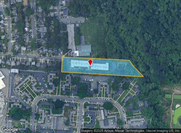
293 Murray Hill Ter
New York-Jersey City-White Plains, NY-NJ
510X100
03-00268-0000-00006
Bergen
Governmentalpublicusegeneral
New Jersey
X
6
34003C0211H
1.17 AC
0
Greater Bergen County
2025
Northern New Jersey
003500
DEMOGRAPHICS near 293 Murray Hill Ter
1 Mile
3 Mile
5 Mile
2024 Total Population
27,530
185,921
475,611
2029 Population
27,431
185,535
469,250
Pop Growth 2024-2029
(0.36%)
(0.21%)
(1.34%)
Average Age
40
41
42
2024 Total Households
8,913
64,726
179,270
HH Growth 2024-2029
(0.35%)
(0.21%)
(1.52%)
Median Household Inc
$112,124
$114,879
$98,906
Avg Household Size
3.00
2.80
2.50
2024 Avg HH Vehicles
2.00
2.00
1.00
Median Home Value
$442,857
$484,441
$496,840
Median Year Built
1951
1954
1957
Nearby Places
Map Layers
Map Styles
 Street
 Aerial
- Restaurants
- Banks
- Shops
- Fitness
- Groceries
PUBLIC TRANSPORTATION
COMMUTER RAIL
New Bridge Landing (Pascack Valley Line - NJ Transit Commuter Rail (NJ Transit))
DRIVE
WALK
Distance
New Bridge Landing (Pascack Valley Line - NJ Transit Commuter Rail (NJ Transit))
5 min
2.5 mi
River Edge (Pascack Valley Line - NJ Transit Commuter Rail (NJ Transit))
DRIVE
WALK
Distance
River Edge (Pascack Valley Line - NJ Transit Commuter Rail (NJ Transit))
6 min
3.2 mi
AIRPORT
LaGuardia
DRIVE
WALK
Distance
LaGuardia
28 min
16.8 mi
Newark Liberty International
DRIVE
WALK
Distance
Newark Liberty International
24 min
19.4 mi
Westchester County
DRIVE
WALK
Distance
Westchester County
48 min
31.5 mi
Freight Ports
NY - Red Hook Container Terminal
DRIVE
WALK
Distance
NY - Red Hook Container Terminal
38 min
21.7 mi
Nearby Properties
Address
Land Use
TOTAL SIZE
Lot Size
Zoning
Address
Land Use
TOTAL SIZE
Lot Size
Zoning
512,862 SF
14.16 AC
Address
Land Use
TOTAL SIZE
Lot Size
Zoning
572,137 SF
14.11 AC
R-D
Address
Land Use
TOTAL SIZE
Lot Size
Zoning
20.07 AC
H
Address
Land Use
TOTAL SIZE
Lot Size
Zoning
74,550 SF
11.28 AC
OI
Address
Land Use
TOTAL SIZE
Lot Size
Zoning
219.71 AC
O
Address
Land Use
TOTAL SIZE
Lot Size
Zoning
100,151 SF
22.13 AC
B2
Address
Land Use
TOTAL SIZE
Lot Size
Zoning
25,620 SF
21.37 AC
Address
Land Use
TOTAL SIZE
Lot Size
Zoning
5.22 AC
APT
Address
Land Use
TOTAL SIZE
Lot Size
Zoning
4.54 AC
R-M3
Address
Land Use
TOTAL SIZE
Lot Size
Zoning
2.55 AC
RC-1
Address
Land Use
TOTAL SIZE
Lot Size
Zoning
303,434 SF
13.34 AC
Address
Land Use
TOTAL SIZE
Lot Size
Zoning
15.76 AC
B2
Address
Land Use
TOTAL SIZE
Lot Size
Zoning
Address
Land Use
TOTAL SIZE
Lot Size
Zoning
2.92 AC
RC-2
Address
Land Use
TOTAL SIZE
Lot Size
Zoning
5.53 AC
RS
Address
Land Use
TOTAL SIZE
Lot Size
Zoning
Address
Land Use
TOTAL SIZE
Lot Size
Zoning
65,087 SF
4 AC
Address
Land Use
TOTAL SIZE
Lot Size
Zoning
140 AC
RS
Address
Land Use
TOTAL SIZE
Lot Size
Zoning
135.51 AC
RR
Address
Land Use
TOTAL SIZE
Lot Size
Zoning
Address
Land Use
TOTAL SIZE
Lot Size
Zoning
1 AC
RC-1
Address
Land Use
TOTAL SIZE
Lot Size
Zoning
343,036 SF
8.50 AC
Address
Land Use
TOTAL SIZE
Lot Size
Zoning
Address
Land Use
TOTAL SIZE
Lot Size
Zoning
2.63 AC
OI
Address
Land Use
TOTAL SIZE
Lot Size
Zoning
9.48 AC
RA
Address
Land Use
TOTAL SIZE
Lot Size
Zoning
Address
Land Use
TOTAL SIZE
Lot Size
Zoning
1.12 AC
Address
Land Use
TOTAL SIZE
Lot Size
Zoning
68,824 SF
34.75 AC
R-D
Address
Land Use
TOTAL SIZE
Lot Size
Zoning
7.34 AC
Address
Land Use
TOTAL SIZE
Lot Size
Zoning
7.02 AC
RC-1
The World's #1 Commercial Real Estate Marketplace
Connect with us
© 2025 CoStar Group
The information above has been obtained from sources believed reliable. While we do not doubt its accuracy we have not verified it and make no guarantee, warranty or representation about it. It is your responsibility to independently confirm its accuracy and completeness. Any projections, opinions, assumptions, or estimates used are for example only and do not represent the current or future performance of the property. The value of this transaction to you depends on tax and other factors which should be evaluated by your tax, financial, and legal advisors. You and your advisors should conduct a careful, independent investigation of the property to determine to your satisfaction the suitability of the property for your needs.