Property Record
293 Route 311, Patterson, NY 12563
NEARBY LISTINGS FOR SALE OR LEASE
-
-
View all Patterson listings for sale on LoopNet.com
Property Detail
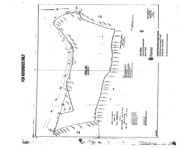
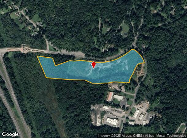
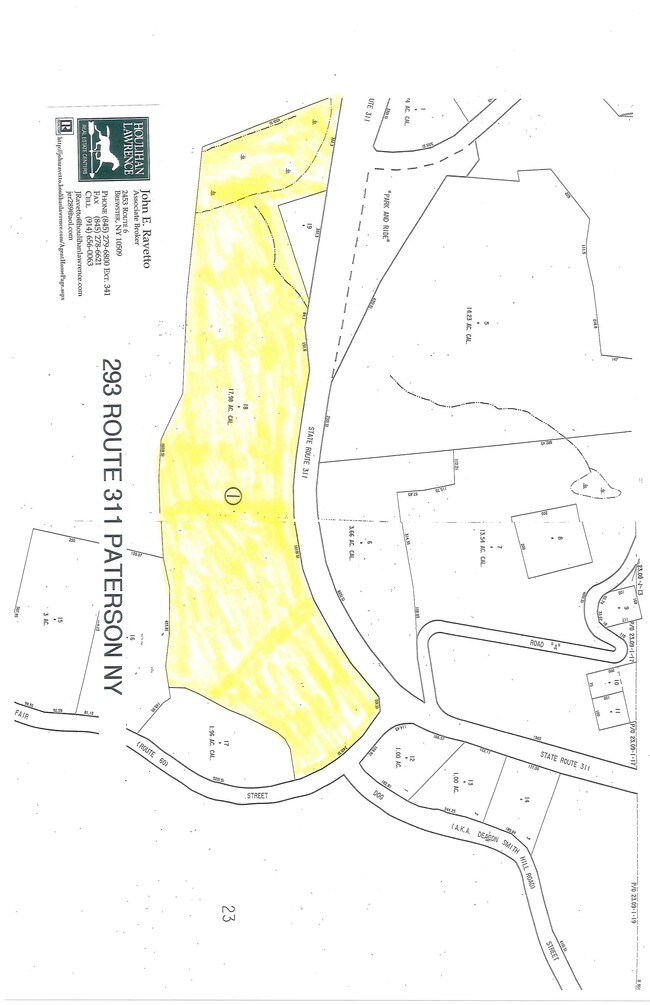
293 Route 311
372400-023-013-0001-018-000-0000
Putnam
Industrialacreage
New York
X
18.00
36079C0132E
17.06 AC
2024
Brewster
2024
Westchester/So Connecticut
010202
Dutchess County-Putnam County, NY
DEMOGRAPHICS near 293 Route 311
1 Mile
3 Mile
5 Mile
2024 Total Population
1,200
14,622
35,746
2029 Population
1,212
14,680
35,886
Pop Growth 2024-2029
+ 1.00%
+ 0.40%
+ 0.39%
Average Age
44
43
43
2024 Total Households
436
5,479
13,019
HH Growth 2024-2029
+ 0.92%
+ 0.38%
+ 0.40%
Median Household Inc
$96,490
$93,098
$98,641
Avg Household Size
2.60
2.60
2.60
2024 Avg HH Vehicles
2.00
2.00
2.00
Median Home Value
$349,137
$340,739
$363,679
Median Year Built
1968
1966
1972
Nearby Places
Map Layers
Map Styles
 Street
 Aerial
- Restaurants
- Banks
- Shops
- Fitness
- Groceries
PUBLIC TRANSPORTATION
COMMUTER RAIL
Patterson Station (Harlem Line - Metro-North Commuter Railroad Company (Metro-North))
DRIVE
WALK
Distance
Patterson Station (Harlem Line - Metro-North Commuter Railroad Company (Metro-North))
7 min
4.1 mi
Southeast Station (Harlem Line - Metro-North Commuter Railroad Company (Metro-North))
DRIVE
WALK
Distance
Southeast Station (Harlem Line - Metro-North Commuter Railroad Company (Metro-North))
12 min
5.4 mi
AIRPORT
New York Stewart International
DRIVE
WALK
Distance
New York Stewart International
41 min
30.4 mi
Westchester County
DRIVE
WALK
Distance
Westchester County
40 min
32.0 mi
Freight Ports
Port of New Haven
DRIVE
WALK
Distance
Port of New Haven
74 min
51.7 mi
SALE & LEASE HISTORY
LISTING DATE
SALE/LEASE

Sep 24, 2016
For Sale
Apr 30, 2019
For Sale
Nearby Properties
Address
Land Use
TOTAL SIZE
Lot Size
Zoning
Address
Land Use
TOTAL SIZE
Lot Size
Zoning
170,015 SF
70.32 AC
R160
Address
Land Use
TOTAL SIZE
Lot Size
Zoning
223,335 SF
27.56 AC
OP2
Address
Land Use
TOTAL SIZE
Lot Size
Zoning
164.46 AC
OP3
Address
Land Use
TOTAL SIZE
Lot Size
Zoning
36,877 SF
65.72 AC
R10
Address
Land Use
TOTAL SIZE
Lot Size
Zoning
116,349 SF
14.49 AC
R4
Address
Land Use
TOTAL SIZE
Lot Size
Zoning
64.48 AC
OP3
Address
Land Use
TOTAL SIZE
Lot Size
Zoning
101,756 SF
25.78 AC
R40
Address
Land Use
TOTAL SIZE
Lot Size
Zoning
40,613 SF
49.91 AC
I
Address
Land Use
TOTAL SIZE
Lot Size
Zoning
72,040 SF
9.87 AC
I
Address
Land Use
TOTAL SIZE
Lot Size
Zoning
77,537 SF
19.41 AC
R1
Address
Land Use
TOTAL SIZE
Lot Size
Zoning
41,082 SF
21 AC
R4
Address
Land Use
TOTAL SIZE
Lot Size
Zoning
Address
Land Use
TOTAL SIZE
Lot Size
Zoning
51,048 SF
32.65 AC
R40
Address
Land Use
TOTAL SIZE
Lot Size
Zoning
33,627 SF
57.08 AC
R80
Address
Land Use
TOTAL SIZE
Lot Size
Zoning
Address
Land Use
TOTAL SIZE
Lot Size
Zoning
Address
Land Use
TOTAL SIZE
Lot Size
Zoning
Address
Land Use
TOTAL SIZE
Lot Size
Zoning
581.90 AC
R4
Address
Land Use
TOTAL SIZE
Lot Size
Zoning
Address
Land Use
TOTAL SIZE
Lot Size
Zoning
18,286 SF
152.66 AC
R4
Address
Land Use
TOTAL SIZE
Lot Size
Zoning
7,806 SF
134.53 AC
R4
Address
Land Use
TOTAL SIZE
Lot Size
Zoning
2,764 SF
85.13 AC
R4
Address
Land Use
TOTAL SIZE
Lot Size
Zoning
32.64 AC
R1
Address
Land Use
TOTAL SIZE
Lot Size
Zoning
149.68 AC
C1
Address
Land Use
TOTAL SIZE
Lot Size
Zoning
21,160 SF
3.54 AC
R40
Address
Land Use
TOTAL SIZE
Lot Size
Zoning
10,370 SF
30.93 AC
R4
Address
Land Use
TOTAL SIZE
Lot Size
Zoning
Address
Land Use
TOTAL SIZE
Lot Size
Zoning
60,828 SF
6.95 AC
R80
Address
Land Use
TOTAL SIZE
Lot Size
Zoning
616 SF
63.50 AC
R10
Address
Land Use
TOTAL SIZE
Lot Size
Zoning
19,495 SF
11.88 AC
IOC
The World's #1 Commercial Real Estate Marketplace
Connect with us
© 2025 CoStar Group
The information above has been obtained from sources believed reliable. While we do not doubt its accuracy we have not verified it and make no guarantee, warranty or representation about it. It is your responsibility to independently confirm its accuracy and completeness. Any projections, opinions, assumptions, or estimates used are for example only and do not represent the current or future performance of the property. The value of this transaction to you depends on tax and other factors which should be evaluated by your tax, financial, and legal advisors. You and your advisors should conduct a careful, independent investigation of the property to determine to your satisfaction the suitability of the property for your needs.