Property Record
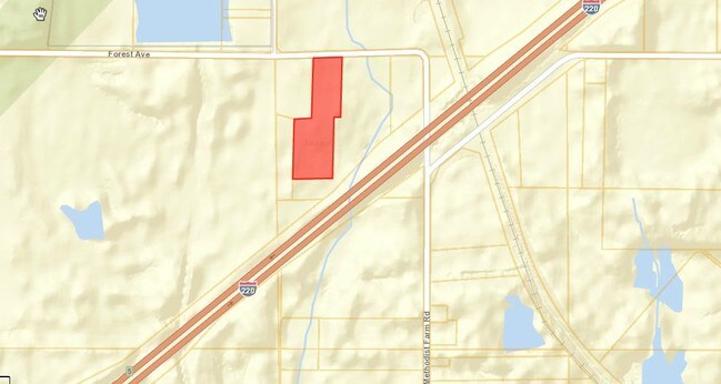
2930 Forest Avenue Ext, Jackson, MS 39213

Property Detail
2930 Forest Avenue Ext
Jackson, MS
BEG INT S/L FOREST AVE EXT & W/L ANNIE RD W 731.24 FT TO POB S 544.65 FT W 59.26 FT S 548.65 FT W 359.12 FT N 548.65 FT E 158.32 FT N 550.9 FT E 260.06 FT TO POB PT LOT 20 GARLAND COMM FARMS SUBN
0730-0018-000
HINDS
Retirementnursinghomecombined
Mississippi
B and X Area of moderate flood hazard, usually the area between the limits of the 100-year and 500-year floods.
20
0
7.73 AC
2025
North Jackson
000600
Jackson
1,332 SF
NEARBY LISTINGS FOR SALE OR LEASE
-
-
View all Jackson listings for sale on LoopNet.com
DEMOGRAPHICS near 2930 Forest Avenue Ext
1 mile
3 mile
5 mile
2024 Total Population
277
25,258
82,513
2029 Population
265
24,489
80,263
Pop Growth 2024-2029
(4.33%)
(3.04%)
(2.73%)
Average Age
34
42
40
2024 Total Households
109
10,732
35,274
HH Growth 2024-2029
(4.59%)
(3.12%)
(2.94%)
Median Household Inc
$19,772
$34,865
$39,602
Avg Household Size
2.60
2.30
2.20
2024 Avg HH Vehicles
2.00
2.00
2.00
Median Home Value
$84,782
$82,038
$104,928
Median Year Built
1976
1967
1967
Nearby Places
Map Layers
Map Styles
 Street
 Aerial
Transit
 Traffic
 Biking
Places
Listings with unknown addresses are not visible on the map
- Restaurants
- Banks
- Shops
- Fitness
- Groceries
PUBLIC TRANSPORTATION
COMMUTER RAIL
Jackson (City of New Orleans - Amtrak)
Drive
Walk
Distance
Jackson (City of New Orleans - Amtrak)
14 min
6.1 mi
AIRPORT
Jackson-Medgar Wiley Evers International
Drive
Walk
Distance
Jackson-Medgar Wiley Evers International
30 min
16.1 mi
Freight Ports
Port of Greater Baton Rouge
Drive
Walk
Distance
Port of Greater Baton Rouge
208 min
183.7 mi
Nearby Properties
Address
Land Use
TOTAL SIZE
Lot Size
Zoning
Address
Land Use
TOTAL SIZE
Lot Size
Zoning
10,100 SF
548 AC
Address
Land Use
TOTAL SIZE
Lot Size
Zoning
16,932 SF
41.60 AC
Address
Land Use
TOTAL SIZE
Lot Size
Zoning
126,628 SF
6.74 AC
Address
Land Use
TOTAL SIZE
Lot Size
Zoning
55,160 SF
3 AC
Address
Land Use
TOTAL SIZE
Lot Size
Zoning
57,234 SF
Address
Land Use
TOTAL SIZE
Lot Size
Zoning
310,650 SF
17 AC
Address
Land Use
TOTAL SIZE
Lot Size
Zoning
9,003 SF
1 AC
Address
Land Use
TOTAL SIZE
Lot Size
Zoning
108,979 SF
5 AC
Address
Land Use
TOTAL SIZE
Lot Size
Zoning
3,370 SF
13.37 AC
Address
Land Use
TOTAL SIZE
Lot Size
Zoning
132,342 SF
4 AC
Address
Land Use
TOTAL SIZE
Lot Size
Zoning
139,497 SF
12 AC
Address
Land Use
TOTAL SIZE
Lot Size
Zoning
40,000 SF
63.11 AC
Address
Land Use
TOTAL SIZE
Lot Size
Zoning
562.15 AC
Address
Land Use
TOTAL SIZE
Lot Size
Zoning
38,142 SF
16.35 AC
Address
Land Use
TOTAL SIZE
Lot Size
Zoning
16,264 SF
7.79 AC
Address
Land Use
TOTAL SIZE
Lot Size
Zoning
253,477 SF
23 AC
Address
Land Use
TOTAL SIZE
Lot Size
Zoning
39,928 SF
1 AC
Address
Land Use
TOTAL SIZE
Lot Size
Zoning
14,260 SF
3.05 AC
Address
Land Use
TOTAL SIZE
Lot Size
Zoning
2,344 SF
10 AC
Address
Land Use
TOTAL SIZE
Lot Size
Zoning
20,244 SF
7 AC
Address
Land Use
TOTAL SIZE
Lot Size
Zoning
89,064 SF
8.13 AC
Address
Land Use
TOTAL SIZE
Lot Size
Zoning
582,942 SF
31.22 AC
Address
Land Use
TOTAL SIZE
Lot Size
Zoning
8,610 SF
2 AC
Address
Land Use
TOTAL SIZE
Lot Size
Zoning
108,570 SF
8 AC
Address
Land Use
TOTAL SIZE
Lot Size
Zoning
61,865 SF
4 AC
Address
Land Use
TOTAL SIZE
Lot Size
Zoning
357,468 SF
15 AC
Address
Land Use
TOTAL SIZE
Lot Size
Zoning
1,550 SF
19.71 AC
Address
Land Use
TOTAL SIZE
Lot Size
Zoning
31,250 SF
3 AC
Address
Land Use
TOTAL SIZE
Lot Size
Zoning
41 AC
Address
Land Use
TOTAL SIZE
Lot Size
Zoning
46,812 SF
The World's #1 Commercial Real Estate Marketplace
Connect with us
© 2026 CoStar Group
The information above has been obtained from sources believed reliable. While we do not doubt its accuracy we have not verified it and make no guarantee, warranty or representation about it. It is your responsibility to independently confirm its accuracy and completeness. Any projections, opinions, assumptions, or estimates used are for example only and do not represent the current or future performance of the property. The value of this transaction to you depends on tax and other factors which should be evaluated by your tax, financial, and legal advisors. You and your advisors should conduct a careful, independent investigation of the property to determine to your satisfaction the suitability of the property for your needs.