Property Record
2930 Short Vine St, Cincinnati, OH 45219
NEARBY LISTINGS FOR SALE OR LEASE
Property Detail
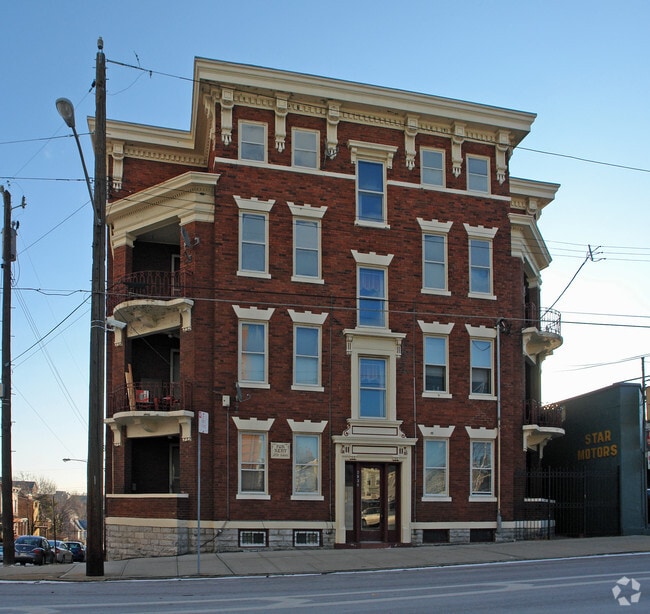
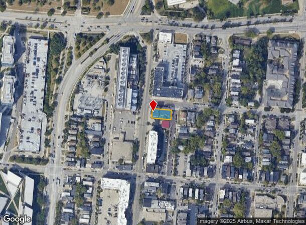
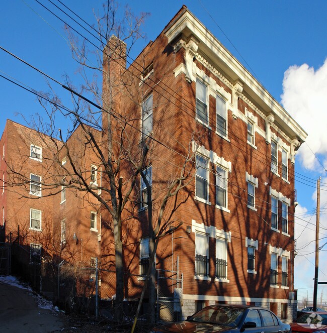
2930 Short Vine St
Cincinnati, OH-KY-IN
Corry Sub
104-0004-0031
VINE ST 57.56 X 116 LOT 8 PT 7 T F CORRY SUB
Apartment
Hamilton
X
Ohio
39061C0219E
8
2024
0.16 AC
2024
Corryville
003200
Cincinnati/Dayton
6,915 SF
DEMOGRAPHICS near 2930 Short Vine St
1 Mile
3 Mile
5 Mile
2024 Total Population
31,161
149,552
347,248
2029 Population
31,467
151,720
350,221
Pop Growth 2024-2029
+ 0.98%
+ 1.45%
+ 0.86%
Average Age
29
36
37
2024 Total Households
11,026
67,118
154,826
HH Growth 2024-2029
+ 1.32%
+ 1.54%
+ 0.85%
Median Household Inc
$31,684
$46,108
$48,251
Avg Household Size
2.00
2.00
2.10
2024 Avg HH Vehicles
1.00
1.00
1.00
Median Home Value
$223,491
$235,808
$206,136
Median Year Built
1955
1948
1949
Nearby Places
Map Layers
Map Styles
 Street
 Aerial
- Restaurants
- Banks
- Shops
- Fitness
- Groceries
PUBLIC TRANSPORTATION
COMMUTER RAIL
DRIVE
WALK
Distance
9 min
3.1 mi
AIRPORT
Cincinnati/Northern Kentucky International
DRIVE
WALK
Distance
Cincinnati/Northern Kentucky International
29 min
16.0 mi
Nearby Properties
Address
Land Use
TOTAL SIZE
Lot Size
Zoning
Address
Land Use
TOTAL SIZE
Lot Size
Zoning
77.73 AC
IR
Address
Land Use
TOTAL SIZE
Lot Size
Zoning
6.35 AC
IR
Address
Land Use
TOTAL SIZE
Lot Size
Zoning
39.99 AC
MG
Address
Land Use
TOTAL SIZE
Lot Size
Zoning
11.82 AC
Address
Land Use
TOTAL SIZE
Lot Size
Zoning
19.36 AC
Address
Land Use
TOTAL SIZE
Lot Size
Zoning
17.10 AC
DD
Address
Land Use
TOTAL SIZE
Lot Size
Zoning
1.97 AC
DD
Address
Land Use
TOTAL SIZE
Lot Size
Zoning
62.10 AC
Address
Land Use
TOTAL SIZE
Lot Size
Zoning
11.41 AC
IR
Address
Land Use
TOTAL SIZE
Lot Size
Zoning
22.45 AC
Address
Land Use
TOTAL SIZE
Lot Size
Zoning
13.80 AC
Address
Land Use
TOTAL SIZE
Lot Size
Zoning
9.55 AC
Address
Land Use
TOTAL SIZE
Lot Size
Zoning
3.09 AC
Address
Land Use
TOTAL SIZE
Lot Size
Zoning
2.80 AC
IR
Address
Land Use
TOTAL SIZE
Lot Size
Zoning
3.40 AC
IR
Address
Land Use
TOTAL SIZE
Lot Size
Zoning
Address
Land Use
TOTAL SIZE
Lot Size
Zoning
3.51 AC
DD
Address
Land Use
TOTAL SIZE
Lot Size
Zoning
Address
Land Use
TOTAL SIZE
Lot Size
Zoning
153,312 SF
4 AC
Address
Land Use
TOTAL SIZE
Lot Size
Zoning
9.14 AC
Address
Land Use
TOTAL SIZE
Lot Size
Zoning
11.68 AC
Address
Land Use
TOTAL SIZE
Lot Size
Zoning
7.14 AC
Address
Land Use
TOTAL SIZE
Lot Size
Zoning
1.95 AC
Address
Land Use
TOTAL SIZE
Lot Size
Zoning
Address
Land Use
TOTAL SIZE
Lot Size
Zoning
2.46 AC
Address
Land Use
TOTAL SIZE
Lot Size
Zoning
844,128 SF
1.22 AC
DD
Address
Land Use
TOTAL SIZE
Lot Size
Zoning
0.43 AC
DD
Address
Land Use
TOTAL SIZE
Lot Size
Zoning
4.46 AC
DD
Address
Land Use
TOTAL SIZE
Lot Size
Zoning
0.91 AC
DD
Address
Land Use
TOTAL SIZE
Lot Size
Zoning
13.32 AC
The World's #1 Commercial Real Estate Marketplace
Connect with us
© 2025 CoStar Group
The information above has been obtained from sources believed reliable. While we do not doubt its accuracy we have not verified it and make no guarantee, warranty or representation about it. It is your responsibility to independently confirm its accuracy and completeness. Any projections, opinions, assumptions, or estimates used are for example only and do not represent the current or future performance of the property. The value of this transaction to you depends on tax and other factors which should be evaluated by your tax, financial, and legal advisors. You and your advisors should conduct a careful, independent investigation of the property to determine to your satisfaction the suitability of the property for your needs.