Property Record
2930 W Co Highway 30A Hwy W, Santa Rosa Beach, FL 32459

NEARBY LISTINGS FOR SALE OR LEASE
-
-
View all Santa Rosa Beach listings for sale on LoopNet.com
Property Detail
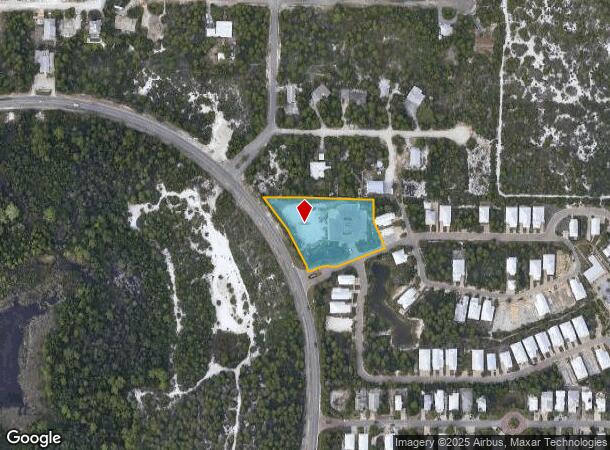
2930 W Co Highway 30A Hwy W
Crestview-Fort Walton Beach-Destin, FL
Highland Parks At Blue Mountain Beach
01-3S-20-34000-009-0010
COM NE/C OF SW4 OF SE4 SEC 01-3S-20W, N 88 DEG 5403W 1729.41FT FOR POB; N 88 DEG 5403W 369.63FT TO E/LY ROW CO RD C-30A, CURVE SW/LY RADIUS 990.37FT ARC E/LY ROW CENTRAL ANGLE 16 DEG 3029 285.34FT (CHORD B&D=S 31 DEG 1210E 284.36FT), DPRT ROW N 69 DE
Officebuilding
Walton
X
Florida
12131C0677H
10
2025
1.67 AC
2025
Florida Panhandle Area
950606
Other Market Areas
13,281 SF
DEMOGRAPHICS near 2930 W Co Highway 30A Hwy W
1 Mile
3 Mile
5 Mile
2024 Total Population
2,864
8,263
17,247
2029 Population
3,812
10,793
22,221
Pop Growth 2024-2029
+ 33.10%
+ 30.62%
+ 28.84%
Average Age
45
44
42
2024 Total Households
1,190
3,381
6,969
HH Growth 2024-2029
+ 33.53%
+ 31.17%
+ 29.43%
Median Household Inc
$103,380
$78,912
$78,646
Avg Household Size
2.30
2.30
2.40
2024 Avg HH Vehicles
2.00
2.00
2.00
Median Home Value
$594,565
$494,461
$482,105
Median Year Built
2004
2003
2003
Nearby Places
- Restaurants
- Banks
- Shops
- Fitness
- Groceries
PUBLIC TRANSPORTATION
AIRPORT
Eglin AFB/Destin-Ft Walton Beach
DRIVE
WALK
Distance
Eglin AFB/Destin-Ft Walton Beach
72 min
32.0 mi
Northwest Florida Beaches International
DRIVE
WALK
Distance
Northwest Florida Beaches International
56 min
36.7 mi
Freight Ports
Port of Panama City
DRIVE
WALK
Distance
Port of Panama City
55 min
35.0 mi
Nearby Properties
Address
Land Use
TOTAL SIZE
Lot Size
Zoning
Address
Land Use
TOTAL SIZE
Lot Size
Zoning
191,948 SF
45.59 AC
3310
Address
Land Use
TOTAL SIZE
Lot Size
Zoning
269,585 SF
14.50 AC
SMNBHD
Address
Land Use
TOTAL SIZE
Lot Size
Zoning
210,258 SF
20.45 AC
TC1
Address
Land Use
TOTAL SIZE
Lot Size
Zoning
200,408 SF
10.73 AC
VMU
Address
Land Use
TOTAL SIZE
Lot Size
Zoning
247.93 AC
LKDUNE
Address
Land Use
TOTAL SIZE
Lot Size
Zoning
17,317 SF
65.65 AC
GULFFR
Address
Land Use
TOTAL SIZE
Lot Size
Zoning
154,979 SF
9.92 AC
TC1
Address
Land Use
TOTAL SIZE
Lot Size
Zoning
2.27 AC
GULFFR
Address
Land Use
TOTAL SIZE
Lot Size
Zoning
0.87 AC
GULFFR
Address
Land Use
TOTAL SIZE
Lot Size
Zoning
109,317 SF
10 AC
TC1
Address
Land Use
TOTAL SIZE
Lot Size
Zoning
483 SF
4.15 AC
GULFFR
Address
Land Use
TOTAL SIZE
Lot Size
Zoning
73,257 SF
10.62 AC
HWY 98
Address
Land Use
TOTAL SIZE
Lot Size
Zoning
Address
Land Use
TOTAL SIZE
Lot Size
Zoning
83,492 SF
7.25 AC
HWY 98
Address
Land Use
TOTAL SIZE
Lot Size
Zoning
99,367 SF
0.56 AC
Address
Land Use
TOTAL SIZE
Lot Size
Zoning
2.44 AC
GULFFR
Address
Land Use
TOTAL SIZE
Lot Size
Zoning
14,291 SF
59.59 AC
Address
Land Use
TOTAL SIZE
Lot Size
Zoning
0.78 AC
GULFFR
Address
Land Use
TOTAL SIZE
Lot Size
Zoning
2.30 AC
VMU
Address
Land Use
TOTAL SIZE
Lot Size
Zoning
54,208 SF
9.75 AC
NBHDIN
Address
Land Use
TOTAL SIZE
Lot Size
Zoning
5,494 SF
0.84 AC
GULFFR
Address
Land Use
TOTAL SIZE
Lot Size
Zoning
7,152 SF
0.91 AC
Address
Land Use
TOTAL SIZE
Lot Size
Zoning
50,793 SF
23.08 AC
3310
Address
Land Use
TOTAL SIZE
Lot Size
Zoning
4.23 AC
GULFFR
Address
Land Use
TOTAL SIZE
Lot Size
Zoning
9,870 SF
0.66 AC
GULFFR
Address
Land Use
TOTAL SIZE
Lot Size
Zoning
23,073 SF
3.12 AC
HWY 98
Address
Land Use
TOTAL SIZE
Lot Size
Zoning
1.16 AC
GULFFR
Address
Land Use
TOTAL SIZE
Lot Size
Zoning
3,059 SF
0.84 AC
GULFFR
Address
Land Use
TOTAL SIZE
Lot Size
Zoning
32,601 SF
5 AC
SN
Address
Land Use
TOTAL SIZE
Lot Size
Zoning
0.57 AC
LKDUNE
The World's #1 Commercial Real Estate Marketplace
Connect with us
© 2025 CoStar Group
The information above has been obtained from sources believed reliable. While we do not doubt its accuracy we have not verified it and make no guarantee, warranty or representation about it. It is your responsibility to independently confirm its accuracy and completeness. Any projections, opinions, assumptions, or estimates used are for example only and do not represent the current or future performance of the property. The value of this transaction to you depends on tax and other factors which should be evaluated by your tax, financial, and legal advisors. You and your advisors should conduct a careful, independent investigation of the property to determine to your satisfaction the suitability of the property for your needs.