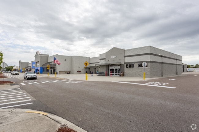
Property Record
2931 S Mccall Rd, Englewood, FL 34224


NEARBY LISTINGS FOR SALE OR LEASE
Property Detail
2931 S Mccall Rd
412004456006
Oyster Creek
Departmentstore
04 41 20 P-7-2 13.39AC. M/L BEG AT NW COR TR A OYSTER CREEK TH N 861 FT W 150 FT N 300 FT TO S ROW SR 776 TH E 249.77 FT S 20 FT W 20 FT S 183.06 FT E124.50 FT N 203.06 FT E 120.78 FT TO W ROW ORIOLE BLVD S ALG W ROW 1263.41 FT TO NE COR TR
AE
Charlotte
12015C0191G
Florida
2024
26.30 AC
2025
Charlotte County
030302
Southwest Florida
194,746 SF
Punta Gorda, FL
DEMOGRAPHICS near 2931 S Mccall Rd
1 Mile
3 Mile
5 Mile
2024 Total Population
5,888
26,006
52,465
2029 Population
7,144
31,315
63,199
Pop Growth 2024-2029
+ 21.33%
+ 20.41%
+ 20.46%
Average Age
62
57
58
2024 Total Households
3,091
12,966
26,191
HH Growth 2024-2029
+ 21.64%
+ 20.72%
+ 20.65%
Median Household Inc
$47,475
$54,880
$56,995
Avg Household Size
1.80
1.90
2.00
2024 Avg HH Vehicles
2.00
2.00
2.00
Median Home Value
$177,884
$248,323
$269,057
Median Year Built
1984
1987
1988
Nearby Places
Map Layers
Map Styles
 Street
 Aerial
- Restaurants
- Banks
- Shops
- Fitness
- Groceries
PUBLIC TRANSPORTATION
AIRPORT
Punta Gorda
DRIVE
WALK
Distance
Punta Gorda
44 min
26.1 mi
Freight Ports
Port Manatee
DRIVE
WALK
Distance
Port Manatee
78 min
57.1 mi
SALE & LEASE HISTORY
LISTING DATE
SALE/LEASE

May 12, 2022
For Sale
Nearby Properties
Address
Land Use
TOTAL SIZE
Lot Size
Zoning
Address
Land Use
TOTAL SIZE
Lot Size
Zoning
796,848 SF
44.28 AC
RE1
Address
Land Use
TOTAL SIZE
Lot Size
Zoning
95,649 SF
10.41 AC
OPI
Address
Land Use
TOTAL SIZE
Lot Size
Zoning
28,490 SF
172 AC
PKR
Address
Land Use
TOTAL SIZE
Lot Size
Zoning
33,654 SF
10.19 AC
RMF5
Address
Land Use
TOTAL SIZE
Lot Size
Zoning
91,934 SF
8.39 AC
PD
Address
Land Use
TOTAL SIZE
Lot Size
Zoning
107,736 SF
35.90 AC
RMF5
Address
Land Use
TOTAL SIZE
Lot Size
Zoning
103,161 SF
2.54 AC
ILW
Address
Land Use
TOTAL SIZE
Lot Size
Zoning
111,505 SF
9.53 AC
CG
Address
Land Use
TOTAL SIZE
Lot Size
Zoning
70,165 SF
22.18 AC
CG
Address
Land Use
TOTAL SIZE
Lot Size
Zoning
58,185 SF
3.40 AC
IG
Address
Land Use
TOTAL SIZE
Lot Size
Zoning
71,462 SF
24.99 AC
RE1
Address
Land Use
TOTAL SIZE
Lot Size
Zoning
89,501 SF
6.52 AC
CG
Address
Land Use
TOTAL SIZE
Lot Size
Zoning
50,672 SF
77.41 AC
RMF1
Address
Land Use
TOTAL SIZE
Lot Size
Zoning
25,777 SF
12.18 AC
PD
Address
Land Use
TOTAL SIZE
Lot Size
Zoning
55,760 SF
3.18 AC
CG
Address
Land Use
TOTAL SIZE
Lot Size
Zoning
25,478 SF
11.06 AC
IG
Address
Land Use
TOTAL SIZE
Lot Size
Zoning
42,228 SF
9.24 AC
RE1
Address
Land Use
TOTAL SIZE
Lot Size
Zoning
51,683 SF
7.16 AC
CG
Address
Land Use
TOTAL SIZE
Lot Size
Zoning
106,737 SF
20.80 AC
RMF5
Address
Land Use
TOTAL SIZE
Lot Size
Zoning
72,168 SF
7.11 AC
CG
Address
Land Use
TOTAL SIZE
Lot Size
Zoning
1,459 SF
11.21 AC
RSF4
Address
Land Use
TOTAL SIZE
Lot Size
Zoning
38,753 SF
8.78 AC
OPI
Address
Land Use
TOTAL SIZE
Lot Size
Zoning
35,351 SF
7.44 AC
CG
Address
Land Use
TOTAL SIZE
Lot Size
Zoning
33,047 SF
10.17 AC
PKR
Address
Land Use
TOTAL SIZE
Lot Size
Zoning
25,568 SF
2.73 AC
CG
Address
Land Use
TOTAL SIZE
Lot Size
Zoning
93.43 AC
RSF2
Address
Land Use
TOTAL SIZE
Lot Size
Zoning
42,955 SF
15.64 AC
OUE1
Address
Land Use
TOTAL SIZE
Lot Size
Zoning
50,080 SF
5.09 AC
CG
Address
Land Use
TOTAL SIZE
Lot Size
Zoning
11.89 AC
RSF4
The World's #1 Commercial Real Estate Marketplace
Connect with us
© 2025 CoStar Group
The information above has been obtained from sources believed reliable. While we do not doubt its accuracy we have not verified it and make no guarantee, warranty or representation about it. It is your responsibility to independently confirm its accuracy and completeness. Any projections, opinions, assumptions, or estimates used are for example only and do not represent the current or future performance of the property. The value of this transaction to you depends on tax and other factors which should be evaluated by your tax, financial, and legal advisors. You and your advisors should conduct a careful, independent investigation of the property to determine to your satisfaction the suitability of the property for your needs.