Property Record
2933 S Tomahawk Rd, Apache Junction, AZ 85119
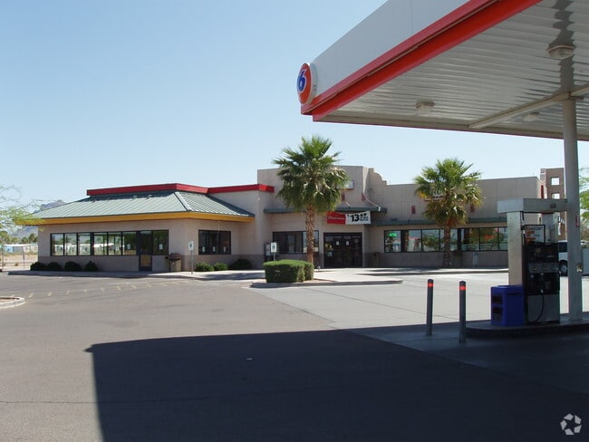


Property Detail
2933 S Tomahawk Rd
103-22-004B
COM AT W 1/4 COR SEC 34-1N-8E TH N-990' THE E-50' TO POB S-89 DEG 57'5 E-319.78' TH S-0 DEG 2'55 W-330' TH N-89 DEG 57'5 W-295.5 8' TH N-5 DEG 42'27 W-194.26' TH N-89 DEG 58'29 W-4.60' TH N-0 DEG 0'6 W-136.72' TO POB SEC 34-1N-8E 2.36 AC
Servicestationmarket
Pinal
UNDESIGNAT
Arizona
AE The base floodplain where base flood elevations are provided. AE Zones are now used on new format FIRMs instead of A1-A30 Zones.
2.36 AC
2024
Apache Junction
2025
Phoenix
000324
Phoenix-Mesa-Chandler, AZ
7,935 SF
NEARBY LISTINGS FOR SALE OR LEASE
DEMOGRAPHICS near 2933 S Tomahawk Rd
1 mile
3 mile
5 mile
2025 Total Population
10,540
39,635
102,233
2030 Population
12,429
46,429
115,227
Pop Growth 2025-2030
+ 17.92%
+ 17.14%
+ 12.71%
Average Age
47
50
49
2025 Total Households
4,580
17,868
43,807
HH Growth 2025-2030
+ 17.99%
+ 17.14%
+ 13.48%
Median Household Inc
$72,296
$59,665
$72,437
Avg Household Size
2.30
2.20
2.30
2025 Avg HH Vehicles
2.00
2.00
2.00
Median Home Value
$310,939
$280,625
$371,852
Median Year Built
1996
1993
1997
Nearby Places
Map Layers
Map Styles
 Street
 Aerial
Transit
 Traffic
 Biking
Places
Listings with unknown addresses are not visible on the map
- Restaurants
- Banks
- Shops
- Fitness
- Groceries
PUBLIC TRANSPORTATION
AIRPORT
Phoenix-Mesa Gateway
Drive
Walk
Distance
Phoenix-Mesa Gateway
23 min
15.5 mi
Phoenix Sky Harbor International
Drive
Walk
Distance
Phoenix Sky Harbor International
41 min
31.4 mi
Freight Ports
Port of San Diego
Drive
Walk
Distance
Port of San Diego
428 min
388.0 mi
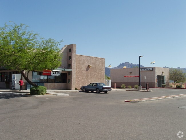
Nearby Properties
Address
Land Use
TOTAL SIZE
Lot Size
Zoning
Address
Land Use
TOTAL SIZE
Lot Size
Zoning
117,169 SF
13.27 AC
Address
Land Use
TOTAL SIZE
Lot Size
Zoning
Address
Land Use
TOTAL SIZE
Lot Size
Zoning
128,905 SF
7.14 AC
UNDESIGNAT
Address
Land Use
TOTAL SIZE
Lot Size
Zoning
Address
Land Use
TOTAL SIZE
Lot Size
Zoning
Address
Land Use
TOTAL SIZE
Lot Size
Zoning
126,549 SF
9.75 AC
Address
Land Use
TOTAL SIZE
Lot Size
Zoning
52,961 SF
7.94 AC
Address
Land Use
TOTAL SIZE
Lot Size
Zoning
108,644 SF
10.12 AC
UNDESIGNAT
Address
Land Use
TOTAL SIZE
Lot Size
Zoning
62,290 SF
7.53 AC
UNDESIGNAT
Address
Land Use
TOTAL SIZE
Lot Size
Zoning
54,706 SF
16.20 AC
UNDESIGNAT
Address
Land Use
TOTAL SIZE
Lot Size
Zoning
Address
Land Use
TOTAL SIZE
Lot Size
Zoning
69,692 SF
7.26 AC
Address
Land Use
TOTAL SIZE
Lot Size
Zoning
11,686 SF
40 AC
Address
Land Use
TOTAL SIZE
Lot Size
Zoning
38,353 SF
5 AC
Address
Land Use
TOTAL SIZE
Lot Size
Zoning
30,775 SF
7.60 AC
UNDESIGNAT
Address
Land Use
TOTAL SIZE
Lot Size
Zoning
102,430 SF
5 AC
UNDESIGNAT
Address
Land Use
TOTAL SIZE
Lot Size
Zoning
26,022 SF
11.03 AC
UNDESIGNAT
Address
Land Use
TOTAL SIZE
Lot Size
Zoning
27,121 SF
4.05 AC
Address
Land Use
TOTAL SIZE
Lot Size
Zoning
196,400 SF
15.67 AC
Address
Land Use
TOTAL SIZE
Lot Size
Zoning
54,300 SF
4.57 AC
UNDESIGNAT
Address
Land Use
TOTAL SIZE
Lot Size
Zoning
683 SF
36.74 AC
UNDESIGNAT
Address
Land Use
TOTAL SIZE
Lot Size
Zoning
24,158 SF
5.19 AC
Address
Land Use
TOTAL SIZE
Lot Size
Zoning
62,758 SF
5 AC
UNDESIGNAT
Address
Land Use
TOTAL SIZE
Lot Size
Zoning
4,000 SF
20 AC
CI2
Address
Land Use
TOTAL SIZE
Lot Size
Zoning
30,477 SF
3.91 AC
UNDESIGNAT
Address
Land Use
TOTAL SIZE
Lot Size
Zoning
28,800 SF
4.59 AC
Address
Land Use
TOTAL SIZE
Lot Size
Zoning
Address
Land Use
TOTAL SIZE
Lot Size
Zoning
20,967 SF
3.60 AC
UNDESIGNAT
The World's #1 Commercial Real Estate Marketplace
Connect with us
© 2026 CoStar Group
The information above has been obtained from sources believed reliable. While we do not doubt its accuracy we have not verified it and make no guarantee, warranty or representation about it. It is your responsibility to independently confirm its accuracy and completeness. Any projections, opinions, assumptions, or estimates used are for example only and do not represent the current or future performance of the property. The value of this transaction to you depends on tax and other factors which should be evaluated by your tax, financial, and legal advisors. You and your advisors should conduct a careful, independent investigation of the property to determine to your satisfaction the suitability of the property for your needs.