Property Record
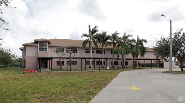
2935 Del Prado Blvd S, Cape Coral, FL 33904


NEARBY LISTINGS FOR SALE OR LEASE
Property Detail
2935 Del Prado Blvd S
Cape Coral-Fort Myers, FL
Cape Coral
32-44-24-C4-0030B.0010
CAPE CORAL U-20 PB 17 PG 104 S 500 FT OF W 523 FT OF TRACT B + BLK 1179 LOTS 1 THRU 8
Officebuilding
Lee
AE
Florida
12071C0402G
1-8
2024
7.36 AC
2025
Cape Coral
010701
Southwest Florida
32,496 SF
DEMOGRAPHICS near 2935 Del Prado Blvd S
1 Mile
3 Mile
5 Mile
2024 Total Population
8,253
62,400
196,074
2029 Population
9,724
73,433
231,474
Pop Growth 2024-2029
+ 17.82%
+ 17.68%
+ 18.05%
Average Age
50
47
45
2024 Total Households
3,528
26,736
83,442
HH Growth 2024-2029
+ 17.43%
+ 17.35%
+ 17.72%
Median Household Inc
$65,451
$62,591
$61,506
Avg Household Size
2.20
2.30
2.30
2024 Avg HH Vehicles
2.00
2.00
2.00
Median Home Value
$325,697
$289,563
$285,595
Median Year Built
1980
1986
1987
Nearby Places
Map Layers
Map Styles
 Street
 Aerial
- Restaurants
- Banks
- Shops
- Fitness
- Groceries
PUBLIC TRANSPORTATION
AIRPORT
Southwest Florida International
DRIVE
WALK
Distance
Southwest Florida International
30 min
18.0 mi
Punta Gorda
DRIVE
WALK
Distance
Punta Gorda
42 min
27.0 mi
Freight Ports
Port Manatee
DRIVE
WALK
Distance
Port Manatee
122 min
98.7 mi
Nearby Properties
Address
Land Use
TOTAL SIZE
Lot Size
Zoning
Address
Land Use
TOTAL SIZE
Lot Size
Zoning
634,872 SF
43.30 AC
C1-D
Address
Land Use
TOTAL SIZE
Lot Size
Zoning
476,419 SF
36.49 AC
C1
Address
Land Use
TOTAL SIZE
Lot Size
Zoning
282,066 SF
39.45 AC
INS
Address
Land Use
TOTAL SIZE
Lot Size
Zoning
278,679 SF
29.21 AC
C1-D
Address
Land Use
TOTAL SIZE
Lot Size
Zoning
101,204 SF
12.34 AC
P1-D
Address
Land Use
TOTAL SIZE
Lot Size
Zoning
139,978 SF
10.75 AC
C-1
Address
Land Use
TOTAL SIZE
Lot Size
Zoning
142,773 SF
10.82 AC
C-1
Address
Land Use
TOTAL SIZE
Lot Size
Zoning
144,607 SF
20 AC
INS
Address
Land Use
TOTAL SIZE
Lot Size
Zoning
54,248 SF
15.42 AC
C1-W
Address
Land Use
TOTAL SIZE
Lot Size
Zoning
101,999 SF
7.17 AC
P-1
Address
Land Use
TOTAL SIZE
Lot Size
Zoning
99,749 SF
11.49 AC
WSHP
Address
Land Use
TOTAL SIZE
Lot Size
Zoning
113,239 SF
12.62 AC
R1-D
Address
Land Use
TOTAL SIZE
Lot Size
Zoning
227,560 SF
27.45 AC
C1-D
Address
Land Use
TOTAL SIZE
Lot Size
Zoning
47,660 SF
3.52 AC
C1-D
Address
Land Use
TOTAL SIZE
Lot Size
Zoning
95,942 SF
5.22 AC
C1-D
Address
Land Use
TOTAL SIZE
Lot Size
Zoning
78,988 SF
2.89 AC
C1-D
Address
Land Use
TOTAL SIZE
Lot Size
Zoning
52,003 SF
6.66 AC
WSHP
Address
Land Use
TOTAL SIZE
Lot Size
Zoning
69,261 SF
8.44 AC
WSHP
Address
Land Use
TOTAL SIZE
Lot Size
Zoning
84,145 SF
8.11 AC
C-1
Address
Land Use
TOTAL SIZE
Lot Size
Zoning
74,368 SF
2.32 AC
SC
Address
Land Use
TOTAL SIZE
Lot Size
Zoning
36,649 SF
2.82 AC
C-1
Address
Land Use
TOTAL SIZE
Lot Size
Zoning
201,687 SF
11.80 AC
C-1
Address
Land Use
TOTAL SIZE
Lot Size
Zoning
53,979 SF
3.24 AC
P-1
Address
Land Use
TOTAL SIZE
Lot Size
Zoning
52,459 SF
9.22 AC
C-1
Address
Land Use
TOTAL SIZE
Lot Size
Zoning
86,497 SF
6.20 AC
SC
Address
Land Use
TOTAL SIZE
Lot Size
Zoning
139,446 SF
9.94 AC
C1-D
Address
Land Use
TOTAL SIZE
Lot Size
Zoning
45,809 SF
1.75 AC
SC
Address
Land Use
TOTAL SIZE
Lot Size
Zoning
34,482 SF
2.39 AC
C-1
Address
Land Use
TOTAL SIZE
Lot Size
Zoning
51,688 SF
3.60 AC
C-1
Address
Land Use
TOTAL SIZE
Lot Size
Zoning
67,396 SF
2.02 AC
SC
The World's #1 Commercial Real Estate Marketplace
Connect with us
© 2026 CoStar Group
The information above has been obtained from sources believed reliable. While we do not doubt its accuracy we have not verified it and make no guarantee, warranty or representation about it. It is your responsibility to independently confirm its accuracy and completeness. Any projections, opinions, assumptions, or estimates used are for example only and do not represent the current or future performance of the property. The value of this transaction to you depends on tax and other factors which should be evaluated by your tax, financial, and legal advisors. You and your advisors should conduct a careful, independent investigation of the property to determine to your satisfaction the suitability of the property for your needs.