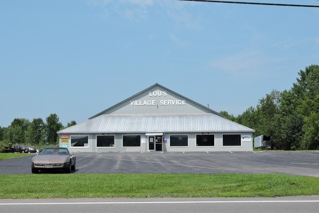
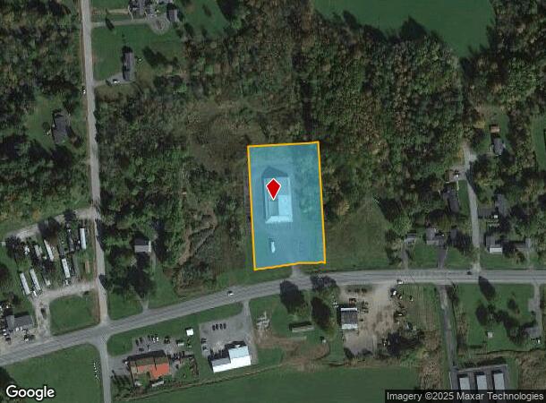
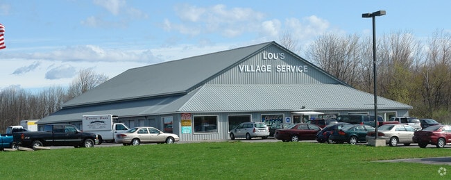
Property Record
2937 Route 5, Canastota, NY 13032
NEARBY LISTINGS FOR SALE OR LEASE
Property Detail
2937 Route 5
Syracuse, NY
Madison
253689-043-000-0003-027-014-0000
New York
Vehiclerentalsvehiclesales
27.014
2025
3 AC
2024
Madison County
030300
Syracuse
10,880 SF
DEMOGRAPHICS near 2937 Route 5
1 Mile
3 Mile
5 Mile
2024 Total Population
510
6,704
12,285
2029 Population
500
6,568
12,045
Pop Growth 2024-2029
(1.96%)
(2.03%)
(1.95%)
Average Age
43
42
43
2024 Total Households
209
2,807
5,077
HH Growth 2024-2029
(1.91%)
(2.14%)
(2.07%)
Median Household Inc
$73,499
$65,729
$68,600
Avg Household Size
2.40
2.30
2.40
2024 Avg HH Vehicles
2.00
2.00
2.00
Median Home Value
$163,218
$174,587
$181,554
Median Year Built
1965
1963
1964
Nearby Places
Map Layers
Map Styles
 Street
 Aerial
- Restaurants
- Banks
- Shops
- Fitness
- Groceries
PUBLIC TRANSPORTATION
AIRPORT
Syracuse Hancock International
DRIVE
WALK
Distance
Syracuse Hancock International
41 min
28.9 mi
SALE & LEASE HISTORY
LISTING DATE
SALE/LEASE

Aug 10, 2018
For Sale
Aug 09, 2018
For Lease
Nearby Properties
Address
Land Use
TOTAL SIZE
Lot Size
Zoning
Address
Land Use
TOTAL SIZE
Lot Size
Zoning
198,383 SF
39.78 AC
AG
Address
Land Use
TOTAL SIZE
Lot Size
Zoning
6.43 AC
IND
Address
Land Use
TOTAL SIZE
Lot Size
Zoning
Address
Land Use
TOTAL SIZE
Lot Size
Zoning
480 SF
5.83 AC
IND
Address
Land Use
TOTAL SIZE
Lot Size
Zoning
Address
Land Use
TOTAL SIZE
Lot Size
Zoning
Address
Land Use
TOTAL SIZE
Lot Size
Zoning
Address
Land Use
TOTAL SIZE
Lot Size
Zoning
49,200 SF
7.54 AC
IND
Address
Land Use
TOTAL SIZE
Lot Size
Zoning
24.57 AC
Address
Land Use
TOTAL SIZE
Lot Size
Zoning
75,228 SF
4.27 AC
RM
Address
Land Use
TOTAL SIZE
Lot Size
Zoning
Address
Land Use
TOTAL SIZE
Lot Size
Zoning
50,196 SF
5.56 AC
Address
Land Use
TOTAL SIZE
Lot Size
Zoning
7,000 SF
32.83 AC
CM
Address
Land Use
TOTAL SIZE
Lot Size
Zoning
Address
Land Use
TOTAL SIZE
Lot Size
Zoning
Address
Land Use
TOTAL SIZE
Lot Size
Zoning
Address
Land Use
TOTAL SIZE
Lot Size
Zoning
27,850 SF
5.02 AC
AG
Address
Land Use
TOTAL SIZE
Lot Size
Zoning
144,966 SF
8.47 AC
Address
Land Use
TOTAL SIZE
Lot Size
Zoning
17,007 SF
1.21 AC
R2
Address
Land Use
TOTAL SIZE
Lot Size
Zoning
Address
Land Use
TOTAL SIZE
Lot Size
Zoning
10.08 AC
IND
Address
Land Use
TOTAL SIZE
Lot Size
Zoning
21,928 SF
2.07 AC
PD
Address
Land Use
TOTAL SIZE
Lot Size
Zoning
Address
Land Use
TOTAL SIZE
Lot Size
Zoning
7,192 SF
4 AC
Address
Land Use
TOTAL SIZE
Lot Size
Zoning
26,848 SF
5.25 AC
AG
Address
Land Use
TOTAL SIZE
Lot Size
Zoning
62,000 SF
10.12 AC
IND
Address
Land Use
TOTAL SIZE
Lot Size
Zoning
14,673 SF
2.33 AC
CM
Address
Land Use
TOTAL SIZE
Lot Size
Zoning
48,260 SF
10.77 AC
IND
Address
Land Use
TOTAL SIZE
Lot Size
Zoning
Address
Land Use
TOTAL SIZE
Lot Size
Zoning
28,135 SF
6.99 AC
The World's #1 Commercial Real Estate Marketplace
Connect with us
© 2025 CoStar Group
The information above has been obtained from sources believed reliable. While we do not doubt its accuracy we have not verified it and make no guarantee, warranty or representation about it. It is your responsibility to independently confirm its accuracy and completeness. Any projections, opinions, assumptions, or estimates used are for example only and do not represent the current or future performance of the property. The value of this transaction to you depends on tax and other factors which should be evaluated by your tax, financial, and legal advisors. You and your advisors should conduct a careful, independent investigation of the property to determine to your satisfaction the suitability of the property for your needs.