No Photo
Property Record
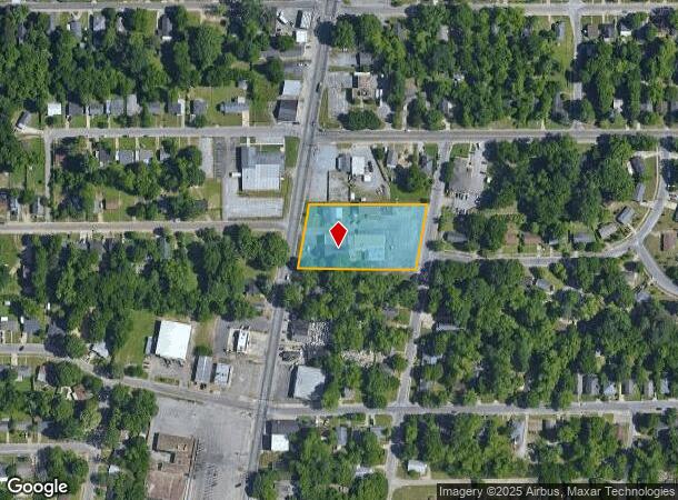
2938 Lower Wetumpka Rd, Montgomery, AL 36110

NEARBY LISTINGS FOR SALE OR LEASE
Property Detail
2938 Lower Wetumpka Rd
Montgomery, AL
Chisholm Baptist Church Prop
04-09-32-2-002-018.000
LESS THE SOUTH EAST 50FT X 125FT 0409322002018000
Theater
Montgomery
X
Alabama
01101C0091J
a
0
1.55 AC
2025
North Montgomery
002500
Montgomery
22,002 SF
DEMOGRAPHICS near 2938 Lower Wetumpka Rd
1 Mile
3 Mile
5 Mile
2024 Total Population
8,094
27,608
73,906
2029 Population
8,059
27,307
73,270
Pop Growth 2024-2029
(0.43%)
(1.09%)
(0.86%)
Average Age
37
38
39
2024 Total Households
3,160
11,269
29,683
HH Growth 2024-2029
(0.57%)
(1.19%)
(0.73%)
Median Household Inc
$33,452
$39,058
$43,346
Avg Household Size
2.50
2.30
2.20
2024 Avg HH Vehicles
2.00
2.00
2.00
Median Home Value
$58,878
$86,765
$120,185
Median Year Built
1968
1961
1966
Nearby Places
Map Layers
Map Styles
 Street
 Aerial
- Restaurants
- Banks
- Shops
- Fitness
- Groceries
PUBLIC TRANSPORTATION
AIRPORT
Montgomery Regional (Dannelly Field)
DRIVE
WALK
Distance
Montgomery Regional (Dannelly Field)
18 min
13.3 mi
Freight Ports
Port of Mobile
DRIVE
WALK
Distance
Port of Mobile
188 min
172.3 mi
SALE & LEASE HISTORY
LISTING DATE
SALE/LEASE

Oct 12, 2020
For Sale
Nearby Properties
Address
Land Use
TOTAL SIZE
Lot Size
Zoning
Address
Land Use
TOTAL SIZE
Lot Size
Zoning
800,140 SF
2.27 AC
T5
Address
Land Use
TOTAL SIZE
Lot Size
Zoning
392,741 SF
2.98 AC
T5
Address
Land Use
TOTAL SIZE
Lot Size
Zoning
150,842 SF
5.40 AC
T5
Address
Land Use
TOTAL SIZE
Lot Size
Zoning
427,546 SF
37.68 AC
M-1
Address
Land Use
TOTAL SIZE
Lot Size
Zoning
58,930 SF
2.24 AC
T5
Address
Land Use
TOTAL SIZE
Lot Size
Zoning
122,119 SF
21 AC
R-75-S
Address
Land Use
TOTAL SIZE
Lot Size
Zoning
117,175 SF
1.49 AC
T5
Address
Land Use
TOTAL SIZE
Lot Size
Zoning
3,221 SF
14.41 AC
R-65-M
Address
Land Use
TOTAL SIZE
Lot Size
Zoning
22,183 SF
8.38 AC
T5
Address
Land Use
TOTAL SIZE
Lot Size
Zoning
96,168 SF
95.16 AC
INST
Address
Land Use
TOTAL SIZE
Lot Size
Zoning
144,788 SF
0.33 AC
T5
Address
Land Use
TOTAL SIZE
Lot Size
Zoning
0.90 AC
T5
Address
Land Use
TOTAL SIZE
Lot Size
Zoning
67,643 SF
12.82 AC
M-1
Address
Land Use
TOTAL SIZE
Lot Size
Zoning
84,003 SF
0.51 AC
T5
Address
Land Use
TOTAL SIZE
Lot Size
Zoning
1,750 SF
14.61 AC
Address
Land Use
TOTAL SIZE
Lot Size
Zoning
79,846 SF
14.54 AC
Address
Land Use
TOTAL SIZE
Lot Size
Zoning
64,640 SF
0.52 AC
T5
Address
Land Use
TOTAL SIZE
Lot Size
Zoning
64,117 SF
0.34 AC
T5
Address
Land Use
TOTAL SIZE
Lot Size
Zoning
1,910 SF
11.09 AC
R-65-M
Address
Land Use
TOTAL SIZE
Lot Size
Zoning
51,900 SF
0.20 AC
T5
Address
Land Use
TOTAL SIZE
Lot Size
Zoning
25,652 SF
5.88 AC
T5
Address
Land Use
TOTAL SIZE
Lot Size
Zoning
61,600 SF
0.49 AC
T5
Address
Land Use
TOTAL SIZE
Lot Size
Zoning
1,665 SF
6.80 AC
R-65-M
Address
Land Use
TOTAL SIZE
Lot Size
Zoning
13,356 SF
0.60 AC
T5
Address
Land Use
TOTAL SIZE
Lot Size
Zoning
78,520 SF
0.59 AC
T5
Address
Land Use
TOTAL SIZE
Lot Size
Zoning
12,891 SF
35.50 AC
M-1
Address
Land Use
TOTAL SIZE
Lot Size
Zoning
127,232 SF
9.61 AC
M-1
Address
Land Use
TOTAL SIZE
Lot Size
Zoning
58,437 SF
2.67 AC
T5
Address
Land Use
TOTAL SIZE
Lot Size
Zoning
15,883 SF
1.15 AC
T5
Address
Land Use
TOTAL SIZE
Lot Size
Zoning
22,009 SF
0.59 AC
T5
The World's #1 Commercial Real Estate Marketplace
Connect with us
© 2025 CoStar Group
The information above has been obtained from sources believed reliable. While we do not doubt its accuracy we have not verified it and make no guarantee, warranty or representation about it. It is your responsibility to independently confirm its accuracy and completeness. Any projections, opinions, assumptions, or estimates used are for example only and do not represent the current or future performance of the property. The value of this transaction to you depends on tax and other factors which should be evaluated by your tax, financial, and legal advisors. You and your advisors should conduct a careful, independent investigation of the property to determine to your satisfaction the suitability of the property for your needs.