Property Record
2939 Saunders Sett Rd, Lewiston, NY 14092
NEARBY LISTINGS FOR SALE OR LEASE
-
-
View all Lewiston listings for sale on LoopNet.com
Property Detail
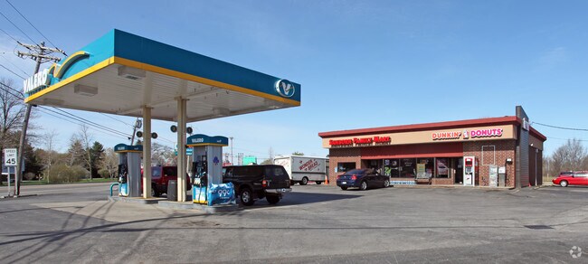
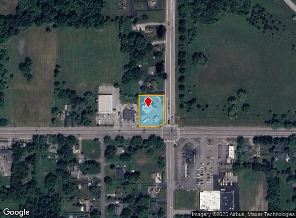
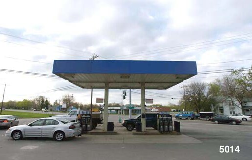
2939 Saunders Sett Rd
292489-118-020-0003-008-000
OUTSIDE 760029
Servicestationmarket
Niagara
X
New York
36063C0194E
8.000
2025
0.62 AC
2024
Outlying Niagara County
024401
Buffalo/Niagara Falls
2,425 SF
Buffalo-Cheektowaga-Niagara Falls, NY
DEMOGRAPHICS near 2939 Saunders Sett Rd
1 Mile
3 Mile
5 Mile
2024 Total Population
1,503
6,514
25,976
2029 Population
1,483
6,419
25,584
Pop Growth 2024-2029
(1.33%)
(1.46%)
(1.51%)
Average Age
42
43
44
2024 Total Households
594
2,539
10,671
HH Growth 2024-2029
(1.18%)
(1.50%)
(1.56%)
Median Household Inc
$74,394
$80,739
$75,335
Avg Household Size
2.40
2.40
2.30
2024 Avg HH Vehicles
2.00
2.00
2.00
Median Home Value
$180,555
$215,407
$220,070
Median Year Built
1962
1962
1974
Nearby Places
- Restaurants
- Banks
- Shops
- Fitness
- Groceries
PUBLIC TRANSPORTATION
AIRPORT
Niagara Falls International
DRIVE
WALK
Distance
Niagara Falls International
12 min
5.8 mi
Buffalo Niagara International
DRIVE
WALK
Distance
Buffalo Niagara International
35 min
20.2 mi
Nearby Properties
Address
Land Use
TOTAL SIZE
Lot Size
Zoning
Address
Land Use
TOTAL SIZE
Lot Size
Zoning
53,548 SF
267.77 AC
AR
Address
Land Use
TOTAL SIZE
Lot Size
Zoning
181,549 SF
81.90 AC
Address
Land Use
TOTAL SIZE
Lot Size
Zoning
114,632 SF
72.20 AC
Address
Land Use
TOTAL SIZE
Lot Size
Zoning
116,100 SF
11.90 AC
AR
Address
Land Use
TOTAL SIZE
Lot Size
Zoning
49,780 SF
5.60 AC
B2
Address
Land Use
TOTAL SIZE
Lot Size
Zoning
8.40 AC
Address
Land Use
TOTAL SIZE
Lot Size
Zoning
50,000 SF
13.10 AC
Address
Land Use
TOTAL SIZE
Lot Size
Zoning
8,544 SF
3.80 AC
Address
Land Use
TOTAL SIZE
Lot Size
Zoning
8,544 SF
4.20 AC
Address
Land Use
TOTAL SIZE
Lot Size
Zoning
20,400 SF
1.82 AC
B2
Address
Land Use
TOTAL SIZE
Lot Size
Zoning
47,835 SF
8.30 AC
Address
Land Use
TOTAL SIZE
Lot Size
Zoning
18,170 SF
6.40 AC
Address
Land Use
TOTAL SIZE
Lot Size
Zoning
65,000 SF
11 AC
Address
Land Use
TOTAL SIZE
Lot Size
Zoning
18,829 SF
7.10 AC
Address
Land Use
TOTAL SIZE
Lot Size
Zoning
6,120 SF
3.60 AC
PD
Address
Land Use
TOTAL SIZE
Lot Size
Zoning
50,000 SF
33.10 AC
Address
Land Use
TOTAL SIZE
Lot Size
Zoning
67,877 SF
20.30 AC
Address
Land Use
TOTAL SIZE
Lot Size
Zoning
33,320 SF
5.50 AC
Address
Land Use
TOTAL SIZE
Lot Size
Zoning
38,526 SF
4.60 AC
B1
Address
Land Use
TOTAL SIZE
Lot Size
Zoning
1.40 AC
Address
Land Use
TOTAL SIZE
Lot Size
Zoning
42,786 SF
4.20 AC
Address
Land Use
TOTAL SIZE
Lot Size
Zoning
130,862 SF
16.14 AC
Address
Land Use
TOTAL SIZE
Lot Size
Zoning
15,144 SF
5.50 AC
Address
Land Use
TOTAL SIZE
Lot Size
Zoning
7,865 SF
551 AC
09500
Address
Land Use
TOTAL SIZE
Lot Size
Zoning
34,816 SF
9.60 AC
Address
Land Use
TOTAL SIZE
Lot Size
Zoning
Address
Land Use
TOTAL SIZE
Lot Size
Zoning
5,512 SF
2.60 AC
PD
Address
Land Use
TOTAL SIZE
Lot Size
Zoning
8,111 SF
12.50 AC
Address
Land Use
TOTAL SIZE
Lot Size
Zoning
7,254 SF
3.80 AC
Address
Land Use
TOTAL SIZE
Lot Size
Zoning
64,587 SF
1.60 AC
The World's #1 Commercial Real Estate Marketplace
Connect with us
© 2025 CoStar Group
The information above has been obtained from sources believed reliable. While we do not doubt its accuracy we have not verified it and make no guarantee, warranty or representation about it. It is your responsibility to independently confirm its accuracy and completeness. Any projections, opinions, assumptions, or estimates used are for example only and do not represent the current or future performance of the property. The value of this transaction to you depends on tax and other factors which should be evaluated by your tax, financial, and legal advisors. You and your advisors should conduct a careful, independent investigation of the property to determine to your satisfaction the suitability of the property for your needs.