Property Record
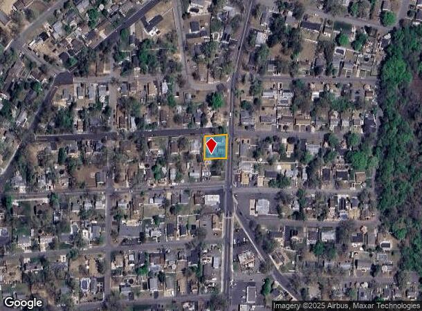
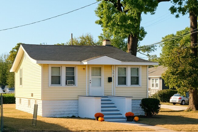
294 Devoe Ave, Spotswood, NJ 08884

NEARBY LISTINGS FOR SALE OR LEASE
-
-
-
-
No Photo
-
-
-
-
View all Spotswood listings for sale on LoopNet.com
Property Detail
294 Devoe Ave
New York-Jersey City-White Plains, NY-NJ
Appleby Estates Spotswood Middlesex Coun
24-00111-5-00012
100X100
Commercialnec
Middlesex
X
New Jersey
34023C0144F
12
2024
0.23 AC
2025
Brunswick
008101
Northern New Jersey
931 SF
DEMOGRAPHICS near 294 Devoe Ave
1 Mile
3 Mile
5 Mile
2024 Total Population
8,341
57,790
149,758
2029 Population
8,439
58,697
152,167
Pop Growth 2024-2029
+ 1.17%
+ 1.57%
+ 1.61%
Average Age
43
42
43
2024 Total Households
2,909
20,132
53,227
HH Growth 2024-2029
+ 1.10%
+ 1.43%
+ 1.59%
Median Household Inc
$135,308
$128,167
$121,159
Avg Household Size
2.80
2.80
2.80
2024 Avg HH Vehicles
2.00
2.00
2.00
Median Home Value
$487,066
$500,403
$556,480
Median Year Built
1970
1976
1977
Nearby Places
Map Layers
Map Styles
 Street
 Aerial
- Restaurants
- Banks
- Shops
- Fitness
- Groceries
PUBLIC TRANSPORTATION
AIRPORT
Trenton Mercer
DRIVE
WALK
Distance
Trenton Mercer
48 min
30.6 mi
Newark Liberty International
DRIVE
WALK
Distance
Newark Liberty International
46 min
32.8 mi
Freight Ports
New York Container Terminal
DRIVE
WALK
Distance
New York Container Terminal
39 min
27.9 mi
SALE & LEASE HISTORY
LISTING DATE
SALE/LEASE

Aug 07, 2025
For Sale
Nearby Properties
Address
Land Use
TOTAL SIZE
Lot Size
Zoning
Address
Land Use
TOTAL SIZE
Lot Size
Zoning
Address
Land Use
TOTAL SIZE
Lot Size
Zoning
14,552 SF
484.47 AC
R20
Address
Land Use
TOTAL SIZE
Lot Size
Zoning
160,986 SF
60.24 AC
Address
Land Use
TOTAL SIZE
Lot Size
Zoning
5.10 AC
Address
Land Use
TOTAL SIZE
Lot Size
Zoning
56 AC
LI-4
Address
Land Use
TOTAL SIZE
Lot Size
Zoning
245,980 SF
54.02 AC
OP1
Address
Land Use
TOTAL SIZE
Lot Size
Zoning
7,701 SF
38.78 AC
R30
Address
Land Use
TOTAL SIZE
Lot Size
Zoning
8,512 SF
65.36 AC
MH
Address
Land Use
TOTAL SIZE
Lot Size
Zoning
34.73 AC
LI-4
Address
Land Use
TOTAL SIZE
Lot Size
Zoning
7,801 SF
9.26 AC
CN
Address
Land Use
TOTAL SIZE
Lot Size
Zoning
12.01 AC
Address
Land Use
TOTAL SIZE
Lot Size
Zoning
2.53 AC
HR
Address
Land Use
TOTAL SIZE
Lot Size
Zoning
93,180 SF
0.65 AC
C-4
Address
Land Use
TOTAL SIZE
Lot Size
Zoning
7,702 SF
20.75 AC
AF
Address
Land Use
TOTAL SIZE
Lot Size
Zoning
29.98 AC
O1
Address
Land Use
TOTAL SIZE
Lot Size
Zoning
64,544 SF
7.62 AC
C-2
Address
Land Use
TOTAL SIZE
Lot Size
Zoning
7,803 SF
16.70 AC
R6
Address
Land Use
TOTAL SIZE
Lot Size
Zoning
219,430 SF
16.50 AC
HC2
Address
Land Use
TOTAL SIZE
Lot Size
Zoning
27.15 AC
I-3
Address
Land Use
TOTAL SIZE
Lot Size
Zoning
282,731 SF
24.96 AC
HC2
Address
Land Use
TOTAL SIZE
Lot Size
Zoning
88,177 SF
20.40 AC
R30
Address
Land Use
TOTAL SIZE
Lot Size
Zoning
19,110 SF
0.29 AC
C-3B
Address
Land Use
TOTAL SIZE
Lot Size
Zoning
Address
Land Use
TOTAL SIZE
Lot Size
Zoning
179,144 SF
24.40 AC
LI
Address
Land Use
TOTAL SIZE
Lot Size
Zoning
115,636 SF
5.31 AC
SC
Address
Land Use
TOTAL SIZE
Lot Size
Zoning
77,981 SF
14.96 AC
Address
Land Use
TOTAL SIZE
Lot Size
Zoning
62,591 SF
19.89 AC
FHC
Address
Land Use
TOTAL SIZE
Lot Size
Zoning
7,701 SF
8.89 AC
R6
Address
Land Use
TOTAL SIZE
Lot Size
Zoning
7,702 SF
9.90 AC
AF
Address
Land Use
TOTAL SIZE
Lot Size
Zoning
7,801 SF
197.28 AC
R7
The World's #1 Commercial Real Estate Marketplace
Connect with us
© 2025 CoStar Group
The information above has been obtained from sources believed reliable. While we do not doubt its accuracy we have not verified it and make no guarantee, warranty or representation about it. It is your responsibility to independently confirm its accuracy and completeness. Any projections, opinions, assumptions, or estimates used are for example only and do not represent the current or future performance of the property. The value of this transaction to you depends on tax and other factors which should be evaluated by your tax, financial, and legal advisors. You and your advisors should conduct a careful, independent investigation of the property to determine to your satisfaction the suitability of the property for your needs.