Property Record
294 E Belvidere Rd, Hainesville, IL 60030


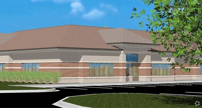
Property Detail
294 E Belvidere Rd
Chicago-Naperville-Elgin, IL-IN
PT SW SW;BEG MST WLY COR LOT 55 DEERPOINT TRAILS SUB PHASE 1 ,S 143.91,E189.47,N 66.56,W 110.13,NW TO POB(EX E20)SEC TION 27 TOWNSHIP 45 RANGE 10
06-27-300-044
Lake
Commercialacreage
Illinois
B and X Area of moderate flood hazard, usually the area between the limits of the 100-year and 500-year floods.
55
2024
0.36 AC
2025
Central Northwest
861108
Chicago
NEARBY LISTINGS FOR SALE OR LEASE
DEMOGRAPHICS near 294 E Belvidere Rd
1 mile
3 mile
5 mile
2025 Total Population
9,067
60,316
135,946
2030 Population
9,128
60,589
136,675
Pop Growth 2025-2030
+ 0.67%
+ 0.45%
+ 0.54%
Average Age
38
39
39
2025 Total Households
3,224
20,769
47,337
HH Growth 2025-2030
+ 0.53%
+ 0.45%
+ 0.55%
Median Household Inc
$112,068
$93,352
$105,780
Avg Household Size
2.80
2.80
2.80
2025 Avg HH Vehicles
2.00
2.00
2.00
Median Home Value
$278,653
$246,732
$276,634
Median Year Built
1991
1991
1992
Nearby Places
Map Layers
Map Styles
 Street
 Aerial
Layers
 Traffic
 Biking
Places
Listings with unknown addresses are not visible on the map
- Restaurants
- Banks
- Shops
- Fitness
- Groceries
PUBLIC TRANSPORTATION
COMMUTER RAIL
Grayslake Station (Md-N) (Milwaukee District North Line - Northeast Illinois Regional Commuter Railroad (Metra))
Drive
Walk
Distance
Grayslake Station (Md-N) (Milwaukee District North Line - Northeast Illinois Regional Commuter Railroad (Metra))
3 min
1.4 mi
Washington St (Grayslake) Station (Ncs) (North Central Service - Northeast Illinois Regional Commuter Railroad (Metra))
Drive
Walk
Distance
Washington St (Grayslake) Station (Ncs) (North Central Service - Northeast Illinois Regional Commuter Railroad (Metra))
5 min
2.4 mi
AIRPORT
Chicago O'Hare International
Drive
Walk
Distance
Chicago O'Hare International
47 min
35.8 mi
Freight Ports
Port Milwaukee
Drive
Walk
Distance
Port Milwaukee
67 min
54.7 mi
Nearby Properties
Address
Land Use
TOTAL SIZE
Lot Size
Zoning
Address
Land Use
TOTAL SIZE
Lot Size
Zoning
1,401,971 SF
85.78 AC
Address
Land Use
TOTAL SIZE
Lot Size
Zoning
4,022,130 SF
22.22 AC
Address
Land Use
TOTAL SIZE
Lot Size
Zoning
298,181 SF
20.41 AC
Address
Land Use
TOTAL SIZE
Lot Size
Zoning
194,075 SF
14.84 AC
Address
Land Use
TOTAL SIZE
Lot Size
Zoning
1,656,984 SF
11.84 AC
Address
Land Use
TOTAL SIZE
Lot Size
Zoning
1,407,234 SF
12.09 AC
Address
Land Use
TOTAL SIZE
Lot Size
Zoning
49.21 AC
Address
Land Use
TOTAL SIZE
Lot Size
Zoning
282,999 SF
23.06 AC
Address
Land Use
TOTAL SIZE
Lot Size
Zoning
100,123 SF
12.63 AC
Address
Land Use
TOTAL SIZE
Lot Size
Zoning
89,754 SF
8.64 AC
Address
Land Use
TOTAL SIZE
Lot Size
Zoning
132,256 SF
18.59 AC
Address
Land Use
TOTAL SIZE
Lot Size
Zoning
41,308 SF
4.48 AC
Address
Land Use
TOTAL SIZE
Lot Size
Zoning
79,136 SF
30.10 AC
Address
Land Use
TOTAL SIZE
Lot Size
Zoning
71,064 SF
29.20 AC
Address
Land Use
TOTAL SIZE
Lot Size
Zoning
421,146 SF
4.79 AC
Address
Land Use
TOTAL SIZE
Lot Size
Zoning
115,805 SF
4.38 AC
Address
Land Use
TOTAL SIZE
Lot Size
Zoning
70,256 SF
33.85 AC
Address
Land Use
TOTAL SIZE
Lot Size
Zoning
58,922 SF
71.36 AC
Address
Land Use
TOTAL SIZE
Lot Size
Zoning
86,920 SF
6.89 AC
Address
Land Use
TOTAL SIZE
Lot Size
Zoning
Address
Land Use
TOTAL SIZE
Lot Size
Zoning
17,484 SF
3.52 AC
Address
Land Use
TOTAL SIZE
Lot Size
Zoning
77,864 SF
5.28 AC
Address
Land Use
TOTAL SIZE
Lot Size
Zoning
31.65 AC
Address
Land Use
TOTAL SIZE
Lot Size
Zoning
104,143 SF
11.96 AC
Address
Land Use
TOTAL SIZE
Lot Size
Zoning
41,925 SF
5.15 AC
Address
Land Use
TOTAL SIZE
Lot Size
Zoning
62,821 SF
6.79 AC
Address
Land Use
TOTAL SIZE
Lot Size
Zoning
50,137 SF
15.97 AC
Address
Land Use
TOTAL SIZE
Lot Size
Zoning
45,772 SF
89.95 AC
Address
Land Use
TOTAL SIZE
Lot Size
Zoning
50,208 SF
18.37 AC
Address
Land Use
TOTAL SIZE
Lot Size
Zoning
39,253 SF
2.26 AC
The World's #1 Commercial Real Estate Marketplace
Connect with us
© 2026 CoStar Group
The information above has been obtained from sources believed reliable. While we do not doubt its accuracy we have not verified it and make no guarantee, warranty or representation about it. It is your responsibility to independently confirm its accuracy and completeness. Any projections, opinions, assumptions, or estimates used are for example only and do not represent the current or future performance of the property. The value of this transaction to you depends on tax and other factors which should be evaluated by your tax, financial, and legal advisors. You and your advisors should conduct a careful, independent investigation of the property to determine to your satisfaction the suitability of the property for your needs.