Property Record
294 Exeter Rd, Hampton Falls, NH 03844

Property Detail
294 Exeter Rd
Commercialnec
Rockingham
AGRI/R
New Hampshire
A Areas with a 1% annual chance of flooding and a 26% chance of flooding over the life of a 30-year mortgage.
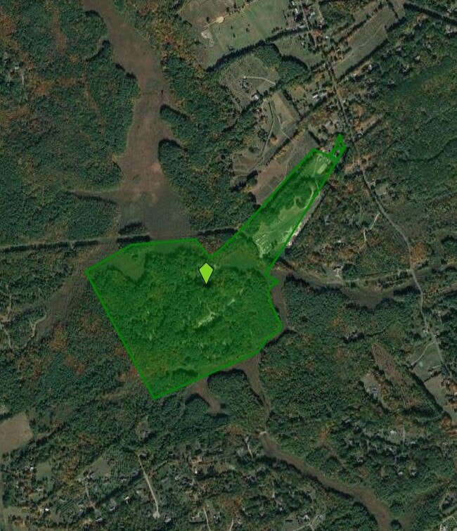
125 AC
2025
Rockingham
2025
Boston
064000
Boston-Cambridge-Newton, MA-NH
1,719 SF
HMPF-000006-000000-000039
NEARBY LISTINGS FOR SALE OR LEASE
-
-
View all Hampton Falls listings for sale on LoopNet.com
DEMOGRAPHICS near 294 Exeter Rd
1 mile
3 mile
5 mile
2025 Total Population
486
12,879
42,190
2030 Population
483
13,011
42,895
Pop Growth 2025-2030
(0.62%)
+ 1.02%
+ 1.67%
Average Age
45
47
46
2025 Total Households
184
5,434
17,621
HH Growth 2025-2030
(1.09%)
+ 0.99%
+ 1.60%
Median Household Inc
$159,146
$112,897
$101,239
Avg Household Size
2.60
2.30
2.30
2025 Avg HH Vehicles
3.00
2.00
2.00
Median Home Value
$750,000
$603,710
$597,574
Median Year Built
1977
1979
1982
Nearby Places
Map Layers
Map Styles
 Street
 Aerial
Transit
 Traffic
 Biking
Places
Listings with unknown addresses are not visible on the map
- Restaurants
- Banks
- Shops
- Fitness
- Groceries
Nearby Properties
Address
Land Use
TOTAL SIZE
Lot Size
Zoning
Address
Land Use
TOTAL SIZE
Lot Size
Zoning
172,987 SF
89.06 AC
IND
Address
Land Use
TOTAL SIZE
Lot Size
Zoning
19,956 SF
14.55 AC
H
Address
Land Use
TOTAL SIZE
Lot Size
Zoning
177,803 SF
49.86 AC
IND
Address
Land Use
TOTAL SIZE
Lot Size
Zoning
7.36 AC
R-2
Address
Land Use
TOTAL SIZE
Lot Size
Zoning
12,487 SF
7.01 AC
R-5
Address
Land Use
TOTAL SIZE
Lot Size
Zoning
87,993 SF
8.59 AC
I
Address
Land Use
TOTAL SIZE
Lot Size
Zoning
263,990 SF
17.53 AC
I
Address
Land Use
TOTAL SIZE
Lot Size
Zoning
22,614 SF
11.07 AC
R-2
Address
Land Use
TOTAL SIZE
Lot Size
Zoning
1.20 AC
H
Address
Land Use
TOTAL SIZE
Lot Size
Zoning
29,073 SF
1.14 AC
R-2
Address
Land Use
TOTAL SIZE
Lot Size
Zoning
48,348 SF
8.60 AC
R-5
Address
Land Use
TOTAL SIZE
Lot Size
Zoning
361,216 SF
28.12 AC
IND
Address
Land Use
TOTAL SIZE
Lot Size
Zoning
0.88 AC
R-2
Address
Land Use
TOTAL SIZE
Lot Size
Zoning
79,305 SF
17.18 AC
G
Address
Land Use
TOTAL SIZE
Lot Size
Zoning
17,987 SF
26.90 AC
RES
Address
Land Use
TOTAL SIZE
Lot Size
Zoning
20,593 SF
19.83 AC
R-2
Address
Land Use
TOTAL SIZE
Lot Size
Zoning
64,221 SF
11.70 AC
H
Address
Land Use
TOTAL SIZE
Lot Size
Zoning
22,614 SF
0.29 AC
R-2
Address
Land Use
TOTAL SIZE
Lot Size
Zoning
62,835 SF
7.96 AC
IND
Address
Land Use
TOTAL SIZE
Lot Size
Zoning
245,000 SF
6.35 AC
H
Address
Land Use
TOTAL SIZE
Lot Size
Zoning
160,616 SF
9.03 AC
C-2
Address
Land Use
TOTAL SIZE
Lot Size
Zoning
50,370 SF
10.97 AC
NP
Address
Land Use
TOTAL SIZE
Lot Size
Zoning
73,282 SF
15.79 AC
GCBD
Address
Land Use
TOTAL SIZE
Lot Size
Zoning
46,512 SF
1 AC
H
Address
Land Use
TOTAL SIZE
Lot Size
Zoning
69,700 SF
2.46 AC
C-2
Address
Land Use
TOTAL SIZE
Lot Size
Zoning
65,131 SF
8.96 AC
C-2
Address
Land Use
TOTAL SIZE
Lot Size
Zoning
0.64 AC
R-2
Address
Land Use
TOTAL SIZE
Lot Size
Zoning
26,991 SF
5.32 AC
NP
Address
Land Use
TOTAL SIZE
Lot Size
Zoning
40,968 SF
12.20 AC
IG
Address
Land Use
TOTAL SIZE
Lot Size
Zoning
67,186 SF
16.57 AC
NP
The World's #1 Commercial Real Estate Marketplace
Connect with us
© 2026 CoStar Group
The information above has been obtained from sources believed reliable. While we do not doubt its accuracy we have not verified it and make no guarantee, warranty or representation about it. It is your responsibility to independently confirm its accuracy and completeness. Any projections, opinions, assumptions, or estimates used are for example only and do not represent the current or future performance of the property. The value of this transaction to you depends on tax and other factors which should be evaluated by your tax, financial, and legal advisors. You and your advisors should conduct a careful, independent investigation of the property to determine to your satisfaction the suitability of the property for your needs.