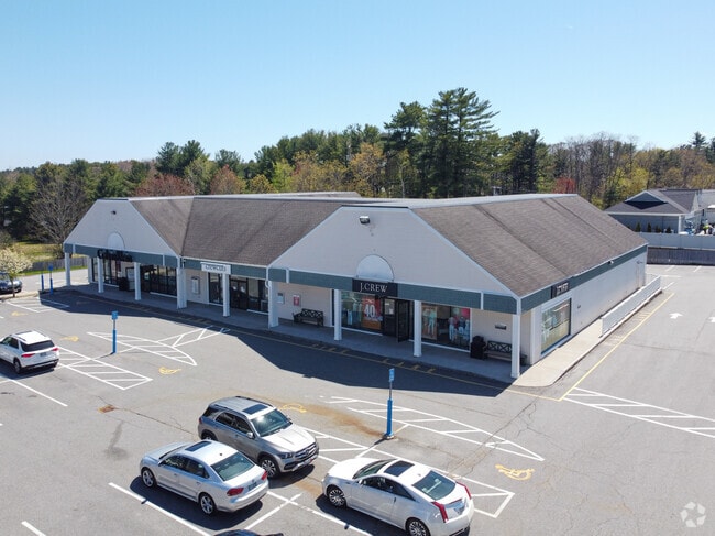
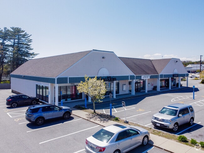
Property Record
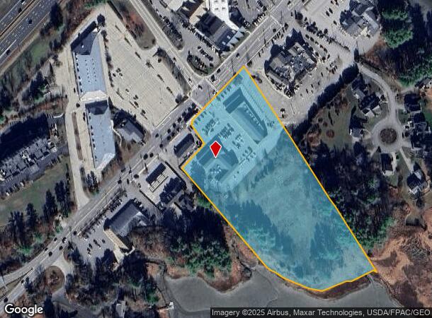
294 Us Route 1, Kittery, ME 03904
NEARBY LISTINGS FOR SALE OR LEASE
-
-
-
-
-
No Photo
-
-
-
View all Kittery listings for sale on LoopNet.com
Property Detail
294 Us Route 1
KITT-000038-000000-000014
York
Commercialnec
Maine
AE
14
23031C0726G
7 AC
2024
York County
2024
Portland/South Portland
038001
Portland-South Portland, ME
13,020 SF
DEMOGRAPHICS near 294 Us Route 1
1 Mile
3 Mile
5 Mile
2024 Total Population
1,581
21,284
40,929
2029 Population
1,667
22,379
42,922
Pop Growth 2024-2029
+ 5.44%
+ 5.14%
+ 4.87%
Average Age
49
45
45
2024 Total Households
767
9,926
18,417
HH Growth 2024-2029
+ 5.48%
+ 5.08%
+ 4.82%
Median Household Inc
$65,373
$90,126
$97,195
Avg Household Size
2.00
2.10
2.10
2024 Avg HH Vehicles
1.00
2.00
2.00
Median Home Value
$420,270
$468,793
$498,479
Median Year Built
1988
1967
1966
Nearby Places
Map Layers
Map Styles
 Street
 Aerial
- Restaurants
- Banks
- Shops
- Fitness
- Groceries
PUBLIC TRANSPORTATION
AIRPORT
Portsmouth International at Pease
DRIVE
WALK
Distance
Portsmouth International at Pease
13 min
5.8 mi
Freight Ports
Portland, ME
DRIVE
WALK
Distance
Portland, ME
57 min
48.3 mi
Nearby Properties
Address
Land Use
TOTAL SIZE
Lot Size
Zoning
Address
Land Use
TOTAL SIZE
Lot Size
Zoning
152,028 SF
CD5
Address
Land Use
TOTAL SIZE
Lot Size
Zoning
144,226 SF
5.72 AC
M
Address
Land Use
TOTAL SIZE
Lot Size
Zoning
Address
Land Use
TOTAL SIZE
Lot Size
Zoning
22.33 AC
MU-N
Address
Land Use
TOTAL SIZE
Lot Size
Zoning
102,617 SF
1.27 AC
CD5
Address
Land Use
TOTAL SIZE
Lot Size
Zoning
57,711 SF
1.44 AC
CD4
Address
Land Use
TOTAL SIZE
Lot Size
Zoning
136,711 SF
1.85 AC
CD5
Address
Land Use
TOTAL SIZE
Lot Size
Zoning
86,293 SF
0.64 AC
CD5
Address
Land Use
TOTAL SIZE
Lot Size
Zoning
18.49 AC
GRB
Address
Land Use
TOTAL SIZE
Lot Size
Zoning
77,523 SF
CD5
Address
Land Use
TOTAL SIZE
Lot Size
Zoning
69,457 SF
0.98 AC
CD5
Address
Land Use
TOTAL SIZE
Lot Size
Zoning
3.97 AC
SD
Address
Land Use
TOTAL SIZE
Lot Size
Zoning
58,070 SF
0.53 AC
CD4
Address
Land Use
TOTAL SIZE
Lot Size
Zoning
84,273 SF
13.61 AC
C-1
Address
Land Use
TOTAL SIZE
Lot Size
Zoning
39,780 SF
8.82 AC
OR
Address
Land Use
TOTAL SIZE
Lot Size
Zoning
81,964 SF
6.99 AC
OR
Address
Land Use
TOTAL SIZE
Lot Size
Zoning
8.04 AC
M
Address
Land Use
TOTAL SIZE
Lot Size
Zoning
40,736 SF
14.82 AC
C-1
Address
Land Use
TOTAL SIZE
Lot Size
Zoning
278,670 SF
1.86 AC
M
Address
Land Use
TOTAL SIZE
Lot Size
Zoning
57,456 SF
0.31 AC
CD5
Address
Land Use
TOTAL SIZE
Lot Size
Zoning
92,943 SF
8.55 AC
C-1
Address
Land Use
TOTAL SIZE
Lot Size
Zoning
201,109 SF
35.12 AC
WI
Address
Land Use
TOTAL SIZE
Lot Size
Zoning
47,866 SF
CD5
Address
Land Use
TOTAL SIZE
Lot Size
Zoning
10.78 AC
GRB
Address
Land Use
TOTAL SIZE
Lot Size
Zoning
203,601 SF
2.64 AC
M
Address
Land Use
TOTAL SIZE
Lot Size
Zoning
48,626 SF
0.24 AC
CD5
Address
Land Use
TOTAL SIZE
Lot Size
Zoning
51,507 SF
1.96 AC
GRB
Address
Land Use
TOTAL SIZE
Lot Size
Zoning
61,554 SF
2.16 AC
CD4
Address
Land Use
TOTAL SIZE
Lot Size
Zoning
58,304 SF
0.55 AC
CD5
Address
Land Use
TOTAL SIZE
Lot Size
Zoning
6.82 AC
GRB
The World's #1 Commercial Real Estate Marketplace
Connect with us
© 2026 CoStar Group
The information above has been obtained from sources believed reliable. While we do not doubt its accuracy we have not verified it and make no guarantee, warranty or representation about it. It is your responsibility to independently confirm its accuracy and completeness. Any projections, opinions, assumptions, or estimates used are for example only and do not represent the current or future performance of the property. The value of this transaction to you depends on tax and other factors which should be evaluated by your tax, financial, and legal advisors. You and your advisors should conduct a careful, independent investigation of the property to determine to your satisfaction the suitability of the property for your needs.