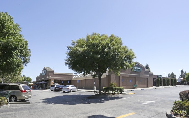
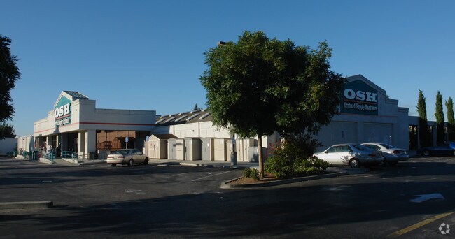
Property Record
2940 Alum Rock Ave, San Jose, CA 95127

NEARBY LISTINGS FOR SALE OR LEASE
Property Detail
2940 Alum Rock Ave
484-21-046
Lyndale
Storebuilding
Santa Clara
X
California
06085C0252J
3.40 AC
2024
East San Jose-Willow Glen
2025
South Bay/San Jose
504101
San Jose-Sunnyvale-Santa Clara, CA
50,897 SF
DEMOGRAPHICS near 2940 Alum Rock Ave
1 Mile
3 Mile
5 Mile
2024 Total Population
36,795
212,182
456,709
2029 Population
34,768
202,130
437,638
Pop Growth 2024-2029
(5.51%)
(4.74%)
(4.18%)
Average Age
39
39
39
2024 Total Households
9,629
55,914
133,085
HH Growth 2024-2029
(5.84%)
(5.02%)
(4.24%)
Median Household Inc
$84,923
$106,577
$114,912
Avg Household Size
3.60
3.50
3.20
2024 Avg HH Vehicles
2.00
2.00
2.00
Median Home Value
$726,567
$896,587
$949,101
Median Year Built
1967
1972
1976
Nearby Places
Map Layers
Map Styles
 Street
 Aerial
- Restaurants
- Banks
- Shops
- Fitness
- Groceries
PUBLIC TRANSPORTATION
COMMUTER RAIL
DRIVE
WALK
Distance
11 min
6.3 mi
San Jose Diridon (Caltrain - Caltrain (Caltrain))
DRIVE
WALK
Distance
San Jose Diridon (Caltrain - Caltrain (Caltrain))
11 min
6.3 mi
AIRPORT
Norman Y Mineta San Jose International
DRIVE
WALK
Distance
Norman Y Mineta San Jose International
13 min
7.5 mi
Metro Oakland International
DRIVE
WALK
Distance
Metro Oakland International
49 min
37.0 mi
San Francisco International
DRIVE
WALK
Distance
San Francisco International
50 min
38.7 mi
Nearby Properties
Address
Land Use
TOTAL SIZE
Lot Size
Zoning
Address
Land Use
TOTAL SIZE
Lot Size
Zoning
33.32 AC
R140
Address
Land Use
TOTAL SIZE
Lot Size
Zoning
3.74 AC
APD
Address
Land Use
TOTAL SIZE
Lot Size
Zoning
230,946 SF
2.86 AC
I
Address
Land Use
TOTAL SIZE
Lot Size
Zoning
2.78 AC
APD
Address
Land Use
TOTAL SIZE
Lot Size
Zoning
153,024 SF
8.11 AC
R3BPD
Address
Land Use
TOTAL SIZE
Lot Size
Zoning
116,044 SF
7 AC
C3PD
Address
Land Use
TOTAL SIZE
Lot Size
Zoning
3.98 AC
SJ
Address
Land Use
TOTAL SIZE
Lot Size
Zoning
335,832 SF
20.42 AC
R3AH
Address
Land Use
TOTAL SIZE
Lot Size
Zoning
269,680 SF
13.75 AC
R3AH
Address
Land Use
TOTAL SIZE
Lot Size
Zoning
121,260 SF
8.59 AC
A120
Address
Land Use
TOTAL SIZE
Lot Size
Zoning
549,100 SF
51.91 AC
CG
Address
Land Use
TOTAL SIZE
Lot Size
Zoning
9.49 AC
M1H
Address
Land Use
TOTAL SIZE
Lot Size
Zoning
149,343 SF
12 AC
SJ
Address
Land Use
TOTAL SIZE
Lot Size
Zoning
124,000 SF
13.12 AC
C1
Address
Land Use
TOTAL SIZE
Lot Size
Zoning
10.67 AC
A(PD)
Address
Land Use
TOTAL SIZE
Lot Size
Zoning
142,100 SF
10.69 AC
IP
Address
Land Use
TOTAL SIZE
Lot Size
Zoning
159,300 SF
8.91 AC
RM
Address
Land Use
TOTAL SIZE
Lot Size
Zoning
159,300 SF
8.55 AC
RM
Address
Land Use
TOTAL SIZE
Lot Size
Zoning
104,556 SF
4.90 AC
C3PD
Address
Land Use
TOTAL SIZE
Lot Size
Zoning
276,762 SF
11.29 AC
RM-PD
Address
Land Use
TOTAL SIZE
Lot Size
Zoning
105,490 SF
9.48 AC
C3
Address
Land Use
TOTAL SIZE
Lot Size
Zoning
3.70 AC
APD
Address
Land Use
TOTAL SIZE
Lot Size
Zoning
71,946 SF
9.18 AC
CG
Address
Land Use
TOTAL SIZE
Lot Size
Zoning
4.97 AC
APD
Address
Land Use
TOTAL SIZE
Lot Size
Zoning
7,000 SF
14.10 AC
CG
Address
Land Use
TOTAL SIZE
Lot Size
Zoning
141,942 SF
1.93 AC
LI
Address
Land Use
TOTAL SIZE
Lot Size
Zoning
118,876 SF
6.52 AC
R3
Address
Land Use
TOTAL SIZE
Lot Size
Zoning
80,865 SF
3.13 AC
APD
Address
Land Use
TOTAL SIZE
Lot Size
Zoning
Address
Land Use
TOTAL SIZE
Lot Size
Zoning
0.94 AC
R1
The World's #1 Commercial Real Estate Marketplace
Connect with us
© 2026 CoStar Group
The information above has been obtained from sources believed reliable. While we do not doubt its accuracy we have not verified it and make no guarantee, warranty or representation about it. It is your responsibility to independently confirm its accuracy and completeness. Any projections, opinions, assumptions, or estimates used are for example only and do not represent the current or future performance of the property. The value of this transaction to you depends on tax and other factors which should be evaluated by your tax, financial, and legal advisors. You and your advisors should conduct a careful, independent investigation of the property to determine to your satisfaction the suitability of the property for your needs.