Property Record
2941 Highway 1 S, Elgin, SC 29045
NEARBY LISTINGS FOR SALE OR LEASE
-
-
-
-
No Photo
-
View all Elgin listings for sale on LoopNet.com
Property Detail
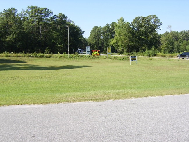
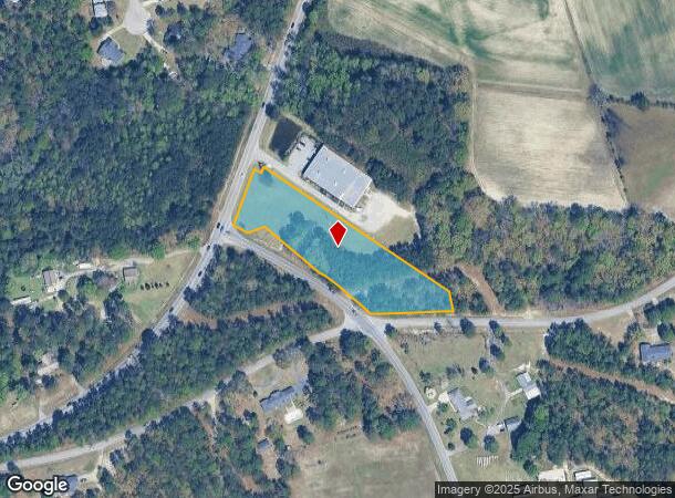
2941 Highway 1 S
Columbia, SC
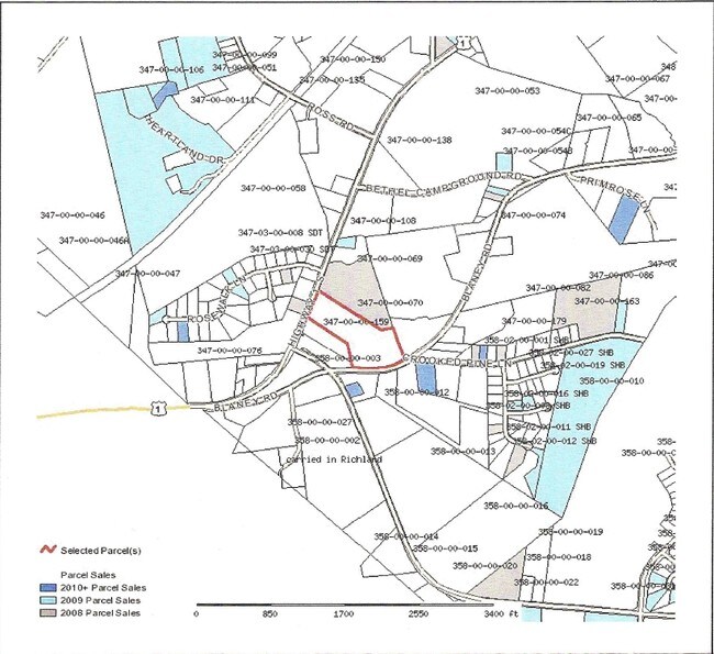
Plat Of Survey Prepared For Ken Newman P
347-00-00-159
2669-170 1659-47
Residentialacreage
Kershaw
X
South Carolina
45079C0164L
2.52 AC
2025
Kershaw County
2025
Columbia
970908
DEMOGRAPHICS near 2941 Highway 1 S
1 Mile
3 Mile
5 Mile
2024 Total Population
1,512
21,519
60,893
2029 Population
1,637
22,637
62,876
Pop Growth 2024-2029
+ 8.27%
+ 5.20%
+ 3.26%
Average Age
39
38
38
2024 Total Households
545
8,074
22,901
HH Growth 2024-2029
+ 8.44%
+ 5.21%
+ 3.29%
Median Household Inc
$72,299
$72,098
$72,412
Avg Household Size
2.70
2.60
2.60
2024 Avg HH Vehicles
2.00
2.00
2.00
Median Home Value
$187,930
$217,735
$206,300
Median Year Built
1998
2004
2002
Nearby Places
Map Layers
Map Styles
 Street
 Aerial
- Restaurants
- Banks
- Shops
- Fitness
- Groceries
PUBLIC TRANSPORTATION
AIRPORT
Columbia Metro
DRIVE
WALK
Distance
Columbia Metro
50 min
28.9 mi
Freight Ports
North Charleston Terminal
DRIVE
WALK
Distance
North Charleston Terminal
145 min
124.6 mi
SALE & LEASE HISTORY
LISTING DATE
SALE/LEASE

Sep 24, 2016
For Sale
Nearby Properties
Address
Land Use
TOTAL SIZE
Lot Size
Zoning
Address
Land Use
TOTAL SIZE
Lot Size
Zoning
329,677 SF
17.12 AC
PDD
Address
Land Use
TOTAL SIZE
Lot Size
Zoning
313,664 SF
33.91 AC
RG-2
Address
Land Use
TOTAL SIZE
Lot Size
Zoning
210,926 SF
22 AC
HI
Address
Land Use
TOTAL SIZE
Lot Size
Zoning
275,286 SF
15.53 AC
PD
Address
Land Use
TOTAL SIZE
Lot Size
Zoning
84,860 SF
5.13 AC
PUD-R
Address
Land Use
TOTAL SIZE
Lot Size
Zoning
2,420 SF
4.03 AC
M-1
Address
Land Use
TOTAL SIZE
Lot Size
Zoning
148,156 SF
29.79 AC
PUD-C
Address
Land Use
TOTAL SIZE
Lot Size
Zoning
186,393 SF
13.12 AC
HI
Address
Land Use
TOTAL SIZE
Lot Size
Zoning
11,550 SF
6.76 AC
HI
Address
Land Use
TOTAL SIZE
Lot Size
Zoning
11,036 SF
9 AC
PUD-C
Address
Land Use
TOTAL SIZE
Lot Size
Zoning
40,603 SF
4.64 AC
MUNICIPAL
Address
Land Use
TOTAL SIZE
Lot Size
Zoning
2,474 SF
104.46 AC
RU
Address
Land Use
TOTAL SIZE
Lot Size
Zoning
41,886 SF
4.56 AC
MUNICIPAL
Address
Land Use
TOTAL SIZE
Lot Size
Zoning
6,892 SF
0.82 AC
GC
Address
Land Use
TOTAL SIZE
Lot Size
Zoning
9,397 SF
5.50 AC
OI
Address
Land Use
TOTAL SIZE
Lot Size
Zoning
10,560 SF
3.61 AC
GC
Address
Land Use
TOTAL SIZE
Lot Size
Zoning
2,583 SF
1.24 AC
MUNICIPAL
Address
Land Use
TOTAL SIZE
Lot Size
Zoning
25,060 SF
7.59 AC
GC
Address
Land Use
TOTAL SIZE
Lot Size
Zoning
14,550 SF
2.02 AC
MUNICIPAL
Address
Land Use
TOTAL SIZE
Lot Size
Zoning
63.97 AC
R15
Address
Land Use
TOTAL SIZE
Lot Size
Zoning
7,366 SF
0.52 AC
MUNICIPAL
Address
Land Use
TOTAL SIZE
Lot Size
Zoning
6,854 SF
5 AC
RU
Address
Land Use
TOTAL SIZE
Lot Size
Zoning
3,542 SF
13.62 AC
PD
Address
Land Use
TOTAL SIZE
Lot Size
Zoning
2,651 SF
0.95 AC
MUNICIPAL
Address
Land Use
TOTAL SIZE
Lot Size
Zoning
9,020 SF
0.83 AC
MUNICIPAL
Address
Land Use
TOTAL SIZE
Lot Size
Zoning
2,118 SF
1.16 AC
C-3
Address
Land Use
TOTAL SIZE
Lot Size
Zoning
6,650 SF
1.19 AC
MUNICIPAL
Address
Land Use
TOTAL SIZE
Lot Size
Zoning
3,512 SF
0.83 AC
MUNICIPAL
Address
Land Use
TOTAL SIZE
Lot Size
Zoning
15,770 SF
1.04 AC
GC
Address
Land Use
TOTAL SIZE
Lot Size
Zoning
6,806 SF
1.14 AC
GC
The World's #1 Commercial Real Estate Marketplace
Connect with us
© 2025 CoStar Group
The information above has been obtained from sources believed reliable. While we do not doubt its accuracy we have not verified it and make no guarantee, warranty or representation about it. It is your responsibility to independently confirm its accuracy and completeness. Any projections, opinions, assumptions, or estimates used are for example only and do not represent the current or future performance of the property. The value of this transaction to you depends on tax and other factors which should be evaluated by your tax, financial, and legal advisors. You and your advisors should conduct a careful, independent investigation of the property to determine to your satisfaction the suitability of the property for your needs.