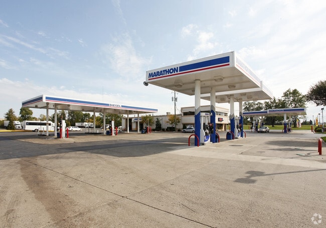
Property Record
29420 S Wixom Rd, Wixom, MI 48393

NEARBY LISTINGS FOR SALE OR LEASE
Property Detail
29420 S Wixom Rd
22-08-100-047
T1N, R8E, SEC 8 PART OF W 1/2 OF NW 1/4 BEG AT PT DIST S 01-28-00 W 490 FT & S 88-41-23 E 70 FT FROM NW SEC COR, TH S 88-41-23 E 237.86 FT, TH S 01-55-56 W 160.01 FT, TH N 88-41-23 W 236.56 FT, TH N 01-28-00 E 160 FT TO BEG 0.87 A 9-13-96 FR 004
Commercialnec
Oakland
X
Michigan
26125C0468F
3.15 AC
2024
Central I-96 Corridor
2024
Detroit
133102
Detroit-Warren-Dearborn, MI
DEMOGRAPHICS near 29420 S Wixom Rd
1 Mile
3 Mile
5 Mile
2024 Total Population
465
38,799
107,734
2029 Population
434
38,090
106,721
Pop Growth 2024-2029
(6.67%)
(1.83%)
(0.94%)
Average Age
40
38
40
2024 Total Households
243
16,770
44,156
HH Growth 2024-2029
(7.41%)
(2.29%)
(1.13%)
Median Household Inc
$64,375
$82,023
$94,772
Avg Household Size
1.90
2.30
2.40
2024 Avg HH Vehicles
1.00
2.00
2.00
Median Home Value
$328,333
$374,999
$363,512
Median Year Built
1982
1992
1992
Nearby Places
Map Layers
Map Styles
 Street
 Aerial
- Restaurants
- Banks
- Shops
- Fitness
- Groceries
PUBLIC TRANSPORTATION
AIRPORT
Detroit Metro Wayne County
DRIVE
WALK
Distance
Detroit Metro Wayne County
36 min
30.6 mi
Freight Ports
Port of Toledo
DRIVE
WALK
Distance
Port of Toledo
86 min
72.3 mi
Nearby Properties
Address
Land Use
TOTAL SIZE
Lot Size
Zoning
Address
Land Use
TOTAL SIZE
Lot Size
Zoning
873,288 SF
Address
Land Use
TOTAL SIZE
Lot Size
Zoning
72.63 AC
RM-1
Address
Land Use
TOTAL SIZE
Lot Size
Zoning
86.19 AC
RC2
Address
Land Use
TOTAL SIZE
Lot Size
Zoning
563,160 SF
47.06 AC
Address
Land Use
TOTAL SIZE
Lot Size
Zoning
152,130 SF
64.46 AC
R-C
Address
Land Use
TOTAL SIZE
Lot Size
Zoning
12,872 SF
43.06 AC
RM-1
Address
Land Use
TOTAL SIZE
Lot Size
Zoning
20.71 AC
OSC
Address
Land Use
TOTAL SIZE
Lot Size
Zoning
59.71 AC
RM-1
Address
Land Use
TOTAL SIZE
Lot Size
Zoning
144.50 AC
OSC
Address
Land Use
TOTAL SIZE
Lot Size
Zoning
63.31 AC
OST-EXO
Address
Land Use
TOTAL SIZE
Lot Size
Zoning
184,225 SF
13.84 AC
OSC
Address
Land Use
TOTAL SIZE
Lot Size
Zoning
38.85 AC
RC2
Address
Land Use
TOTAL SIZE
Lot Size
Zoning
OST-EXO
Address
Land Use
TOTAL SIZE
Lot Size
Zoning
Address
Land Use
TOTAL SIZE
Lot Size
Zoning
140,366 SF
30.67 AC
II
Address
Land Use
TOTAL SIZE
Lot Size
Zoning
172,700 SF
Address
Land Use
TOTAL SIZE
Lot Size
Zoning
126,720 SF
8.31 AC
Address
Land Use
TOTAL SIZE
Lot Size
Zoning
7,471 SF
114.63 AC
MM
Address
Land Use
TOTAL SIZE
Lot Size
Zoning
243,502 SF
Address
Land Use
TOTAL SIZE
Lot Size
Zoning
325,725 SF
30.46 AC
Address
Land Use
TOTAL SIZE
Lot Size
Zoning
25.58 AC
RC1
Address
Land Use
TOTAL SIZE
Lot Size
Zoning
279,807 SF
31.24 AC
II
Address
Land Use
TOTAL SIZE
Lot Size
Zoning
26.54 AC
RM-1
Address
Land Use
TOTAL SIZE
Lot Size
Zoning
154,490 SF
Address
Land Use
TOTAL SIZE
Lot Size
Zoning
200,926 SF
30.87 AC
M1
Address
Land Use
TOTAL SIZE
Lot Size
Zoning
286,708 SF
Address
Land Use
TOTAL SIZE
Lot Size
Zoning
208,276 SF
28.02 AC
Address
Land Use
TOTAL SIZE
Lot Size
Zoning
101,752 SF
7.20 AC
Address
Land Use
TOTAL SIZE
Lot Size
Zoning
14.93 AC
RC2
Address
Land Use
TOTAL SIZE
Lot Size
Zoning
325,725 SF
The World's #1 Commercial Real Estate Marketplace
Connect with us
© 2025 CoStar Group
The information above has been obtained from sources believed reliable. While we do not doubt its accuracy we have not verified it and make no guarantee, warranty or representation about it. It is your responsibility to independently confirm its accuracy and completeness. Any projections, opinions, assumptions, or estimates used are for example only and do not represent the current or future performance of the property. The value of this transaction to you depends on tax and other factors which should be evaluated by your tax, financial, and legal advisors. You and your advisors should conduct a careful, independent investigation of the property to determine to your satisfaction the suitability of the property for your needs.