Property Record
2943 W Lowell Ave, Tracy, CA 95377


NEARBY LISTINGS FOR SALE OR LEASE
Property Detail
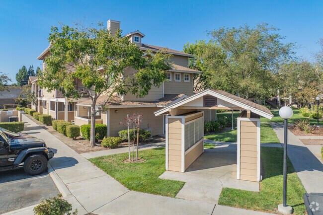
2943 W Lowell Ave
238-600-28
Park Atherton
Apartment
REDRAWN APR-05-2007 FROM ORIGINAL APN 238-020-69
X
San Joaquin
06077C0590F
California
2025
12.06 AC
2025
Tracy
005213
Stockton/Modesto
9,327 SF
Stockton-Lodi, CA
DEMOGRAPHICS near 2943 W Lowell Ave
1 Mile
3 Mile
5 Mile
2024 Total Population
14,746
72,881
124,017
2029 Population
15,588
76,965
131,338
Pop Growth 2024-2029
+ 5.71%
+ 5.60%
+ 5.90%
Average Age
37
37
36
2024 Total Households
4,233
21,960
36,592
HH Growth 2024-2029
+ 5.74%
+ 5.62%
+ 5.94%
Median Household Inc
$107,559
$103,422
$117,750
Avg Household Size
3.40
3.20
3.30
2024 Avg HH Vehicles
3.00
2.00
3.00
Median Home Value
$713,272
$598,253
$660,091
Median Year Built
2001
1991
1997
Nearby Places
Map Layers
Map Styles
 Street
 Aerial
- Restaurants
- Banks
- Shops
- Fitness
- Groceries
PUBLIC TRANSPORTATION
COMMUTER RAIL
Tracy Station (ACE Train - Altamont Corridor Express)
DRIVE
WALK
Distance
Tracy Station (ACE Train - Altamont Corridor Express)
11 min
5.5 mi
Tracy (Altamont Corridor Express - Altamont Commuter Express (ACE))
DRIVE
WALK
Distance
Tracy (Altamont Corridor Express - Altamont Commuter Express (ACE))
10 min
5.5 mi
AIRPORT
Stockton Metro
DRIVE
WALK
Distance
Stockton Metro
28 min
20.8 mi
Freight Ports
Port of Stockton
DRIVE
WALK
Distance
Port of Stockton
31 min
24.1 mi
Nearby Properties
Address
Land Use
TOTAL SIZE
Lot Size
Zoning
Address
Land Use
TOTAL SIZE
Lot Size
Zoning
1,120,082 SF
94.93 AC
AG40
Address
Land Use
TOTAL SIZE
Lot Size
Zoning
663,568 SF
158.06 AC
Address
Land Use
TOTAL SIZE
Lot Size
Zoning
1,034,066 SF
61.05 AC
Address
Land Use
TOTAL SIZE
Lot Size
Zoning
653,447 SF
66.62 AC
IG
Address
Land Use
TOTAL SIZE
Lot Size
Zoning
1,601 SF
17.08 AC
PUD1
Address
Land Use
TOTAL SIZE
Lot Size
Zoning
3.77 AC
Address
Land Use
TOTAL SIZE
Lot Size
Zoning
483,967 SF
77.75 AC
Address
Land Use
TOTAL SIZE
Lot Size
Zoning
726,000 SF
32.29 AC
M1
Address
Land Use
TOTAL SIZE
Lot Size
Zoning
10.15 AC
PUD1
Address
Land Use
TOTAL SIZE
Lot Size
Zoning
490,000 SF
46 AC
IG
Address
Land Use
TOTAL SIZE
Lot Size
Zoning
22,726 SF
8.96 AC
PUD1
Address
Land Use
TOTAL SIZE
Lot Size
Zoning
575,167 SF
46.44 AC
Address
Land Use
TOTAL SIZE
Lot Size
Zoning
49,264 SF
9 AC
Address
Land Use
TOTAL SIZE
Lot Size
Zoning
148,663 SF
16.37 AC
Address
Land Use
TOTAL SIZE
Lot Size
Zoning
225,000 SF
11.13 AC
M
Address
Land Use
TOTAL SIZE
Lot Size
Zoning
95.54 AC
Address
Land Use
TOTAL SIZE
Lot Size
Zoning
64,582 SF
3.10 AC
Address
Land Use
TOTAL SIZE
Lot Size
Zoning
190,388 SF
13.50 AC
Address
Land Use
TOTAL SIZE
Lot Size
Zoning
1,347 SF
4.96 AC
Address
Land Use
TOTAL SIZE
Lot Size
Zoning
55,576 SF
2.65 AC
Address
Land Use
TOTAL SIZE
Lot Size
Zoning
109,438 SF
6.23 AC
Address
Land Use
TOTAL SIZE
Lot Size
Zoning
13,990 SF
8.30 AC
Address
Land Use
TOTAL SIZE
Lot Size
Zoning
62,246 SF
5.82 AC
NS
Address
Land Use
TOTAL SIZE
Lot Size
Zoning
103 AC
AG40
Address
Land Use
TOTAL SIZE
Lot Size
Zoning
47,064 SF
2.36 AC
GC
Address
Land Use
TOTAL SIZE
Lot Size
Zoning
158,572 SF
8.83 AC
Address
Land Use
TOTAL SIZE
Lot Size
Zoning
112,850 SF
8.11 AC
Address
Land Use
TOTAL SIZE
Lot Size
Zoning
11,375 SF
4.51 AC
The World's #1 Commercial Real Estate Marketplace
Connect with us
© 2025 CoStar Group
The information above has been obtained from sources believed reliable. While we do not doubt its accuracy we have not verified it and make no guarantee, warranty or representation about it. It is your responsibility to independently confirm its accuracy and completeness. Any projections, opinions, assumptions, or estimates used are for example only and do not represent the current or future performance of the property. The value of this transaction to you depends on tax and other factors which should be evaluated by your tax, financial, and legal advisors. You and your advisors should conduct a careful, independent investigation of the property to determine to your satisfaction the suitability of the property for your needs.