Property Record
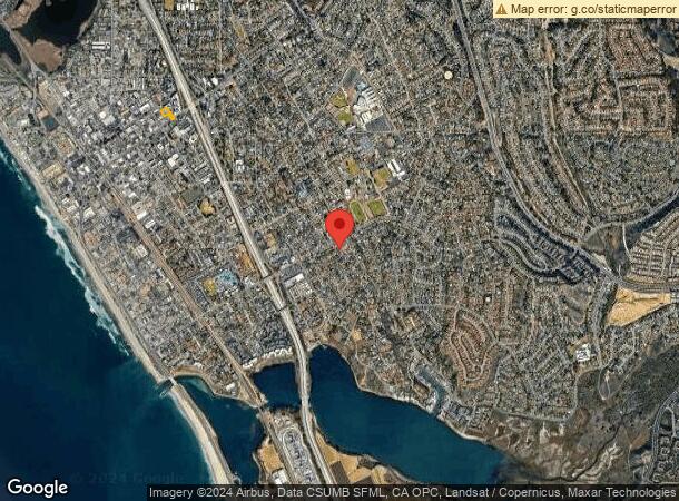
2944 Hope Ave, Carlsbad, CA 92008

Property Detail
2944 Hope Ave
203-320-41
PAR 2 TR PM02868
Commercialacreage
SAN DIEGO
V-B
California
B and X Area of moderate flood hazard, usually the area between the limits of the 100-year and 500-year floods.
0.75 AC
2024
Carlsbad
2025
San Diego
017810
San Diego-Chula Vista-Carlsbad, CA
NEARBY LISTINGS FOR SALE OR LEASE
-
-
-
-
-
-
No Photo
-
-
View all Carlsbad listings for sale on LoopNet.com
DEMOGRAPHICS near 2944 Hope Ave
1 mile
3 mile
5 mile
2025 Total Population
15,256
78,533
189,406
2030 Population
15,504
79,324
191,367
Pop Growth 2025-2030
+ 1.63%
+ 1.01%
+ 1.04%
Average Age
42
42
41
2025 Total Households
6,794
32,175
71,491
HH Growth 2025-2030
+ 1.78%
+ 1.05%
+ 1.14%
Median Household Inc
$98,749
$101,226
$98,461
Avg Household Size
2.20
2.40
2.50
2025 Avg HH Vehicles
2.00
2.00
2.00
Median Home Value
$1,098,739
$1,038,781
$890,287
Median Year Built
1974
1979
1983
Nearby Places
Map Layers
Map Styles
 Street
 Aerial
Layers
 Traffic
 Biking
Places
Listings with unknown addresses are not visible on the map
- Restaurants
- Banks
- Shops
- Fitness
- Groceries
PUBLIC TRANSPORTATION
COMMUTER RAIL
Carlsbad Village (Coaster - San Diego North County Transit District (Coaster/Sprinter/Breeze))
Drive
Walk
Distance
Carlsbad Village (Coaster - San Diego North County Transit District (Coaster/Sprinter/Breeze))
6 min
2.0 mi
Carlsbad Poinsettia (Coaster - San Diego North County Transit District (Coaster/Sprinter/Breeze))
Drive
Walk
Distance
Carlsbad Poinsettia (Coaster - San Diego North County Transit District (Coaster/Sprinter/Breeze))
8 min
3.9 mi
Freight Ports
Port of San Diego
Drive
Walk
Distance
Port of San Diego
47 min
36.7 mi
Nearby Properties
Address
Land Use
TOTAL SIZE
Lot Size
Zoning
Address
Land Use
TOTAL SIZE
Lot Size
Zoning
59,518 SF
5.70 AC
P-U
Address
Land Use
TOTAL SIZE
Lot Size
Zoning
132.11 AC
C-T-Q
Address
Land Use
TOTAL SIZE
Lot Size
Zoning
26.65 AC
C-2-Q
Address
Land Use
TOTAL SIZE
Lot Size
Zoning
15.25 AC
P-C
Address
Land Use
TOTAL SIZE
Lot Size
Zoning
12.71 AC
P-M
Address
Land Use
TOTAL SIZE
Lot Size
Zoning
16 AC
P-C
Address
Land Use
TOTAL SIZE
Lot Size
Zoning
28.15 AC
C-M
Address
Land Use
TOTAL SIZE
Lot Size
Zoning
16.79 AC
R-3-Q
Address
Land Use
TOTAL SIZE
Lot Size
Zoning
9.65 AC
P-C
Address
Land Use
TOTAL SIZE
Lot Size
Zoning
4.26 AC
C-2
Address
Land Use
TOTAL SIZE
Lot Size
Zoning
9.69 AC
C-T-Q
Address
Land Use
TOTAL SIZE
Lot Size
Zoning
20.86 AC
P-M-Q
Address
Land Use
TOTAL SIZE
Lot Size
Zoning
1.77 AC
C-2
Address
Land Use
TOTAL SIZE
Lot Size
Zoning
60.48 AC
OS
Address
Land Use
TOTAL SIZE
Lot Size
Zoning
85,000 SF
4.40 AC
CC
Address
Land Use
TOTAL SIZE
Lot Size
Zoning
19.51 AC
C-2-Q
Address
Land Use
TOTAL SIZE
Lot Size
Zoning
10.63 AC
RD-M
Address
Land Use
TOTAL SIZE
Lot Size
Zoning
2.30 AC
V-R
Address
Land Use
TOTAL SIZE
Lot Size
Zoning
7.38 AC
P-M-Q
Address
Land Use
TOTAL SIZE
Lot Size
Zoning
8.64 AC
R-3-Q
Address
Land Use
TOTAL SIZE
Lot Size
Zoning
95,418 SF
6.51 AC
P-C
Address
Land Use
TOTAL SIZE
Lot Size
Zoning
6.63 AC
RD-M
Address
Land Use
TOTAL SIZE
Lot Size
Zoning
9.76 AC
M
Address
Land Use
TOTAL SIZE
Lot Size
Zoning
57,905 SF
2.16 AC
R-3
Address
Land Use
TOTAL SIZE
Lot Size
Zoning
4.88 AC
P-C
Address
Land Use
TOTAL SIZE
Lot Size
Zoning
1.34 AC
V-B
Address
Land Use
TOTAL SIZE
Lot Size
Zoning
6,024 SF
6.92 AC
VC
Address
Land Use
TOTAL SIZE
Lot Size
Zoning
65,359 SF
3.71 AC
C-2-Q
Address
Land Use
TOTAL SIZE
Lot Size
Zoning
9.15 AC
RD-M-Q
Address
Land Use
TOTAL SIZE
Lot Size
Zoning
14.13 AC
P-M
The World's #1 Commercial Real Estate Marketplace
Connect with us
© 2026 CoStar Group
The information above has been obtained from sources believed reliable. While we do not doubt its accuracy we have not verified it and make no guarantee, warranty or representation about it. It is your responsibility to independently confirm its accuracy and completeness. Any projections, opinions, assumptions, or estimates used are for example only and do not represent the current or future performance of the property. The value of this transaction to you depends on tax and other factors which should be evaluated by your tax, financial, and legal advisors. You and your advisors should conduct a careful, independent investigation of the property to determine to your satisfaction the suitability of the property for your needs.