Property Record
2944 Rosebud Rd, Loganville, GA 30052


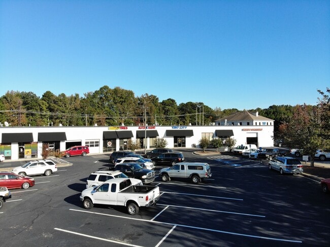

Property Detail
2944 Rosebud Rd
5-101-179
L1 ROSEBUD ROAD
Stripcommercialcenter
GWINNETT
C2
Georgia
B and X Area of moderate flood hazard, usually the area between the limits of the 100-year and 500-year floods.
1
2025
4.96 AC
2025
Lawrenceville/Dacula
050747
Atlanta
38,630 SF
Atlanta-Sandy Springs-Roswell, GA
NEARBY LISTINGS FOR SALE OR LEASE
DEMOGRAPHICS near 2944 Rosebud Rd
1 mile
3 mile
5 mile
2025 Total Population
9,092
58,359
147,147
2030 Population
9,635
61,991
156,057
Pop Growth 2025-2030
+ 5.97%
+ 6.22%
+ 6.06%
Average Age
36
39
39
2025 Total Households
2,873
18,596
47,139
HH Growth 2025-2030
+ 6.09%
+ 6.31%
+ 6.15%
Median Household Inc
$75,898
$89,068
$93,597
Avg Household Size
3.10
3.10
3.10
2025 Avg HH Vehicles
2.00
2.00
2.00
Median Home Value
$358,556
$373,538
$388,439
Median Year Built
2002
2001
2000
Nearby Places
Map Layers
Map Styles
 Street
 Aerial
Transit
 Traffic
 Biking
Places
Listings with unknown addresses are not visible on the map
- Restaurants
- Banks
- Shops
- Fitness
- Groceries
PUBLIC TRANSPORTATION
AIRPORT
Hartsfield - Jackson Atlanta International
Drive
Walk
Distance
Hartsfield - Jackson Atlanta International
57 min
36.9 mi
SALE & LEASE HISTORY
LISTING DATE
SALE/LEASE

Sep 25, 2016
For Lease
Sep 24, 2016
For Sale
Mar 28, 2017
For Lease
Mar 09, 2017
For Lease
Aug 22, 2019
For Lease
Nearby Properties
Address
Land Use
TOTAL SIZE
Lot Size
Zoning
Address
Land Use
TOTAL SIZE
Lot Size
Zoning
352,924 SF
86.43 AC
R100
Address
Land Use
TOTAL SIZE
Lot Size
Zoning
455,030 SF
80.40 AC
R100
Address
Land Use
TOTAL SIZE
Lot Size
Zoning
349,060 SF
59.85 AC
R100
Address
Land Use
TOTAL SIZE
Lot Size
Zoning
221,082 SF
12.90 AC
RM24
Address
Land Use
TOTAL SIZE
Lot Size
Zoning
189,254 SF
40 AC
R100
Address
Land Use
TOTAL SIZE
Lot Size
Zoning
4,408 SF
148.92 AC
R100
Address
Land Use
TOTAL SIZE
Lot Size
Zoning
186,309 SF
15.53 AC
RM
Address
Land Use
TOTAL SIZE
Lot Size
Zoning
133,375 SF
16.50 AC
CH
Address
Land Use
TOTAL SIZE
Lot Size
Zoning
101,193 SF
5.34 AC
C2
Address
Land Use
TOTAL SIZE
Lot Size
Zoning
107,829 SF
7.82 AC
RM
Address
Land Use
TOTAL SIZE
Lot Size
Zoning
82,809 SF
21.79 AC
R100
Address
Land Use
TOTAL SIZE
Lot Size
Zoning
103,892 SF
17.44 AC
CH
Address
Land Use
TOTAL SIZE
Lot Size
Zoning
112,640 SF
5.17 AC
C2
Address
Land Use
TOTAL SIZE
Lot Size
Zoning
91,131 SF
15.60 AC
C2
Address
Land Use
TOTAL SIZE
Lot Size
Zoning
79,276 SF
9.08 AC
C2
Address
Land Use
TOTAL SIZE
Lot Size
Zoning
56,664 SF
5.35 AC
CH
Address
Land Use
TOTAL SIZE
Lot Size
Zoning
105,453 SF
14.57 AC
OI
Address
Land Use
TOTAL SIZE
Lot Size
Zoning
102,850 SF
10.03 AC
LI
Address
Land Use
TOTAL SIZE
Lot Size
Zoning
29,724 SF
24.45 AC
R100
Address
Land Use
TOTAL SIZE
Lot Size
Zoning
105,840 SF
2.66 AC
C2
Address
Land Use
TOTAL SIZE
Lot Size
Zoning
50,623 SF
18.47 AC
R100
Address
Land Use
TOTAL SIZE
Lot Size
Zoning
137,401 SF
12.95 AC
CH
Address
Land Use
TOTAL SIZE
Lot Size
Zoning
65,747 SF
10.91 AC
R100
Address
Land Use
TOTAL SIZE
Lot Size
Zoning
83,286 SF
13.64 AC
C2
Address
Land Use
TOTAL SIZE
Lot Size
Zoning
57,766 SF
11.12 AC
R100
Address
Land Use
TOTAL SIZE
Lot Size
Zoning
101,130 SF
6.05 AC
C2
Address
Land Use
TOTAL SIZE
Lot Size
Zoning
34,130 SF
7.80 AC
R100
Address
Land Use
TOTAL SIZE
Lot Size
Zoning
14,784 SF
90.18 AC
R100
Address
Land Use
TOTAL SIZE
Lot Size
Zoning
32,126 SF
12.66 AC
R100
The World's #1 Commercial Real Estate Marketplace
Connect with us
© 2026 CoStar Group
The information above has been obtained from sources believed reliable. While we do not doubt its accuracy we have not verified it and make no guarantee, warranty or representation about it. It is your responsibility to independently confirm its accuracy and completeness. Any projections, opinions, assumptions, or estimates used are for example only and do not represent the current or future performance of the property. The value of this transaction to you depends on tax and other factors which should be evaluated by your tax, financial, and legal advisors. You and your advisors should conduct a careful, independent investigation of the property to determine to your satisfaction the suitability of the property for your needs.