Property Record
2944 State Route 23, Hillsdale, NY 12529
NEARBY LISTINGS FOR SALE OR LEASE
-
-
View all Hillsdale listings for sale on LoopNet.com
Property Detail
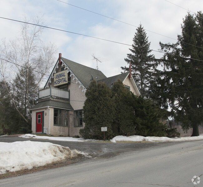
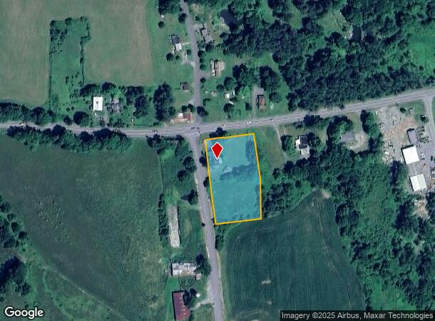
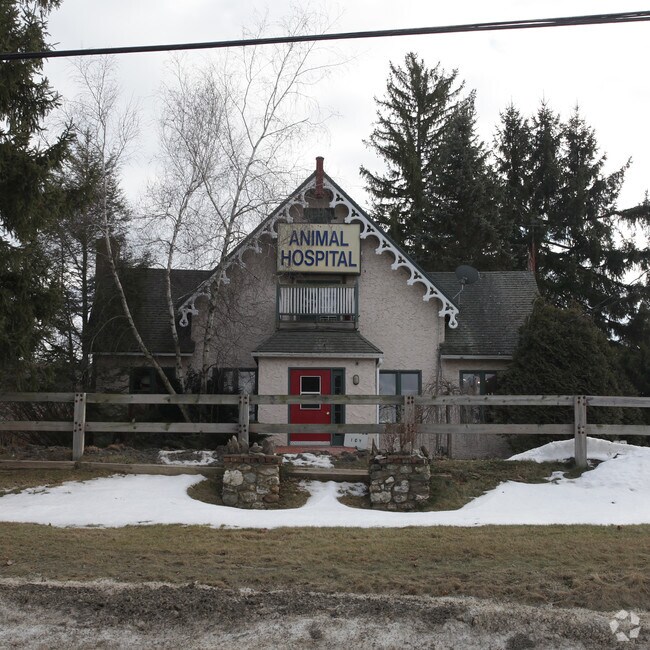
2944 State Route 23
Hudson, NY
MICRO 9397
104200-146-000-0001-055-000-0000
Columbia
Animalhospitalvet
New York
2025
55.000
2024
1.60 AC
000900
Columbia County
1,836 SF
Albany/Schenectady/Troy
DEMOGRAPHICS near 2944 State Route 23
1 Mile
3 Mile
5 Mile
2024 Total Population
307
1,726
4,305
2029 Population
311
1,735
4,329
Pop Growth 2024-2029
+ 1.30%
+ 0.52%
+ 0.56%
Average Age
49
49
49
2024 Total Households
140
781
1,930
HH Growth 2024-2029
+ 1.43%
+ 0.64%
+ 0.62%
Median Household Inc
$87,096
$82,211
$86,013
Avg Household Size
2.20
2.20
2.20
2024 Avg HH Vehicles
2.00
2.00
2.00
Median Home Value
$409,677
$400,382
$416,176
Median Year Built
1964
1963
1967
Nearby Places
- Restaurants
- Banks
- Shops
- Fitness
- Groceries
Nearby Properties
Address
Land Use
TOTAL SIZE
Lot Size
Zoning
Address
Land Use
TOTAL SIZE
Lot Size
Zoning
43,883 SF
164 AC
C
Address
Land Use
TOTAL SIZE
Lot Size
Zoning
11,490 SF
98.40 AC
R1
Address
Land Use
TOTAL SIZE
Lot Size
Zoning
5,812 SF
22.60 AC
R1
Address
Land Use
TOTAL SIZE
Lot Size
Zoning
7,421 SF
23.32 AC
R1
Address
Land Use
TOTAL SIZE
Lot Size
Zoning
1,710 SF
20.80 AC
07 - MIXED
Address
Land Use
TOTAL SIZE
Lot Size
Zoning
3,717 SF
31 AC
RU C
Address
Land Use
TOTAL SIZE
Lot Size
Zoning
2,896 SF
19.50 AC
R1
Address
Land Use
TOTAL SIZE
Lot Size
Zoning
4,320 SF
3.80 AC
07 - MIXED
Address
Land Use
TOTAL SIZE
Lot Size
Zoning
1,200 SF
166.30 AC
07 - MIXED
Address
Land Use
TOTAL SIZE
Lot Size
Zoning
9.03 AC
07 - MIXED
Address
Land Use
TOTAL SIZE
Lot Size
Zoning
1,552 SF
19.82 AC
R1
Address
Land Use
TOTAL SIZE
Lot Size
Zoning
3,295 SF
22.67 AC
RU C
Address
Land Use
TOTAL SIZE
Lot Size
Zoning
1,884 SF
5.17 AC
R1
Address
Land Use
TOTAL SIZE
Lot Size
Zoning
2,016 SF
9.70 AC
C
Address
Land Use
TOTAL SIZE
Lot Size
Zoning
135.98 AC
RU C
Address
Land Use
TOTAL SIZE
Lot Size
Zoning
9,720 SF
16.20 AC
RU C
Address
Land Use
TOTAL SIZE
Lot Size
Zoning
11,250 SF
10.96 AC
07 - MIXED
Address
Land Use
TOTAL SIZE
Lot Size
Zoning
2,693 SF
19.91 AC
07 - MIXED
Address
Land Use
TOTAL SIZE
Lot Size
Zoning
720 SF
15.30 AC
C
Address
Land Use
TOTAL SIZE
Lot Size
Zoning
12,672 SF
15.60 AC
HM
Address
Land Use
TOTAL SIZE
Lot Size
Zoning
172.94 AC
Address
Land Use
TOTAL SIZE
Lot Size
Zoning
3,038 SF
15.81 AC
07 - MIXED
Address
Land Use
TOTAL SIZE
Lot Size
Zoning
15,200 SF
4.01 AC
Address
Land Use
TOTAL SIZE
Lot Size
Zoning
7,000 SF
0.49 AC
HM C
Address
Land Use
TOTAL SIZE
Lot Size
Zoning
8,000 SF
0.56 AC
HM
Address
Land Use
TOTAL SIZE
Lot Size
Zoning
6,000 SF
3.80 AC
HM
Address
Land Use
TOTAL SIZE
Lot Size
Zoning
2,343 SF
5.80 AC
R1
Address
Land Use
TOTAL SIZE
Lot Size
Zoning
3,774 SF
36.03 AC
07 - MIXED
Address
Land Use
TOTAL SIZE
Lot Size
Zoning
3,315 SF
26 AC
07 - MIXED
Address
Land Use
TOTAL SIZE
Lot Size
Zoning
221.30 AC
07 - MIXED
The World's #1 Commercial Real Estate Marketplace
Connect with us
© 2025 CoStar Group
The information above has been obtained from sources believed reliable. While we do not doubt its accuracy we have not verified it and make no guarantee, warranty or representation about it. It is your responsibility to independently confirm its accuracy and completeness. Any projections, opinions, assumptions, or estimates used are for example only and do not represent the current or future performance of the property. The value of this transaction to you depends on tax and other factors which should be evaluated by your tax, financial, and legal advisors. You and your advisors should conduct a careful, independent investigation of the property to determine to your satisfaction the suitability of the property for your needs.