Property Record
2945 4Th St, Wayland, MI 49348

Save to a Folder
{{folder.Name}}
{{folder.ListingIds.length}} Properties
{{folder.ListingIds.length}} Property
Create a New Folder
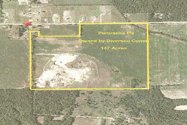
Property Detail
2945 4Th St
Holland, MI
COM W 1/4 COR TH S 89DEG 46'03 E 2141.35; TO POB; TH S 00DEG 34'52 W 270'; TH N 89DEG 46'03 W 640.02'; TH S 00DEG 34'52 W
24-023-009-00
ALLEGAN
Industrialgeneral
Michigan
B and X Area of moderate flood hazard, usually the area between the limits of the 100-year and 500-year floods.
85.24 AC
2025
Outlying Allegan County
2026
West Michigan
030501
NEARBY LISTINGS FOR SALE OR LEASE
-
-
View all Wayland listings for sale on LoopNet.com
DEMOGRAPHICS near 2945 4Th St
1 mile
3 mile
5 mile
2025 Total Population
232
4,861
14,576
2030 Population
233
4,986
14,917
Pop Growth 2025-2030
+ 0.43%
+ 2.57%
+ 2.34%
Average Age
40
42
41
2025 Total Households
80
1,856
5,573
HH Growth 2025-2030
0.00%
+ 2.75%
+ 2.49%
Median Household Inc
$89,166
$86,793
$83,617
Avg Household Size
2.80
2.60
2.60
2025 Avg HH Vehicles
2.00
2.00
2.00
Median Home Value
$333,333
$349,319
$296,433
Median Year Built
1993
1987
1986
Nearby Places
Map Layers
Map Styles
 Street
 Aerial
Layers
 Traffic
 Biking
Places
Listings with unknown addresses are not visible on the map
- Restaurants
- Banks
- Shops
- Fitness
- Groceries
PUBLIC TRANSPORTATION
AIRPORT
Gerald R Ford International
Drive
Walk
Distance
Gerald R Ford International
41 min
29.3 mi
Kalamazoo/Battle Creek International
Drive
Walk
Distance
Kalamazoo/Battle Creek International
50 min
37.6 mi
Freight Ports
Port Milwaukee
Drive
Walk
Distance
Port Milwaukee
301 min
257.0 mi
Nearby Properties
Address
Land Use
TOTAL SIZE
Lot Size
Zoning
Address
Land Use
TOTAL SIZE
Lot Size
Zoning
11.25 AC
MHC
Address
Land Use
TOTAL SIZE
Lot Size
Zoning
1,831 SF
60 AC
Address
Land Use
TOTAL SIZE
Lot Size
Zoning
9,794 SF
39 AC
Address
Land Use
TOTAL SIZE
Lot Size
Zoning
2,674 SF
103.50 AC
Address
Land Use
TOTAL SIZE
Lot Size
Zoning
2,496 SF
239.90 AC
Address
Land Use
TOTAL SIZE
Lot Size
Zoning
5.30 AC
RLF
Address
Land Use
TOTAL SIZE
Lot Size
Zoning
6,500 SF
185 AC
Address
Land Use
TOTAL SIZE
Lot Size
Zoning
54,850 SF
3.20 AC
Address
Land Use
TOTAL SIZE
Lot Size
Zoning
124.54 AC
Address
Land Use
TOTAL SIZE
Lot Size
Zoning
1,630 SF
120 AC
AG
Address
Land Use
TOTAL SIZE
Lot Size
Zoning
2,754 SF
36.54 AC
Address
Land Use
TOTAL SIZE
Lot Size
Zoning
3,939 SF
65.80 AC
Address
Land Use
TOTAL SIZE
Lot Size
Zoning
1,300 SF
159.90 AC
Address
Land Use
TOTAL SIZE
Lot Size
Zoning
120 AC
Address
Land Use
TOTAL SIZE
Lot Size
Zoning
1,966 SF
110.93 AC
AG
Address
Land Use
TOTAL SIZE
Lot Size
Zoning
1,662 SF
98.75 AC
Address
Land Use
TOTAL SIZE
Lot Size
Zoning
2,585 SF
80 AC
Address
Land Use
TOTAL SIZE
Lot Size
Zoning
2,864 SF
80.37 AC
Address
Land Use
TOTAL SIZE
Lot Size
Zoning
1,152 SF
118.57 AC
Address
Land Use
TOTAL SIZE
Lot Size
Zoning
23,080 SF
1.83 AC
Address
Land Use
TOTAL SIZE
Lot Size
Zoning
1,506 SF
80 AC
Address
Land Use
TOTAL SIZE
Lot Size
Zoning
111.38 AC
Address
Land Use
TOTAL SIZE
Lot Size
Zoning
65,400 SF
12.58 AC
C3;GEN
Address
Land Use
TOTAL SIZE
Lot Size
Zoning
1,981 SF
90.22 AC
Address
Land Use
TOTAL SIZE
Lot Size
Zoning
2,302 SF
86.83 AC
Address
Land Use
TOTAL SIZE
Lot Size
Zoning
1,412 SF
70.58 AC
Address
Land Use
TOTAL SIZE
Lot Size
Zoning
107.15 AC
Address
Land Use
TOTAL SIZE
Lot Size
Zoning
1,824 SF
80 AC
Address
Land Use
TOTAL SIZE
Lot Size
Zoning
1,650 SF
80 AC
Address
Land Use
TOTAL SIZE
Lot Size
Zoning
87 SF
The World's #1 Commercial Real Estate Marketplace
Connect with us
© 2026 CoStar Group
The information above has been obtained from sources believed reliable. While we do not doubt its accuracy we have not verified it and make no guarantee, warranty or representation about it. It is your responsibility to independently confirm its accuracy and completeness. Any projections, opinions, assumptions, or estimates used are for example only and do not represent the current or future performance of the property. The value of this transaction to you depends on tax and other factors which should be evaluated by your tax, financial, and legal advisors. You and your advisors should conduct a careful, independent investigation of the property to determine to your satisfaction the suitability of the property for your needs.